Social Studies
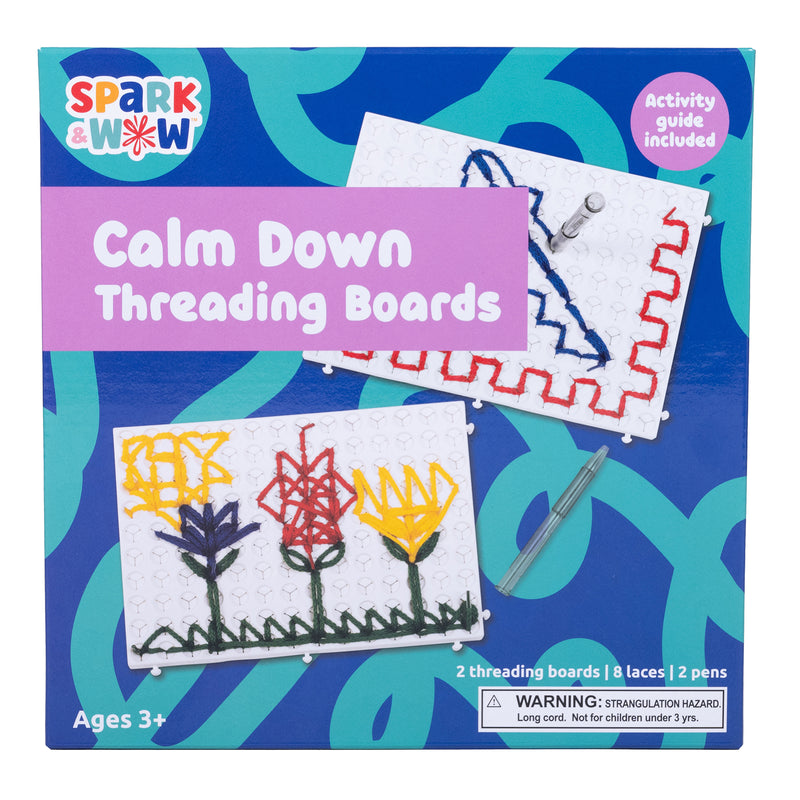
Calm Down Threading Boards

Calm Down Threading Boards
$24.65
MPN: 005646UPC: 819852019289Create and inspire calm with this powerful sensory resource! This set includes 2 threading boards, 8 laces in 4 colors, 2 threading pens and an activity guide. Add this sensory resource to calm down corners, therapy resources or social-emotional learning activities. This threading activity can act as a tool to assist ...
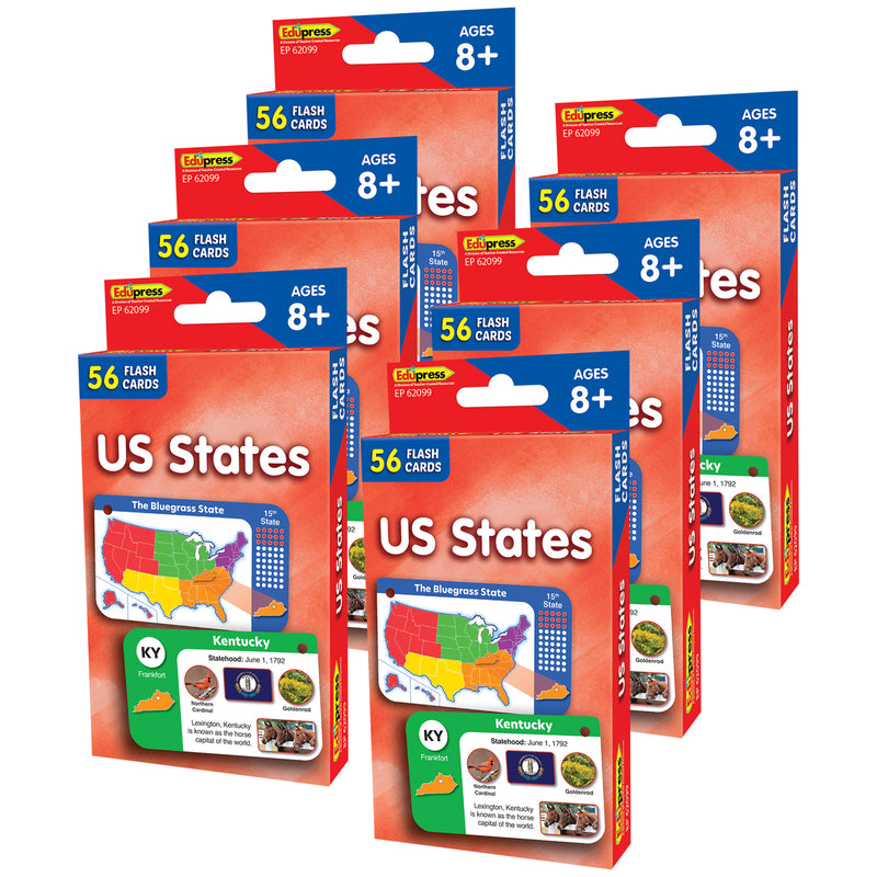

US States Flash Cards, 6 Packs
$41.02
MPN: 005003UPC: 194629156344The flash card set is a versatile and engaging tool for both teachers and parents. Each set includes a collection of full-color, high-interest student cards, along with instructions and tips for educators and caregivers. The set also comes with suggested activities and additional blank cards for customization. The car...
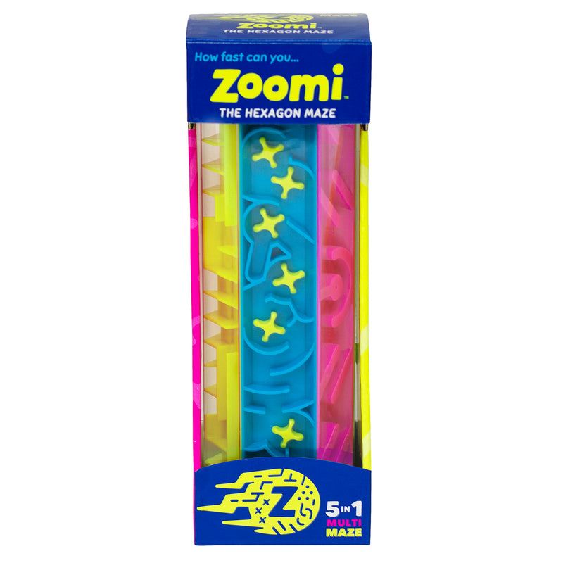
Zoomi Game

Zoomi Game
$34.24
MPN: 006651UPC: 628011475022Are you ready to Zoomi?! Easy to pick up....hard to put down! Twist, turn and tumble through the 6 panels of a-maze-ment! 1) Place the ball at the "START." 2) Twist, turn, and tumble through the 5 mazes. 2) Finish the maze at the "STOP". Victory! Challenge yourself to make it through Zoomi without getting stuck. Try m...

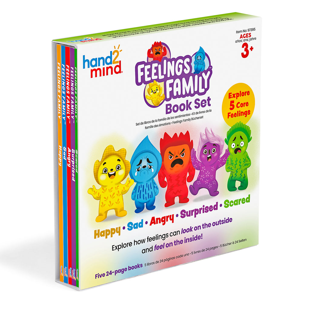
Feelings Family™ Book Set Happy, Sad, Angry, Scared & Surprised
$34.24
MPN: 005083UPC: 848850122448The Feelings Family helps children explore how feelings can look on the outside and feel on the inside. This book set teaches children about Happy, Sad, Angry, Scared, and Surprised through lively characters and relatable scenarios. Prompts and questions are included within the 5 books to engage children and spark tho...
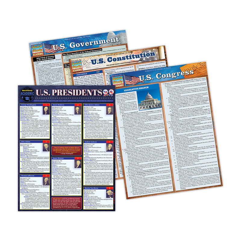

Laminated Study Guide, History Bundle, Set of 4
$41.00
MPN: 006469UPC: 9781423251248This bundle includes one each of U.S. President, U.S. Government, U.S. Congress & U.S. Constitution Laminated Study Guide sets. This bundle is a great learning tool for students and detailed facts they need to know about the U.S. Constitution the U.S. Presidents and how the U.S. Government and U.S. Congress works...

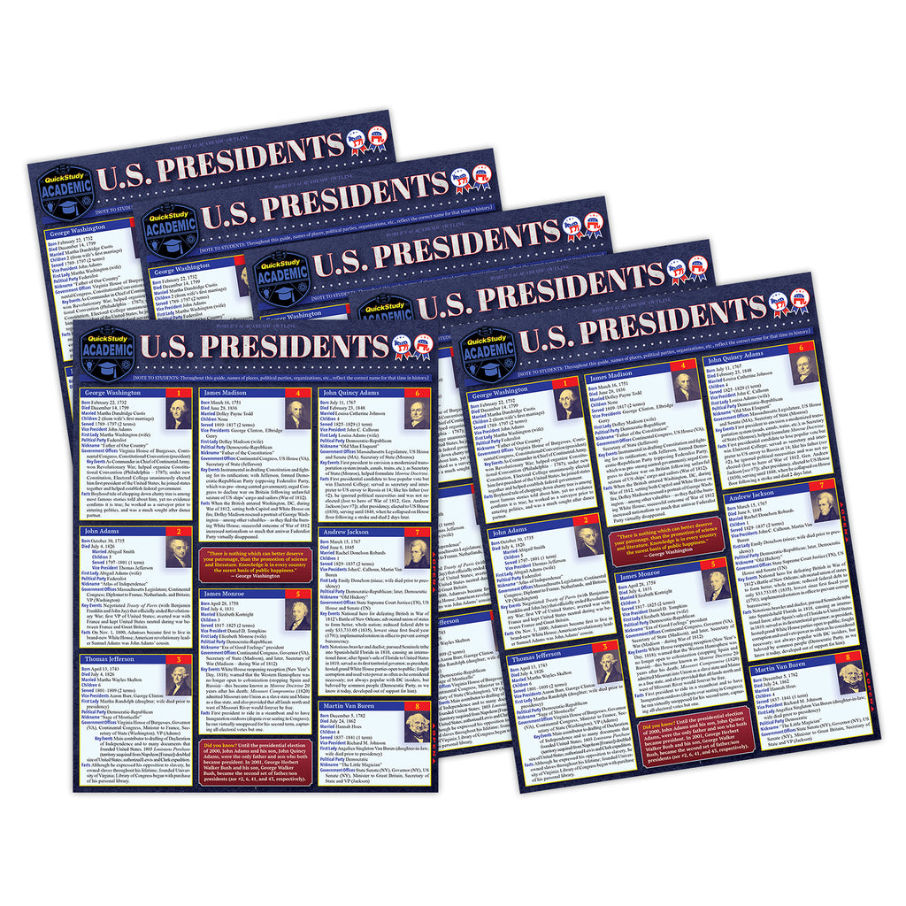
Laminated Study Guide, U.S. Presidents
$74.65
MPN: 006469UPC: 9781423251200Essential facts for the 47 presidents of the United States with key events that give a quick and concise picture of each president, their time in office, and their personality as recorded in history. A great learning tool for students and the facts they need-to-know, but also a great read for those interested in poli...
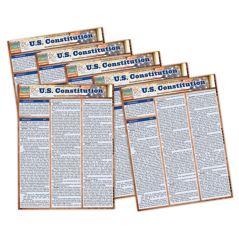

Laminated Study Guide, U.S. Constitution
$57.13
MPN: 006469UPC: 9781423251231Own an indestructible copy of the most important and revered document in U.S. history that is the centerpiece of political discussion and debate more than 200 years after it was written. Reference the actual words and the full text as written and influenced by the Founding Fathers, rather than relying on partial and ...


Laminated Study Guide, U.S. Government
$57.13
MPN: 006469UPC: 9781423251224Worldwide the U.S. government is a hot topic concerning politics, the balance of power, and the future of democracy. This essential six page laminated reference is a concise breakdown of the inner workings of the system as a whole. Written by author and professor Zachary Courser, PhD, a Fellow with the Bipartisan Pol...

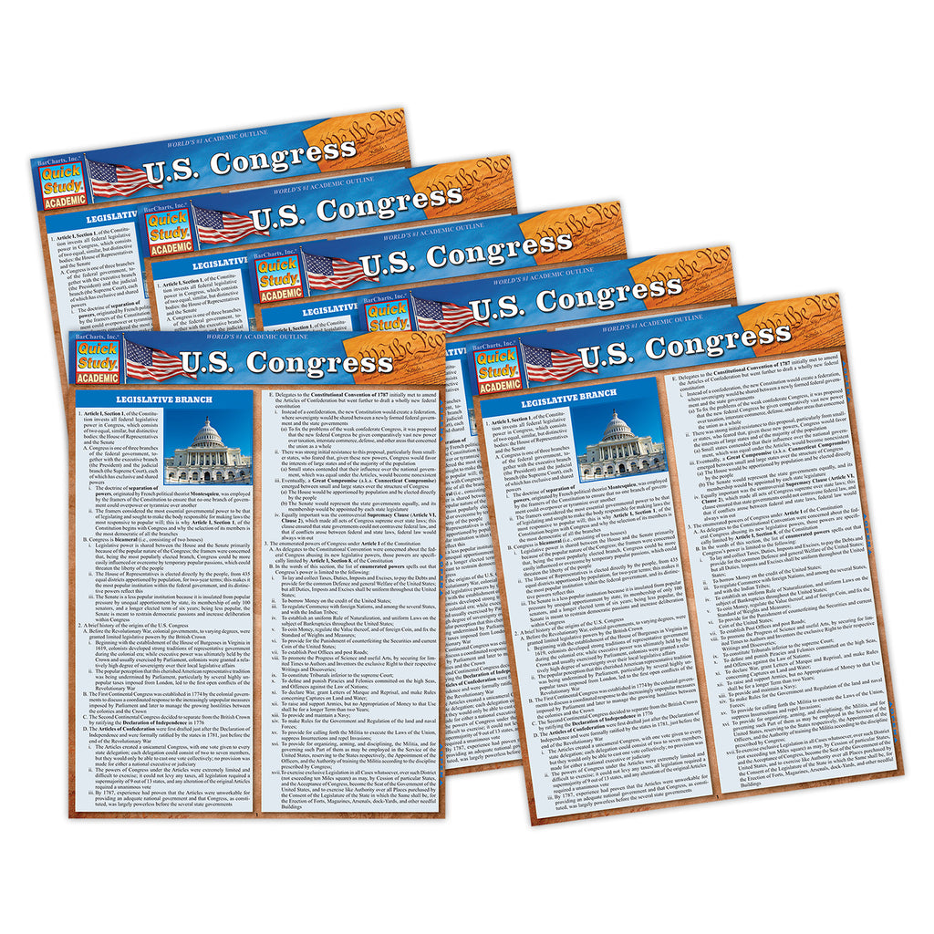
Laminated Study Guide, U.S. Congress
$48.91
MPN: 006469UPC: 9781423251217In the U.S. and worldwide Congress is a hot topic concerning politics, the balance of power, and the future of democracy. This essential six page laminated reference is a concise breakdown of the inner workings of the House and Senate and how they work together to get things done with the Executive Branch. Written by...
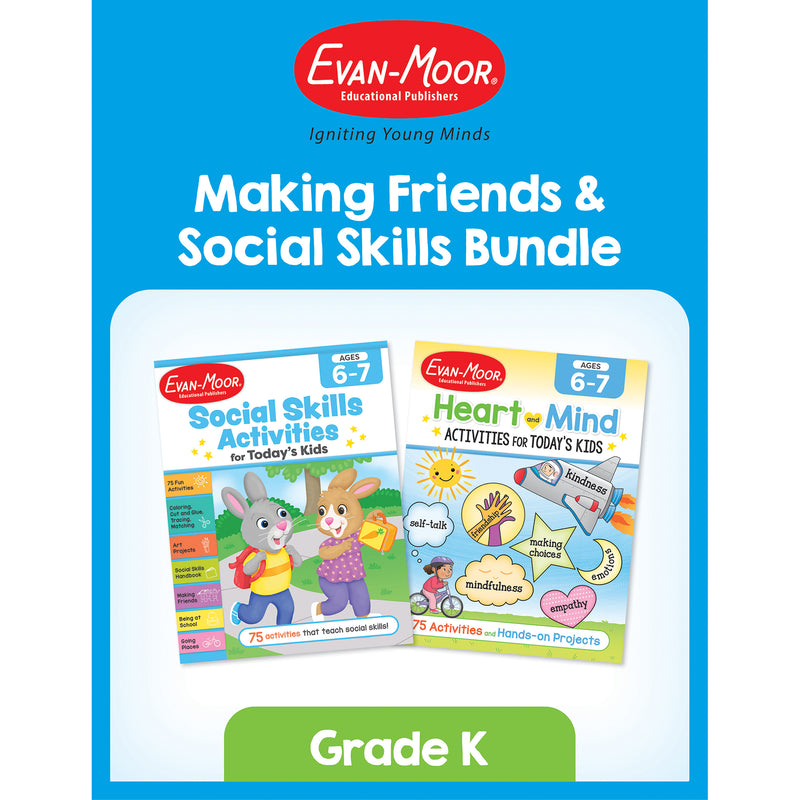

Making Friends & Social Skills Bundle, Grade K
$31.50
MPN: 005033UPC: 9781645144212The Making Friends & Social Skills Bundle, Grade K is a dynamic two-book set designed to help young children build essential social and emotional skills for positive relationships. This bundle includes Social Skills Activities for Today’s Kids Workbook, Ages 6-7 and Heart and Mind Activities for Today's Kids, Age...
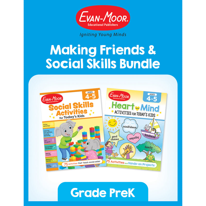
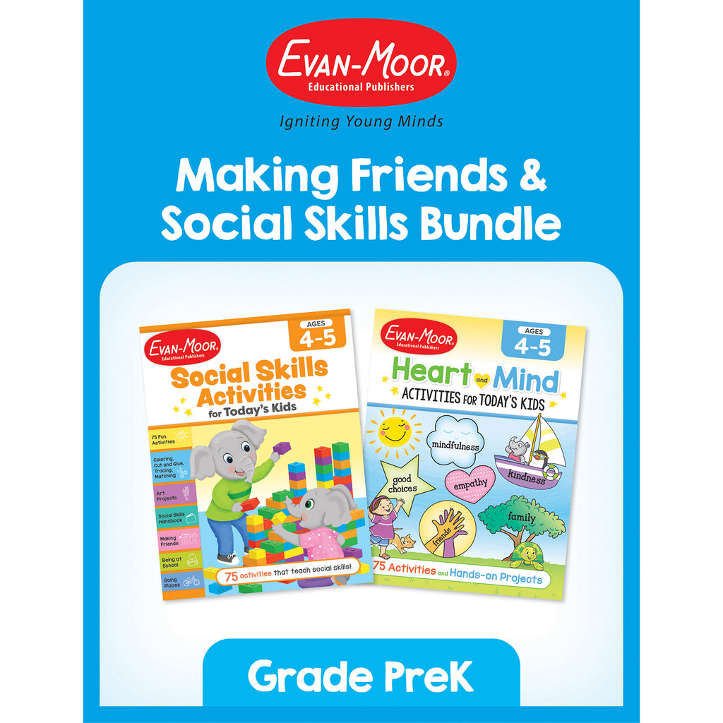
Making Friends & Social Skills Bundle, Grade PreK
$34.24
MPN: 005033UPC: 9781645144205The Making Friends & Social Skills Bundle, Grade PreK is the perfect resource to support young children in developing key social and emotional skills essential for forming positive relationships and navigating everyday interactions. This bundle includes two award-winning workbooks: Social Skills Activities for To...
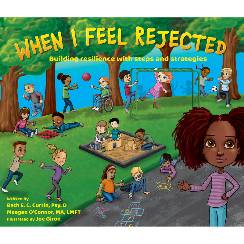
When I Feel Rejected Book

When I Feel Rejected Book
$26.02
MPN: 006438UPC: 899600003883Rejection is a tough, but universal experience. When I Feel Rejected navigates multiple characters through school based incidents in which a rejection occurs. The book acts as a social emotional learning tool that outlines possible responses and coping strategies to rejection.Key Features : i : When I Feel Rejected na...

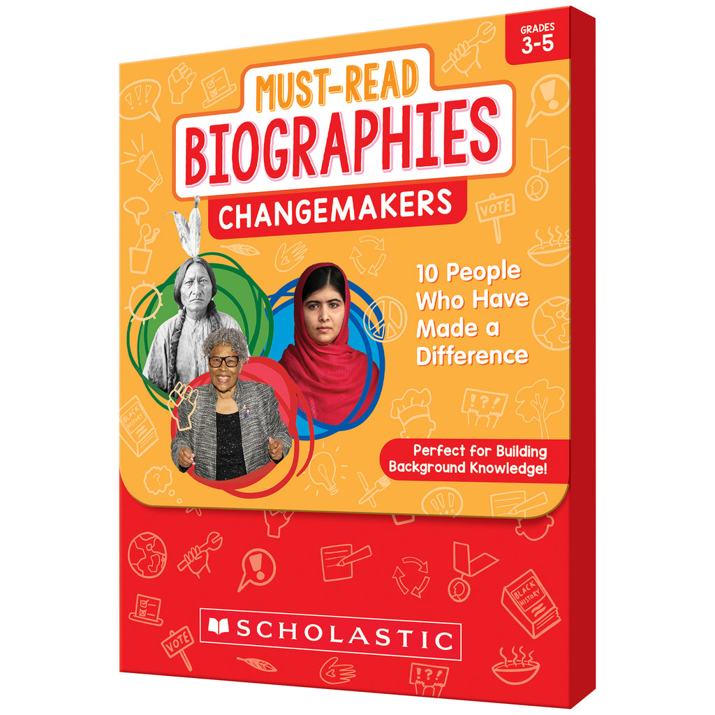
Must Read Biographies Changemakers
$41.09
MPN: 005095UPC: 9781546107101Greta Thunberg, Sitting Bull, Sojourner Truth, Barack Obama … Students will be fascinated by these people's stories, as well as those of the other notable figures in this set. Engaging short texts detail their diverse backgrounds, the challenges they faced, and their triumphs as they set out to make their communities...
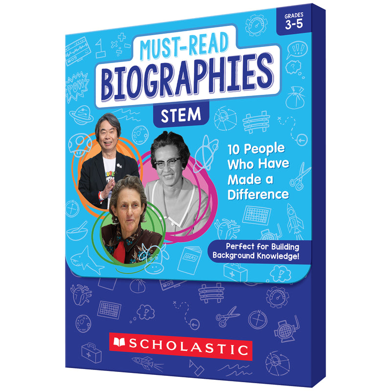
Must Read Biographies Stem
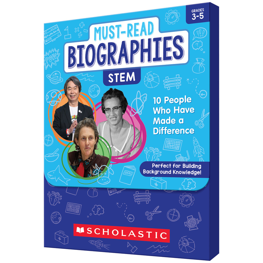
Must Read Biographies Stem
$41.09
MPN: 005095UPC: 9781546107118Katherine Johnson, Shigeru Miyamoto, Temple Grandin, Benjamin Banneker … These people's stories, along with those of other notable figures in this set, will fascinate students who are interested in science, technology, engineering, and math. Engaging short texts detail their diverse backgrounds, the challenges they f...


Must Read Biographies Arts & Sports
$41.09
MPN: 005095UPC: 9781546107095Frida Kahlo, Lin Manuel Miranda, Billie Jean King, Shohei Ohtani … These are just some of the outstanding artists and sports figures whose life stories are sure to captivate students. Engaging short texts detail their diverse backgrounds, the challenges they faced, and their triumphs as they excelled in their respect...

Inclusion Puzzles, Set of 4

Inclusion Puzzles, Set of 4
$61.62
MPN: 006389UPC: 8413082352714Miniland Inclusion Puzzles is a set of 4 different puzzles featuring images of diverse children. Made of washable plastic and very resistant, unbreakable material. Designed to promote values such as tolerance, empathy and diversity. Each puzzle comes with 25 pieces.Key Features : i : Designed to promote values such a...


Bloomie: Flower and Candle Fidget Tool
$20.54
MPN: 006626UPC: 860011709121Introduce your child to the magic of emotional regulation with Bloomie, the innovative flower and candle breathing tool. Designed with a flower on one side and a candle on the other, Bloomie transforms familiar actions into a powerful mindfulness practice. On the flower side, your child can inhale deeply, pretending...
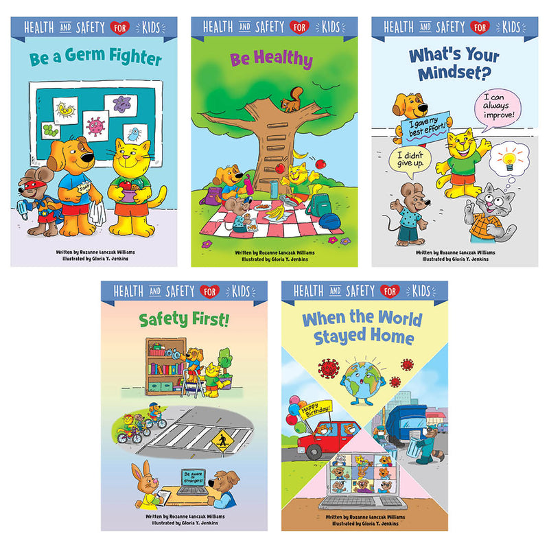
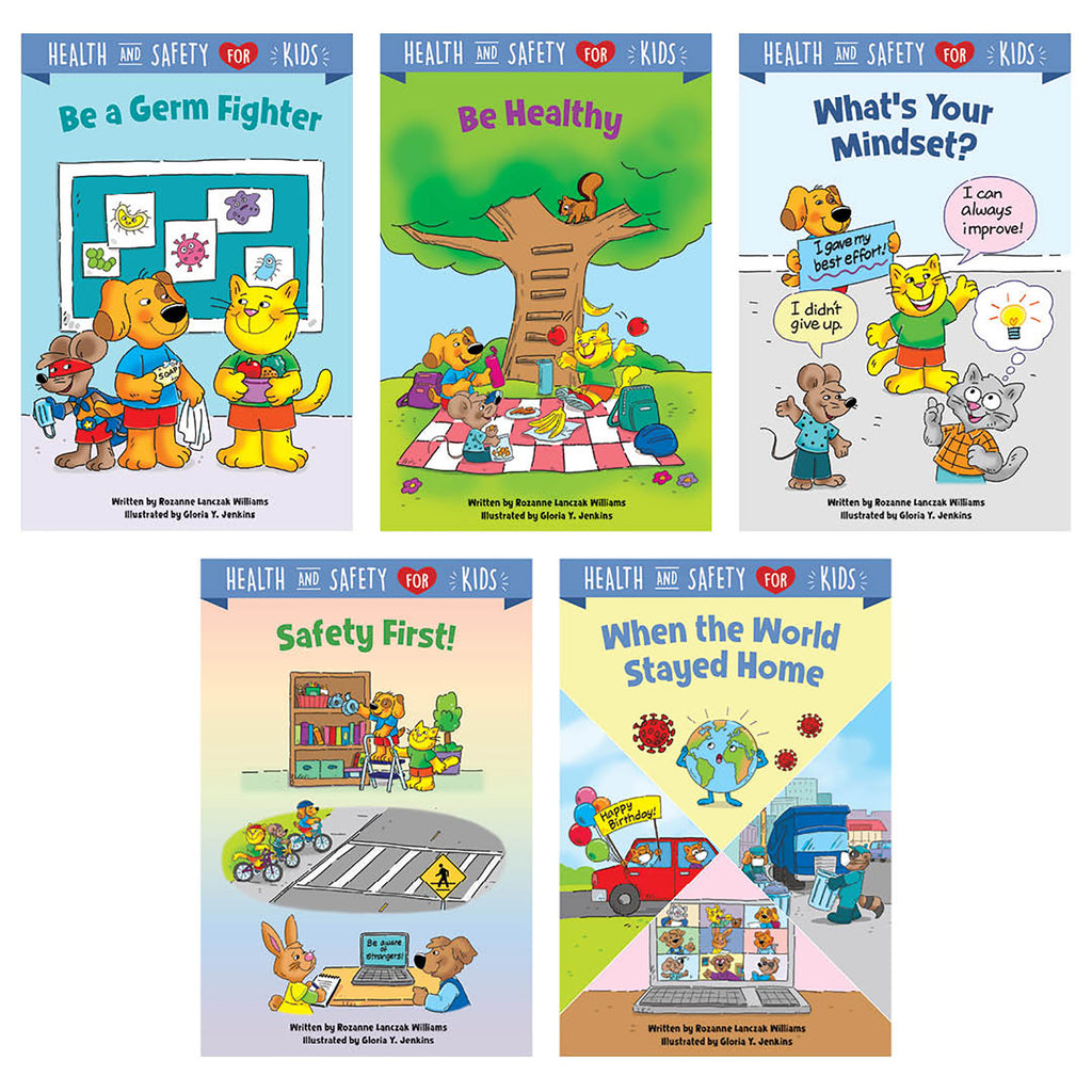
Health & Safety for Kids, 5-Book Pack
$41.03
MPN: 005005UPC: 030554108228Help young learners develop healthy habits, a positive mindset, and social confidence with the stories in the Health and Safety for Kids book series. With the help of loveable characters Cat and Dog, children will learn ways to take care of themselves, stay healthy and fit, handle stressful situations, learn in new wa...
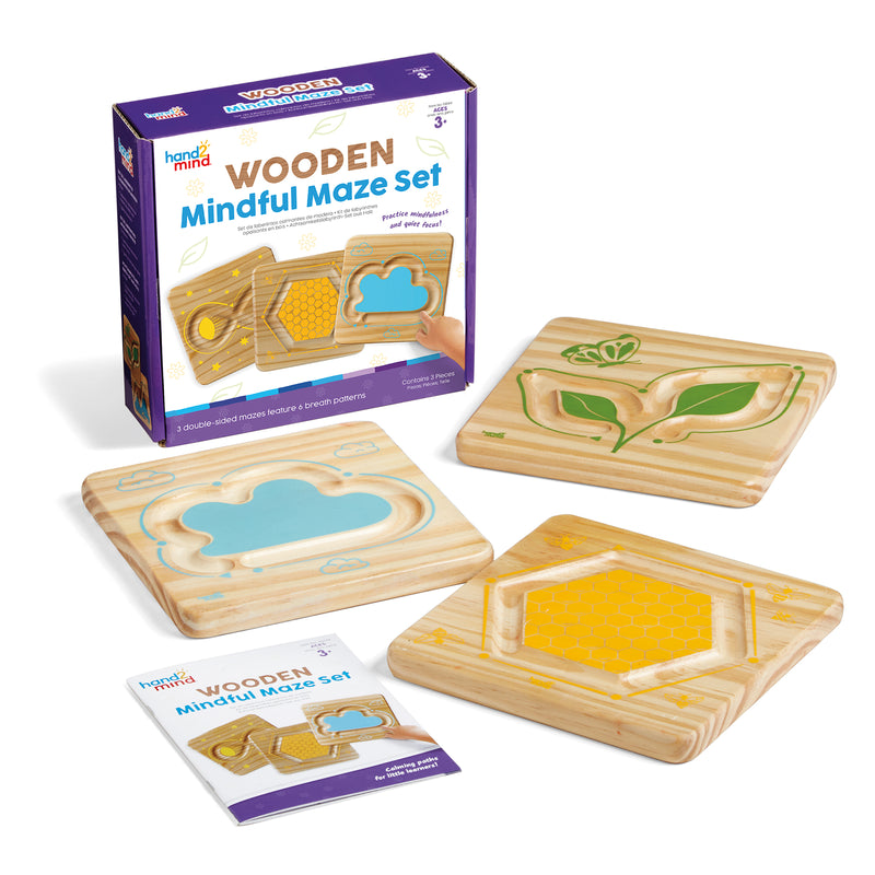
Mindful Maze, Naturals Set

Mindful Maze, Naturals Set
$34.24
MPN: 005083UPC: 848850120345Help students practice mindfulness, quiet focus, and more with this unique set of double-sided breathing boards. Featuring 6 different wooden finger paths, Mindful Maze Naturals helps students understand how to navigate their emotions through relaxing breathing techniques. Includes a Getting Started Guide.Key Features...


Emotion Token Stencils, 8 Per Pack, 2 Packs
$35.59
MPN: 005065UPC: 194629144105Help children explore and understand their emotions by making pictures! This set of 8 stencils is designed to offer a hands-on way for kids to open up about their feelings, promoting empathy and emotional intelligence. By building a discussion around color choices, personal expression, smooth lines or jagged lines, Em...
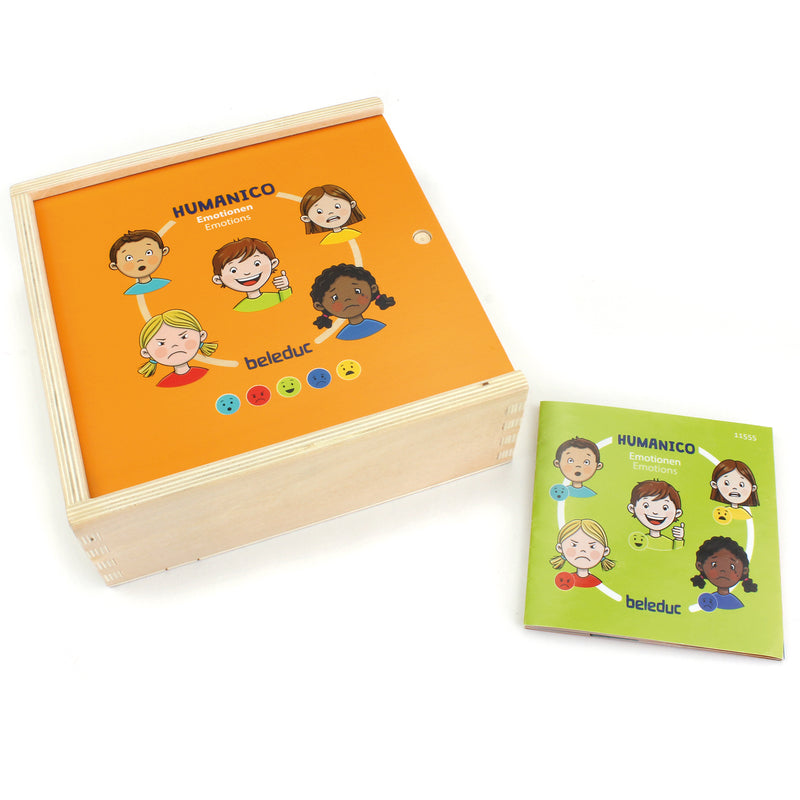
Humanico Emotions Puzzles

Humanico Emotions Puzzles
$34.24
MPN: 006631UPC: 4014888115554Introducing the Humanico Emotions Puzzles! This engaging 30-piece puzzle is designed to enhance social-emotional-learning (SEL) skills, while also fostering logical thinking and communication abilities. With its unique 5-layer design, each layer representing a different emotion, this wooden puzzle provides a wonderfu...
Emotion Token Stencils, Pack of 8
$17.80
MPN: 005065UPC: 066960586374Help children explore and understand their emotions by making pictures! This set of 8 stencils is designed to offer a hands-on way for kids to open up about their feelings, promoting empathy and emotional intelligence. By building a discussion around color choices, personal expression, smooth lines or jagged lines, Em...
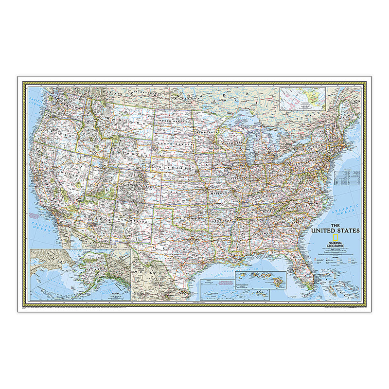
United States Classic Map, Enlarged and Laminated, 69.25" x 48"
$95.83
MPN: 006352UPC: 749717003699Expertly researched and designed, National Geographic's United States wall map is the standard by which other reference maps of the U.S. are measured. Signature Classic styling with bright, easy to read color palette with blue water and colorful state borders. All 50 states with insets for Hawaiian Islands and Alaska ...
World Physical Map, Enlarged and Laminated, 69.25" x 46.25"
$95.83
MPN: 006352UPC: 749717003941Expertly researched and designed, National Geographic's The Physical World map highlights the Earth's land and undersea forms with exquisite hand-painted relief. Drawn in the Winkel Tripel projection, distortions are minimized and unlike many other World maps, Greenland is show the same size as Argentina and not as th...
United States Executive Map, Enlarged and Laminated, 69.25" x 48"
$95.83
MPN: 006352UPC: 749717003927Expertly researched and designed, National Geographic's United States wall map is the standard by which other reference maps of the U.S. are measured. Antique-style "executive" color palette. All 50 states with insets for Hawaiian Islands and Alaska plus inset showing relative size of Alaska. Clearly defined state and...
The Solar System: 2-Sided Map, Laminated, 24.25" x 18.25"
$34.18
MPN: 006352UPC: 749717003996The Solar System, Our Sun's Family, has two sides. The first side includes a description of how our solar system was formed, and shows a map of our solar system, with each planet's orbit in relation to the Sun and to the other planets. Interesting facts and figures accompany each planet's description. Side two is a st...
Earth's Moon Map, Laminated, 42.5" x 28.5"
$47.88
MPN: 006352UPC: 749717003989National Geographic's "The Earth's Moon" is like having an atlas and almanac in one. This incredibly informative wall map features detailed depictions of the entire surface of the moon with a selective index showing the named physical features. Diagrams show the moon's orbital paths, rotation around Earth, librations,...
The Heavens Map, Laminated, 30.5" x 22.75"
$41.03
MPN: 006352UPC: 749717003972The stars of earth's night sky seem to hang like tranquil lanterns, filling us with wonder. They inspire great works of art, and tempt our imaginations into creating stories and myths from the shapes we see. The Heavens shows star charts and constellations for both the Northern and Southern Hemispheres. All 2,844 of t...
The Universe Map, Laminated, 31.25" x 20.25"
$41.03
MPN: 006352UPC: 749717004085As far as we can see with our ever-improving telescopes, there are at least a hundred billion galaxies arrayed throughout the universe. Each, like the Milky Way, is an island galaxy containing billions of stars. This map uses graphic leaps of scales to show how our solar system fits within the vastness of the universe...
Destination Mars: 2-Sided Map, Laminated, 31.25" x 20.25"
$41.03
MPN: 006352UPC: 749717004115See Mars as it really looks, from the heights of Olympus Mons (nearly 70,000 feet above the surface), to ancient canyons, to Hellas Planitia, the lowest point on Mars, where a meteorite punched a hole in the surface 1,300 miles wide and five miles deep. Destination Mars was created for National Geographic with over 1,...
The Milky Way Map, Laminated, 31.25" x 20.25"
$41.03
MPN: 006352UPC: 749717004092This computer-generated image of the Milky Way shows the entire galaxy in one perspective of a 3-D model compiled specially for National Geographic. The model incorporates the positions of hundreds of thousands of stars and nebulae within the galaxy, shows Earth's location, and includes additional photographs, descrip...
Night Sky, Stargazer folded Map Pack Bundle, Folded: 4.25" x 9.25" ; Flat: 25.25" x 18.5"
$34.18
MPN: 006352UPC: 749717055995The Night Sky - Stargazer Map Pack contains two maps, the Northern Hemisphere is centered on Polaris, the North Star, the Southern Hemisphere is centered near Crux, the Southern Cross. The constellations and brighter stars are labeled with their latin names. The map also includes a table of star magnitude or brightnes...
World Executive Map, Mural, 110" x 76.5"
$171.18
MPN: 006352UPC: 749717055063Expertly researched and designed, National Geographic's World Wall Map is the authoritative map of the world by which other reference maps are measured. Antique-style "executive" color palette. Background shows mountain ranges and valleys in subtle shaded relief with mountain ranges labeled. Major water bodies includi...
Space, Stargazer folded Map Pack Bundle, Folded: 4.25" x 9.25" ; Flat: 25.25" x 18.5"
$54.73
MPN: 006352UPC: 749717055988National Geographic's Stargazer Map and Guides Map Pack Bundle of Space includes maps that get progressively further from Earth on four waterproof tear-resistant maps. Each Stargazer Map and Guide shows detailed maps and graphics to help locate features on the moon, planets, and stars. The Stargazer Map and Guides ar...
Pacific Crest Trail Map, Laminated, 18" x 48"
$41.03
MPN: 006352UPC: 749717007697Expertly researched and designed, National Geographic's map of the Pacific Crest Trail is ideal for fans and hikers of this magnificent National Scenic Trail. It makes a great planning tool or as reference to track progress on the 2,600 plus mile length. This beautiful map shows the entire length of the trail from Mex...
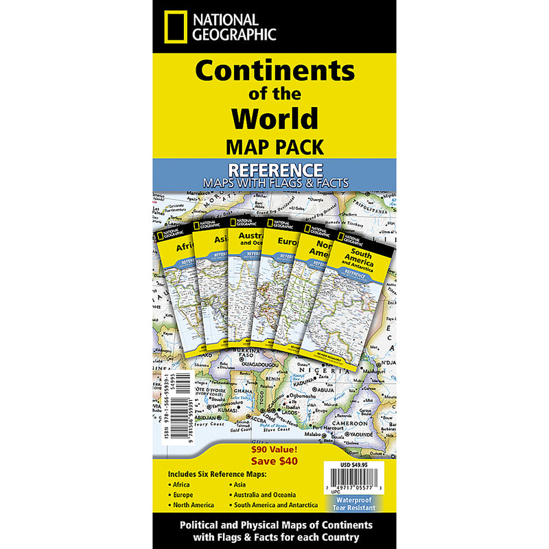

Continents of the World Flags and Facts, folded, Map Pack Bundle, Folded: 4.25" x 9.25" ; Flat: 25.25" x 18.5"
$68.43
MPN: 006352UPC: 749717055773National Geographic's Reference maps with Flags & Facts Map Pack Bundle of Continents includes the seven continents on six waterproof tear-resistant maps. Each continent map includes a political map with countries and cities carefully placed for maximum readability. Each map also includes a physical map of the con...
World Decorator Map, Laminated, 46" x 30.5"
$41.03
MPN: 006352UPC: 749717004696Expertly researched and designed, National Geographic's World Wall Map is the authoritative map of the world by which other reference maps are measured. Colorful Decorator style map with vibrant color palette that fills each country for easy identification. Background shows mountain ranges and valleys in subtle shaded...
World Executive Map, Laminated, 46" x 30.5"
$41.03
MPN: 006352UPC: 749717004771Expertly researched and designed, National Geographic's World Wall Map is the authoritative map of the world by which other reference maps are measured. Antique-style "executive" color palette. Background shows mountain ranges and valleys in subtle shaded relief with mountain ranges labeled. Major water bodies includi...
World Executive Map, Enlarged and Laminated, 73" x 48"
$95.83
MPN: 006352UPC: 749717004788Expertly researched and designed, National Geographic's World Wall Map is the authoritative map of the world by which other reference maps are measured. Antique-style "executive" color palette. Background shows mountain ranges and valleys in subtle shaded relief with mountain ranges labeled. Major water bodies includi...
World Decorator Map, Enlarged and Laminated, 73" x 48"
$95.83
MPN: 006352UPC: 749717004702Expertly researched and designed, National Geographic's World Wall Map is the authoritative map of the world by which other reference maps are measured. Colorful Decorator style map with vibrant color palette that fills each country for easy identification. Background shows mountain ranges and valleys in subtle shaded...
United States Decorator Map, Laminated, 43.5" x 30.5"
$41.03
MPN: 006352UPC: 749717004733National Geographic's Decorator style map of the United States features rich, attractive color fills that bring any room or classroom to life. The map clearly highlights the differences in the urban and physical geography of each state, and national parks are outlined with eye-catching green vignettes. All 50 States a...
United States Decorator Map, Enlarged and Laminated, 43.5" x 30.5"
$95.83
MPN: 006352UPC: 749717004740National Geographic's Decorator style map of the United States features rich, attractive color fills that bring any room or classroom to life. The map clearly highlights the differences in the urban and physical geography of each state, and national parks are outlined with eye-catching green vignettes. All 50 States a...
World Satellite Map, Laminated, 43.5" x 30.5"
$41.03
MPN: 006352UPC: 749717004610National Geographic's striking satellite map of The World is a visually stunning image that makes a wonderful addition to the wall of any office or study. This detailed composite map draws from more than 500 satellite images to give one-kilometer detail and consistent representation of Earth's natural colors and terra...
World Classic Map, Laminated, 43.5" x 30.5"
$41.03
MPN: 006352UPC: 749717004542Expertly researched and designed, National Geographic's World Wall Map is the authoritative map of the world by which other reference maps are measured. Signature Classic style map with bright, easy to read color palette with blue oceans and colorful borders. Background shows mountain ranges and valleys in subtle shad...
Bird Migration, Western Hemisphere Map, Laminated, 20.25" x 31.25"
$34.18
MPN: 006352UPC: 749717004863This National Geographic classic shows the mystery of bird migration and the incredible journeys that birds undertake in the Americas each year. 67 types of birds that migrate are shown on a map of the Americas that is overlaid with pathways that show migration routes from nesting grounds to wintering areas. Full-colo...
World Executive Map, Poster Size and Laminated, 36" x 24"
$41.03
MPN: 006352UPC: 749717005204Expertly researched and designed, National Geographic's World Wall Map is the authoritative map of the world by which other reference maps are measured. Antique-style "executive" color palette. Background shows mountain ranges and valleys in subtle shaded relief with mountain ranges labeled. Major water bodies includi...
World Classic Map, Poster Size and Laminated, 36" x 24"
$41.03
MPN: 006352UPC: 749717005235Expertly researched and designed, National Geographic's World Wall Map is the authoritative map of the world by which other reference maps are measured. Signature Classic style map with bright, easy to read color palette with blue oceans and colorful borders. Background shows mountain ranges and valleys in subtle shad...

United States Classic Map, Poster Size and Laminated, 36" x 24"
$41.03
MPN: 006352UPC: 749717005266Expertly researched and designed, National Geographic's United States wall map is the standard by which other reference maps of the U.S. are measured. Signature Classic styling with bright, easy to read color palette with blue water and colorful state borders. All 50 states with insets for Hawaiian Islands and Alaska ...