Social Studies

Sort by:
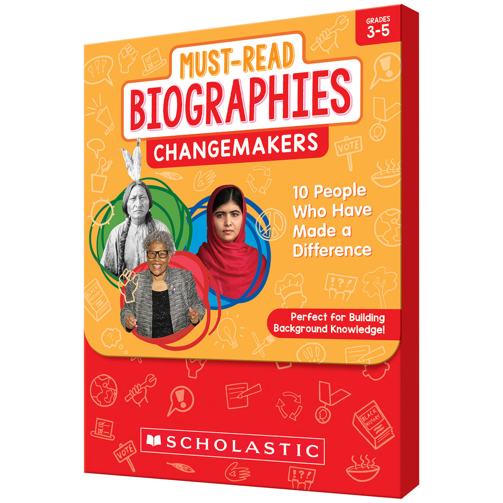
{"id":8751983919319,"title":"Must Read Biographies Changemakers","handle":"must-read-biographies-changemakers","description":"MPN: 005095\u003cbr\u003e\u003cbr\u003eUPC: 9781546107101\u003cbr\u003eGreta Thunberg, Sitting Bull, Sojourner Truth, Barack Obama … Students will be fascinated by these people's stories, as well as those of the other notable figures in this set. Engaging short texts detail their diverse backgrounds, the challenges they faced, and their triumphs as they set out to make their communities and our world a better place to live in. Each biography comes with text-dependent questions that assess students' comprehension and critical thinking skills. Includes 6 copies of each 10 biographies make this set perfect for small-group reading.\u003cbr\u003e\u003cbr\u003eKey Features : \u003cbr\u003e\u003cbr\u003ei : Short engaging biographies of remarkable people that all students should know about\u003cbr\u003eii : Six copies of each biography make this set perfect for small-group reading\u003cbr\u003eiii : Teaching Guide includes text-dependent questions that assess comprehension, vocabulary, and critical thinking skills\u003cbr\u003e\u003cbr\u003eSKU: ERSSC-9781546107101","published_at":"2024-10-30T11:10:12-04:00","created_at":"2024-10-30T11:10:14-04:00","vendor":"Scholastic Teaching Solutions","type":"Social Studies","tags":["8-10 years","Cardstock","History","Ink","Multi","MUST READ BIOGRAPHIES","Paper"],"price":4109,"price_min":4109,"price_max":4109,"available":true,"price_varies":false,"compare_at_price":null,"compare_at_price_min":0,"compare_at_price_max":0,"compare_at_price_varies":false,"variants":[{"id":45812917108951,"title":"Default Title","option1":"Default Title","option2":null,"option3":null,"sku":"ERSSC-9781546107101","requires_shipping":true,"taxable":true,"featured_image":{"id":42010710507735,"product_id":8751983919319,"position":1,"created_at":"2024-10-30T11:10:14-04:00","updated_at":"2024-10-30T11:10:14-04:00","alt":null,"width":1800,"height":1800,"src":"\/\/shop.qualityucanafford.com\/cdn\/shop\/files\/ERSSC-9781546107101.jpg?v=1730301014","variant_ids":[45812917108951]},"available":true,"name":"Must Read Biographies Changemakers","public_title":null,"options":["Default Title"],"price":4109,"weight":998,"compare_at_price":null,"inventory_quantity":20,"inventory_management":"shopify","inventory_policy":"deny","barcode":"9781546107101","featured_media":{"alt":null,"id":34474856153303,"position":1,"preview_image":{"aspect_ratio":1.0,"height":1800,"width":1800,"src":"\/\/shop.qualityucanafford.com\/cdn\/shop\/files\/ERSSC-9781546107101.jpg?v=1730301014"}},"requires_selling_plan":false,"selling_plan_allocations":[]}],"images":["\/\/shop.qualityucanafford.com\/cdn\/shop\/files\/ERSSC-9781546107101.jpg?v=1730301014","\/\/shop.qualityucanafford.com\/cdn\/shop\/files\/ERSSC-9781546107101_1.jpg?v=1730301017"],"featured_image":"\/\/shop.qualityucanafford.com\/cdn\/shop\/files\/ERSSC-9781546107101.jpg?v=1730301014","options":["Title"],"media":[{"alt":null,"id":34474856153303,"position":1,"preview_image":{"aspect_ratio":1.0,"height":1800,"width":1800,"src":"\/\/shop.qualityucanafford.com\/cdn\/shop\/files\/ERSSC-9781546107101.jpg?v=1730301014"},"aspect_ratio":1.0,"height":1800,"media_type":"image","src":"\/\/shop.qualityucanafford.com\/cdn\/shop\/files\/ERSSC-9781546107101.jpg?v=1730301014","width":1800},{"alt":null,"id":34474856218839,"position":2,"preview_image":{"aspect_ratio":1.0,"height":1800,"width":1800,"src":"\/\/shop.qualityucanafford.com\/cdn\/shop\/files\/ERSSC-9781546107101_1.jpg?v=1730301017"},"aspect_ratio":1.0,"height":1800,"media_type":"image","src":"\/\/shop.qualityucanafford.com\/cdn\/shop\/files\/ERSSC-9781546107101_1.jpg?v=1730301017","width":1800}],"requires_selling_plan":false,"selling_plan_groups":[],"content":"MPN: 005095\u003cbr\u003e\u003cbr\u003eUPC: 9781546107101\u003cbr\u003eGreta Thunberg, Sitting Bull, Sojourner Truth, Barack Obama … Students will be fascinated by these people's stories, as well as those of the other notable figures in this set. Engaging short texts detail their diverse backgrounds, the challenges they faced, and their triumphs as they set out to make their communities and our world a better place to live in. Each biography comes with text-dependent questions that assess students' comprehension and critical thinking skills. Includes 6 copies of each 10 biographies make this set perfect for small-group reading.\u003cbr\u003e\u003cbr\u003eKey Features : \u003cbr\u003e\u003cbr\u003ei : Short engaging biographies of remarkable people that all students should know about\u003cbr\u003eii : Six copies of each biography make this set perfect for small-group reading\u003cbr\u003eiii : Teaching Guide includes text-dependent questions that assess comprehension, vocabulary, and critical thinking skills\u003cbr\u003e\u003cbr\u003eSKU: ERSSC-9781546107101"}
Must Read Biographies Changemakers

Must Read Biographies Changemakers

$41.09

MPN: 005095UPC: 9781546107101Greta Thunberg, Sitting Bull, Sojourner Truth, Barack Obama … Students will be fascinated by these people's stories, as well as those of the other notable figures in this set. Engaging short texts detail their diverse backgrounds, the challenges they faced, and their triumphs as they set out to make their communities...


More Info
{"id":8751983853783,"title":"Must Read Biographies Stem","handle":"must-read-biographies-stem","description":"MPN: 005095\u003cbr\u003e\u003cbr\u003eUPC: 9781546107118\u003cbr\u003eKatherine Johnson, Shigeru Miyamoto, Temple Grandin, Benjamin Banneker … These people's stories, along with those of other notable figures in this set, will fascinate students who are interested in science, technology, engineering, and math. Engaging short texts detail their diverse backgrounds, the challenges they faced, and their triumphs. Each biography comes with text-dependent questions that assess comprehension and critical thinking skills. Includes 6 copies of each 10 biographies make this set perfect for small-group reading.\u003cbr\u003e\u003cbr\u003eKey Features : \u003cbr\u003e\u003cbr\u003ei : Short engaging biographies of remarkable people that all students should know about\u003cbr\u003eii : Six copies of each biography make this set perfect for small-group reading\u003cbr\u003eiii : Teaching Guide includes text-dependent questions that assess comprehension, vocabulary, and critical thinking skills\u003cbr\u003e\u003cbr\u003eSKU: ERSSC-9781546107118","published_at":"2024-10-30T11:10:11-04:00","created_at":"2024-10-30T11:10:11-04:00","vendor":"Scholastic Teaching Solutions","type":"Social Studies","tags":["8-10 years","Cardstock","History","Ink","Multi","MUST READ BIOGRAPHIES","Paper"],"price":4109,"price_min":4109,"price_max":4109,"available":true,"price_varies":false,"compare_at_price":null,"compare_at_price_min":0,"compare_at_price_max":0,"compare_at_price_varies":false,"variants":[{"id":45812916748503,"title":"Default Title","option1":"Default Title","option2":null,"option3":null,"sku":"ERSSC-9781546107118","requires_shipping":true,"taxable":true,"featured_image":{"id":42011037565143,"product_id":8751983853783,"position":1,"created_at":"2024-10-30T12:48:04-04:00","updated_at":"2024-10-30T12:48:04-04:00","alt":null,"width":1800,"height":1800,"src":"\/\/shop.qualityucanafford.com\/cdn\/shop\/files\/ERSSC-9781546107118.jpg?v=1730306884","variant_ids":[45812916748503]},"available":true,"name":"Must Read Biographies Stem","public_title":null,"options":["Default Title"],"price":4109,"weight":998,"compare_at_price":null,"inventory_quantity":20,"inventory_management":"shopify","inventory_policy":"deny","barcode":"9781546107118","featured_media":{"alt":null,"id":34475134353623,"position":1,"preview_image":{"aspect_ratio":1.0,"height":1800,"width":1800,"src":"\/\/shop.qualityucanafford.com\/cdn\/shop\/files\/ERSSC-9781546107118.jpg?v=1730306884"}},"requires_selling_plan":false,"selling_plan_allocations":[]}],"images":["\/\/shop.qualityucanafford.com\/cdn\/shop\/files\/ERSSC-9781546107118.jpg?v=1730306884","\/\/shop.qualityucanafford.com\/cdn\/shop\/files\/ERSSC-9781546107118_2.jpg?v=1730306887","\/\/shop.qualityucanafford.com\/cdn\/shop\/files\/ERSSC-9781546107118_1.jpg?v=1730306889","\/\/shop.qualityucanafford.com\/cdn\/shop\/files\/ERSSC-9781546107118_3.jpg?v=1730306891"],"featured_image":"\/\/shop.qualityucanafford.com\/cdn\/shop\/files\/ERSSC-9781546107118.jpg?v=1730306884","options":["Title"],"media":[{"alt":null,"id":34475134353623,"position":1,"preview_image":{"aspect_ratio":1.0,"height":1800,"width":1800,"src":"\/\/shop.qualityucanafford.com\/cdn\/shop\/files\/ERSSC-9781546107118.jpg?v=1730306884"},"aspect_ratio":1.0,"height":1800,"media_type":"image","src":"\/\/shop.qualityucanafford.com\/cdn\/shop\/files\/ERSSC-9781546107118.jpg?v=1730306884","width":1800},{"alt":null,"id":34475134484695,"position":2,"preview_image":{"aspect_ratio":1.0,"height":1800,"width":1800,"src":"\/\/shop.qualityucanafford.com\/cdn\/shop\/files\/ERSSC-9781546107118_2.jpg?v=1730306887"},"aspect_ratio":1.0,"height":1800,"media_type":"image","src":"\/\/shop.qualityucanafford.com\/cdn\/shop\/files\/ERSSC-9781546107118_2.jpg?v=1730306887","width":1800},{"alt":null,"id":34475134550231,"position":3,"preview_image":{"aspect_ratio":1.0,"height":1800,"width":1800,"src":"\/\/shop.qualityucanafford.com\/cdn\/shop\/files\/ERSSC-9781546107118_1.jpg?v=1730306889"},"aspect_ratio":1.0,"height":1800,"media_type":"image","src":"\/\/shop.qualityucanafford.com\/cdn\/shop\/files\/ERSSC-9781546107118_1.jpg?v=1730306889","width":1800},{"alt":null,"id":34475134582999,"position":4,"preview_image":{"aspect_ratio":1.0,"height":1800,"width":1800,"src":"\/\/shop.qualityucanafford.com\/cdn\/shop\/files\/ERSSC-9781546107118_3.jpg?v=1730306891"},"aspect_ratio":1.0,"height":1800,"media_type":"image","src":"\/\/shop.qualityucanafford.com\/cdn\/shop\/files\/ERSSC-9781546107118_3.jpg?v=1730306891","width":1800}],"requires_selling_plan":false,"selling_plan_groups":[],"content":"MPN: 005095\u003cbr\u003e\u003cbr\u003eUPC: 9781546107118\u003cbr\u003eKatherine Johnson, Shigeru Miyamoto, Temple Grandin, Benjamin Banneker … These people's stories, along with those of other notable figures in this set, will fascinate students who are interested in science, technology, engineering, and math. Engaging short texts detail their diverse backgrounds, the challenges they faced, and their triumphs. Each biography comes with text-dependent questions that assess comprehension and critical thinking skills. Includes 6 copies of each 10 biographies make this set perfect for small-group reading.\u003cbr\u003e\u003cbr\u003eKey Features : \u003cbr\u003e\u003cbr\u003ei : Short engaging biographies of remarkable people that all students should know about\u003cbr\u003eii : Six copies of each biography make this set perfect for small-group reading\u003cbr\u003eiii : Teaching Guide includes text-dependent questions that assess comprehension, vocabulary, and critical thinking skills\u003cbr\u003e\u003cbr\u003eSKU: ERSSC-9781546107118"}
Must Read Biographies Stem

Must Read Biographies Stem

$41.09

MPN: 005095UPC: 9781546107118Katherine Johnson, Shigeru Miyamoto, Temple Grandin, Benjamin Banneker … These people's stories, along with those of other notable figures in this set, will fascinate students who are interested in science, technology, engineering, and math. Engaging short texts detail their diverse backgrounds, the challenges they f...


More Info
{"id":8751982903511,"title":"Must Read Biographies Arts \u0026 Sports","handle":"must-read-biographies-arts-sports","description":"MPN: 005095\u003cbr\u003e\u003cbr\u003eUPC: 9781546107095\u003cbr\u003eFrida Kahlo, Lin Manuel Miranda, Billie Jean King, Shohei Ohtani … These are just some of the outstanding artists and sports figures whose life stories are sure to captivate students. Engaging short texts detail their diverse backgrounds, the challenges they faced, and their triumphs as they excelled in their respective fields. Each biography comes with text-dependent questions that assess students' comprehension and critical thinking skills. Includes 6 copies of each 10 biographies make this set perfect for small-group reading.\u003cbr\u003e\u003cbr\u003eKey Features : \u003cbr\u003e\u003cbr\u003ei : Short engaging biographies of remarkable people that all students should know about\u003cbr\u003eii : Six copies of each biography make this set perfect for small-group reading\u003cbr\u003eiii : Teaching Guide includes text-dependent questions that assess comprehension, vocabulary, and critical thinking skills\u003cbr\u003e\u003cbr\u003eSKU: ERSSC-9781546107095","published_at":"2024-10-30T11:08:52-04:00","created_at":"2024-10-30T11:08:54-04:00","vendor":"Scholastic Teaching Solutions","type":"Social Studies","tags":["8-10 years","Cardstock","History","Ink","Multi","MUST READ BIOGRAPHIES","Paper"],"price":4109,"price_min":4109,"price_max":4109,"available":true,"price_varies":false,"compare_at_price":null,"compare_at_price_min":0,"compare_at_price_max":0,"compare_at_price_varies":false,"variants":[{"id":45812912423127,"title":"Default Title","option1":"Default Title","option2":null,"option3":null,"sku":"ERSSC-9781546107095","requires_shipping":true,"taxable":true,"featured_image":{"id":42010704216279,"product_id":8751982903511,"position":1,"created_at":"2024-10-30T11:08:54-04:00","updated_at":"2024-10-30T11:08:54-04:00","alt":null,"width":1800,"height":1800,"src":"\/\/shop.qualityucanafford.com\/cdn\/shop\/files\/ERSSC-9781546107095.jpg?v=1730300934","variant_ids":[45812912423127]},"available":true,"name":"Must Read Biographies Arts \u0026 Sports","public_title":null,"options":["Default Title"],"price":4109,"weight":998,"compare_at_price":null,"inventory_quantity":20,"inventory_management":"shopify","inventory_policy":"deny","barcode":"9781546107095","featured_media":{"alt":null,"id":34474850713815,"position":1,"preview_image":{"aspect_ratio":1.0,"height":1800,"width":1800,"src":"\/\/shop.qualityucanafford.com\/cdn\/shop\/files\/ERSSC-9781546107095.jpg?v=1730300934"}},"requires_selling_plan":false,"selling_plan_allocations":[]}],"images":["\/\/shop.qualityucanafford.com\/cdn\/shop\/files\/ERSSC-9781546107095.jpg?v=1730300934","\/\/shop.qualityucanafford.com\/cdn\/shop\/files\/ERSSC-9781546107095_1.jpg?v=1730300936"],"featured_image":"\/\/shop.qualityucanafford.com\/cdn\/shop\/files\/ERSSC-9781546107095.jpg?v=1730300934","options":["Title"],"media":[{"alt":null,"id":34474850713815,"position":1,"preview_image":{"aspect_ratio":1.0,"height":1800,"width":1800,"src":"\/\/shop.qualityucanafford.com\/cdn\/shop\/files\/ERSSC-9781546107095.jpg?v=1730300934"},"aspect_ratio":1.0,"height":1800,"media_type":"image","src":"\/\/shop.qualityucanafford.com\/cdn\/shop\/files\/ERSSC-9781546107095.jpg?v=1730300934","width":1800},{"alt":null,"id":34474850943191,"position":2,"preview_image":{"aspect_ratio":1.0,"height":1800,"width":1800,"src":"\/\/shop.qualityucanafford.com\/cdn\/shop\/files\/ERSSC-9781546107095_1.jpg?v=1730300936"},"aspect_ratio":1.0,"height":1800,"media_type":"image","src":"\/\/shop.qualityucanafford.com\/cdn\/shop\/files\/ERSSC-9781546107095_1.jpg?v=1730300936","width":1800}],"requires_selling_plan":false,"selling_plan_groups":[],"content":"MPN: 005095\u003cbr\u003e\u003cbr\u003eUPC: 9781546107095\u003cbr\u003eFrida Kahlo, Lin Manuel Miranda, Billie Jean King, Shohei Ohtani … These are just some of the outstanding artists and sports figures whose life stories are sure to captivate students. Engaging short texts detail their diverse backgrounds, the challenges they faced, and their triumphs as they excelled in their respective fields. Each biography comes with text-dependent questions that assess students' comprehension and critical thinking skills. Includes 6 copies of each 10 biographies make this set perfect for small-group reading.\u003cbr\u003e\u003cbr\u003eKey Features : \u003cbr\u003e\u003cbr\u003ei : Short engaging biographies of remarkable people that all students should know about\u003cbr\u003eii : Six copies of each biography make this set perfect for small-group reading\u003cbr\u003eiii : Teaching Guide includes text-dependent questions that assess comprehension, vocabulary, and critical thinking skills\u003cbr\u003e\u003cbr\u003eSKU: ERSSC-9781546107095"}
Must Read Biographies Arts & Sports

Must Read Biographies Arts & Sports

$41.09

MPN: 005095UPC: 9781546107095Frida Kahlo, Lin Manuel Miranda, Billie Jean King, Shohei Ohtani … These are just some of the outstanding artists and sports figures whose life stories are sure to captivate students. Engaging short texts detail their diverse backgrounds, the challenges they faced, and their triumphs as they excelled in their respect...


More Info
{"id":8719615426775,"title":"Inclusion Puzzles, Set of 4","handle":"inclusion-puzzles-set-of-4","description":"MPN: 006389\u003cbr\u003e\u003cbr\u003eUPC: 8413082352714\u003cbr\u003eMiniland Inclusion Puzzles is a set of 4 different puzzles featuring images of diverse children. Made of washable plastic and very resistant, unbreakable material. Designed to promote values such as tolerance, empathy and diversity. Each puzzle comes with 25 pieces.\u003cbr\u003e\u003cbr\u003eKey Features : \u003cbr\u003e\u003cbr\u003ei : Designed to promote values such as tolerance, empathy and diversity. Each puzzle comes with 25 pieces\u003cbr\u003eii : Miniland Inclusion Puzzles it's a set of 4 different Puzzles featuring images of diverse children\u003cbr\u003eiii : Made in Spain\u003cbr\u003eiv : For children ages 2 years and up\u003cbr\u003e\u003cbr\u003eSKU: ERSMLE35271","published_at":"2024-09-23T21:11:23-04:00","created_at":"2024-09-23T21:11:23-04:00","vendor":"Miniland","type":"Social Studies","tags":["2+ years","Multi","Plastic","Self Awareness"],"price":6162,"price_min":6162,"price_max":6162,"available":true,"price_varies":false,"compare_at_price":null,"compare_at_price_min":0,"compare_at_price_max":0,"compare_at_price_varies":false,"variants":[{"id":45702380847319,"title":"Default Title","option1":"Default Title","option2":null,"option3":null,"sku":"ERSMLE35271","requires_shipping":true,"taxable":true,"featured_image":null,"available":true,"name":"Inclusion Puzzles, Set of 4","public_title":null,"options":["Default Title"],"price":6162,"weight":762,"compare_at_price":null,"inventory_quantity":16,"inventory_management":"shopify","inventory_policy":"deny","barcode":"8413082352714","requires_selling_plan":false,"selling_plan_allocations":[]}],"images":[],"featured_image":null,"options":["Title"],"requires_selling_plan":false,"selling_plan_groups":[],"content":"MPN: 006389\u003cbr\u003e\u003cbr\u003eUPC: 8413082352714\u003cbr\u003eMiniland Inclusion Puzzles is a set of 4 different puzzles featuring images of diverse children. Made of washable plastic and very resistant, unbreakable material. Designed to promote values such as tolerance, empathy and diversity. Each puzzle comes with 25 pieces.\u003cbr\u003e\u003cbr\u003eKey Features : \u003cbr\u003e\u003cbr\u003ei : Designed to promote values such as tolerance, empathy and diversity. Each puzzle comes with 25 pieces\u003cbr\u003eii : Miniland Inclusion Puzzles it's a set of 4 different Puzzles featuring images of diverse children\u003cbr\u003eiii : Made in Spain\u003cbr\u003eiv : For children ages 2 years and up\u003cbr\u003e\u003cbr\u003eSKU: ERSMLE35271"}

Inclusion Puzzles, Set of 4

$61.62

MPN: 006389UPC: 8413082352714Miniland Inclusion Puzzles is a set of 4 different puzzles featuring images of diverse children. Made of washable plastic and very resistant, unbreakable material. Designed to promote values such as tolerance, empathy and diversity. Each puzzle comes with 25 pieces.Key Features : i : Designed to promote values such a...


More Info
{"id":8719142846679,"title":"Bloomie: Flower and Candle Fidget Tool","handle":"bloomie-flower-and-candle-fidget-tool","description":"MPN: 006626\u003cbr\u003e\u003cbr\u003eUPC: 860011709121\u003cbr\u003eIntroduce your child to the magic of emotional regulation with Bloomie, the innovative flower and candle breathing tool. Designed with a flower on one side and a candle on the other, Bloomie transforms familiar actions into a powerful mindfulness practice. \n\nOn the flower side, your child can inhale deeply, pretending to smell a flower. This helps them take a calm, deep breath. On the candle side, after smelling the flower, they can push the flower into the tube, which pops out the candle. They then exhale, as if blowing out a candle, helping them release stress and tension.\n\nBloomie guides children through deep breathing exercises, helping them manage their emotions effectively. The interactive design engages your child's senses, making mindfulness both fun and accessible. Compact and portable, Bloomie can be used in a calm corner at home or on the go, providing a convenient way for kids to practice mindfulness anywhere.\n\nBloomie taps into the universal experiences of smelling a flower and blowing out a candle, turning these simple actions into a soothing routine. Help your child harness the power of their breath and discover a path to calm with Bloomie.\u003cbr\u003e\u003cbr\u003eKey Features : \u003cbr\u003e\u003cbr\u003ei : Introduce your child to the magic of emotional regulation with Bloomie, the innovative flower and candle breathing tool\u003cbr\u003eii : Designed with a flower on one side and a candle on the other, Bloomie transforms familiar actions into a powerful mindfulness practice.\u003cbr\u003eiii : Bloomie taps into the universal experiences of smelling a flower and blowing out a candle, turning these simple actions into a soothing routine.\u003cbr\u003eiv : Help your child harness the power of their breath and discover a path to calm with Bloomie.\u003cbr\u003e\u003cbr\u003eSKU: ERSCCJ3010070701","published_at":"2024-11-18T08:11:21-05:00","created_at":"2024-09-23T08:50:27-04:00","vendor":"The Calm Caterpillar","type":"Social Studies","tags":["3-10 years","Multi","Plastic Tubing","Polyester","Self Awareness"],"price":2054,"price_min":2054,"price_max":2054,"available":true,"price_varies":false,"compare_at_price":null,"compare_at_price_min":0,"compare_at_price_max":0,"compare_at_price_varies":false,"variants":[{"id":45699400270039,"title":"Default Title","option1":"Default Title","option2":null,"option3":null,"sku":"ERSCCJ3010070701","requires_shipping":true,"taxable":true,"featured_image":{"id":41699497935063,"product_id":8719142846679,"position":1,"created_at":"2024-09-23T08:50:28-04:00","updated_at":"2024-09-23T08:50:28-04:00","alt":null,"width":1800,"height":1800,"src":"\/\/shop.qualityucanafford.com\/cdn\/shop\/files\/ERSCCJ3010070701.jpg?v=1727095828","variant_ids":[45699400270039]},"available":true,"name":"Bloomie: Flower and Candle Fidget Tool","public_title":null,"options":["Default Title"],"price":2054,"weight":327,"compare_at_price":null,"inventory_quantity":297,"inventory_management":"shopify","inventory_policy":"deny","barcode":"860011709121","featured_media":{"alt":null,"id":34243417047255,"position":1,"preview_image":{"aspect_ratio":1.0,"height":1800,"width":1800,"src":"\/\/shop.qualityucanafford.com\/cdn\/shop\/files\/ERSCCJ3010070701.jpg?v=1727095828"}},"requires_selling_plan":false,"selling_plan_allocations":[]}],"images":["\/\/shop.qualityucanafford.com\/cdn\/shop\/files\/ERSCCJ3010070701.jpg?v=1727095828","\/\/shop.qualityucanafford.com\/cdn\/shop\/files\/ERSCCJ3010070701_1.jpg?v=1727095840","\/\/shop.qualityucanafford.com\/cdn\/shop\/files\/ERSCCJ3010070701_2.jpg?v=1727095842","\/\/shop.qualityucanafford.com\/cdn\/shop\/files\/ERSCCJ3010070701_3.jpg?v=1727095844","\/\/shop.qualityucanafford.com\/cdn\/shop\/files\/ERSCCJ3010070701_4.jpg?v=1727095846","\/\/shop.qualityucanafford.com\/cdn\/shop\/files\/ERSCCJ3010070701_5.jpg?v=1727095848","\/\/shop.qualityucanafford.com\/cdn\/shop\/files\/ERSCCJ3010070701_6.jpg?v=1727095850"],"featured_image":"\/\/shop.qualityucanafford.com\/cdn\/shop\/files\/ERSCCJ3010070701.jpg?v=1727095828","options":["Title"],"media":[{"alt":null,"id":34243417047255,"position":1,"preview_image":{"aspect_ratio":1.0,"height":1800,"width":1800,"src":"\/\/shop.qualityucanafford.com\/cdn\/shop\/files\/ERSCCJ3010070701.jpg?v=1727095828"},"aspect_ratio":1.0,"height":1800,"media_type":"image","src":"\/\/shop.qualityucanafford.com\/cdn\/shop\/files\/ERSCCJ3010070701.jpg?v=1727095828","width":1800},{"alt":null,"id":34243418620119,"position":2,"preview_image":{"aspect_ratio":1.0,"height":1800,"width":1800,"src":"\/\/shop.qualityucanafford.com\/cdn\/shop\/files\/ERSCCJ3010070701_1.jpg?v=1727095840"},"aspect_ratio":1.0,"height":1800,"media_type":"image","src":"\/\/shop.qualityucanafford.com\/cdn\/shop\/files\/ERSCCJ3010070701_1.jpg?v=1727095840","width":1800},{"alt":null,"id":34243418718423,"position":3,"preview_image":{"aspect_ratio":1.0,"height":1800,"width":1800,"src":"\/\/shop.qualityucanafford.com\/cdn\/shop\/files\/ERSCCJ3010070701_2.jpg?v=1727095842"},"aspect_ratio":1.0,"height":1800,"media_type":"image","src":"\/\/shop.qualityucanafford.com\/cdn\/shop\/files\/ERSCCJ3010070701_2.jpg?v=1727095842","width":1800},{"alt":null,"id":34243418783959,"position":4,"preview_image":{"aspect_ratio":1.0,"height":1800,"width":1800,"src":"\/\/shop.qualityucanafford.com\/cdn\/shop\/files\/ERSCCJ3010070701_3.jpg?v=1727095844"},"aspect_ratio":1.0,"height":1800,"media_type":"image","src":"\/\/shop.qualityucanafford.com\/cdn\/shop\/files\/ERSCCJ3010070701_3.jpg?v=1727095844","width":1800},{"alt":null,"id":34243419308247,"position":5,"preview_image":{"aspect_ratio":1.0,"height":1800,"width":1800,"src":"\/\/shop.qualityucanafford.com\/cdn\/shop\/files\/ERSCCJ3010070701_4.jpg?v=1727095846"},"aspect_ratio":1.0,"height":1800,"media_type":"image","src":"\/\/shop.qualityucanafford.com\/cdn\/shop\/files\/ERSCCJ3010070701_4.jpg?v=1727095846","width":1800},{"alt":null,"id":34243419373783,"position":6,"preview_image":{"aspect_ratio":1.0,"height":1800,"width":1800,"src":"\/\/shop.qualityucanafford.com\/cdn\/shop\/files\/ERSCCJ3010070701_5.jpg?v=1727095848"},"aspect_ratio":1.0,"height":1800,"media_type":"image","src":"\/\/shop.qualityucanafford.com\/cdn\/shop\/files\/ERSCCJ3010070701_5.jpg?v=1727095848","width":1800},{"alt":null,"id":34243419439319,"position":7,"preview_image":{"aspect_ratio":1.0,"height":1800,"width":1800,"src":"\/\/shop.qualityucanafford.com\/cdn\/shop\/files\/ERSCCJ3010070701_6.jpg?v=1727095850"},"aspect_ratio":1.0,"height":1800,"media_type":"image","src":"\/\/shop.qualityucanafford.com\/cdn\/shop\/files\/ERSCCJ3010070701_6.jpg?v=1727095850","width":1800}],"requires_selling_plan":false,"selling_plan_groups":[],"content":"MPN: 006626\u003cbr\u003e\u003cbr\u003eUPC: 860011709121\u003cbr\u003eIntroduce your child to the magic of emotional regulation with Bloomie, the innovative flower and candle breathing tool. Designed with a flower on one side and a candle on the other, Bloomie transforms familiar actions into a powerful mindfulness practice. \n\nOn the flower side, your child can inhale deeply, pretending to smell a flower. This helps them take a calm, deep breath. On the candle side, after smelling the flower, they can push the flower into the tube, which pops out the candle. They then exhale, as if blowing out a candle, helping them release stress and tension.\n\nBloomie guides children through deep breathing exercises, helping them manage their emotions effectively. The interactive design engages your child's senses, making mindfulness both fun and accessible. Compact and portable, Bloomie can be used in a calm corner at home or on the go, providing a convenient way for kids to practice mindfulness anywhere.\n\nBloomie taps into the universal experiences of smelling a flower and blowing out a candle, turning these simple actions into a soothing routine. Help your child harness the power of their breath and discover a path to calm with Bloomie.\u003cbr\u003e\u003cbr\u003eKey Features : \u003cbr\u003e\u003cbr\u003ei : Introduce your child to the magic of emotional regulation with Bloomie, the innovative flower and candle breathing tool\u003cbr\u003eii : Designed with a flower on one side and a candle on the other, Bloomie transforms familiar actions into a powerful mindfulness practice.\u003cbr\u003eiii : Bloomie taps into the universal experiences of smelling a flower and blowing out a candle, turning these simple actions into a soothing routine.\u003cbr\u003eiv : Help your child harness the power of their breath and discover a path to calm with Bloomie.\u003cbr\u003e\u003cbr\u003eSKU: ERSCCJ3010070701"}
Bloomie: Flower and Candle Fidget Tool

Bloomie: Flower and Candle Fidget Tool

$20.54

MPN: 006626UPC: 860011709121Introduce your child to the magic of emotional regulation with Bloomie, the innovative flower and candle breathing tool. Designed with a flower on one side and a candle on the other, Bloomie transforms familiar actions into a powerful mindfulness practice. On the flower side, your child can inhale deeply, pretending...


More Info
{"id":8709161713879,"title":"Health \u0026 Safety for Kids, 5-Book Pack","handle":"health-safety-for-kids-5-book-pack","description":"MPN: 005005\u003cbr\u003e\u003cbr\u003eUPC: 030554108228\u003cbr\u003eHelp young learners develop healthy habits, a positive mindset, and social confidence with the stories in the Health and Safety for Kids book series. With the help of loveable characters Cat and Dog, children will learn ways to take care of themselves, stay healthy and fit, handle stressful situations, learn in new ways, feel happy, and be good friends to one another. Story topics will empower children to believe in themselves, practice mindfulness in uncertain times, and stay positive and confident as they choose healthy and safe paths for their lives. Through Cat and Dog's day-to-day experiences, and with a bit of humor thrown in, children will learn practical ways to be healthy, happy, and safe.\n\nThis 5-book series comes with these titles: 10630 Be a Germ Fighter, 10631 Be Healthy, 10632 What's Your Mindset?, 10633 Safety First!, and 10634 When the World Stayed Home. Books measure 6\" x 9\", and include 32 pages. For grade 1-3.\u003cbr\u003e\u003cbr\u003eKey Features : \u003cbr\u003e\u003cbr\u003ei : Help young learners develop healthy habits, a positive mindset, and social confidence with the stories in the Health and Safety for Kids book series\u003cbr\u003eii : With the help of loveable characters Cat and Dog, children will learn ways to take care of themselves, stay healthy and fit, handle stressful situations, learn in new ways, feel happy, and be good friends to one another\u003cbr\u003eiii : Story topics will empower children to believe in themselves, practice mindfulness in uncertain times, and stay positive and confident as they choose healthy and safe paths for their lives\u003cbr\u003eiv : Includes 5 readers\u003cbr\u003e\u003cbr\u003eSKU: ERSCTP10822","published_at":"2024-09-14T10:22:02-04:00","created_at":"2024-09-14T10:22:03-04:00","vendor":"Creative Teaching Press®","type":"Social Studies","tags":["6-8 years","Multi","Paper","Self Awareness"],"price":4103,"price_min":4103,"price_max":4103,"available":true,"price_varies":false,"compare_at_price":null,"compare_at_price_min":0,"compare_at_price_max":0,"compare_at_price_varies":false,"variants":[{"id":45654506275031,"title":"Default Title","option1":"Default Title","option2":null,"option3":null,"sku":"ERSCTP10822","requires_shipping":true,"taxable":true,"featured_image":{"id":41625618546903,"product_id":8709161713879,"position":1,"created_at":"2024-09-14T10:22:03-04:00","updated_at":"2024-09-14T10:22:03-04:00","alt":null,"width":1800,"height":1800,"src":"\/\/shop.qualityucanafford.com\/cdn\/shop\/files\/ERSCTP10822.jpg?v=1726323723","variant_ids":[45654506275031]},"available":true,"name":"Health \u0026 Safety for Kids, 5-Book Pack","public_title":null,"options":["Default Title"],"price":4103,"weight":426,"compare_at_price":null,"inventory_quantity":16,"inventory_management":"shopify","inventory_policy":"deny","barcode":"030554108228","featured_media":{"alt":null,"id":34185329082583,"position":1,"preview_image":{"aspect_ratio":1.0,"height":1800,"width":1800,"src":"\/\/shop.qualityucanafford.com\/cdn\/shop\/files\/ERSCTP10822.jpg?v=1726323723"}},"requires_selling_plan":false,"selling_plan_allocations":[]}],"images":["\/\/shop.qualityucanafford.com\/cdn\/shop\/files\/ERSCTP10822.jpg?v=1726323723","\/\/shop.qualityucanafford.com\/cdn\/shop\/files\/ERSCTP10822_1.jpg?v=1726323726","\/\/shop.qualityucanafford.com\/cdn\/shop\/files\/ERSCTP10822_2.jpg?v=1726323728"],"featured_image":"\/\/shop.qualityucanafford.com\/cdn\/shop\/files\/ERSCTP10822.jpg?v=1726323723","options":["Title"],"media":[{"alt":null,"id":34185329082583,"position":1,"preview_image":{"aspect_ratio":1.0,"height":1800,"width":1800,"src":"\/\/shop.qualityucanafford.com\/cdn\/shop\/files\/ERSCTP10822.jpg?v=1726323723"},"aspect_ratio":1.0,"height":1800,"media_type":"image","src":"\/\/shop.qualityucanafford.com\/cdn\/shop\/files\/ERSCTP10822.jpg?v=1726323723","width":1800},{"alt":null,"id":34185329377495,"position":2,"preview_image":{"aspect_ratio":1.0,"height":1800,"width":1800,"src":"\/\/shop.qualityucanafford.com\/cdn\/shop\/files\/ERSCTP10822_1.jpg?v=1726323726"},"aspect_ratio":1.0,"height":1800,"media_type":"image","src":"\/\/shop.qualityucanafford.com\/cdn\/shop\/files\/ERSCTP10822_1.jpg?v=1726323726","width":1800},{"alt":null,"id":34185329443031,"position":3,"preview_image":{"aspect_ratio":1.0,"height":1800,"width":1800,"src":"\/\/shop.qualityucanafford.com\/cdn\/shop\/files\/ERSCTP10822_2.jpg?v=1726323728"},"aspect_ratio":1.0,"height":1800,"media_type":"image","src":"\/\/shop.qualityucanafford.com\/cdn\/shop\/files\/ERSCTP10822_2.jpg?v=1726323728","width":1800}],"requires_selling_plan":false,"selling_plan_groups":[],"content":"MPN: 005005\u003cbr\u003e\u003cbr\u003eUPC: 030554108228\u003cbr\u003eHelp young learners develop healthy habits, a positive mindset, and social confidence with the stories in the Health and Safety for Kids book series. With the help of loveable characters Cat and Dog, children will learn ways to take care of themselves, stay healthy and fit, handle stressful situations, learn in new ways, feel happy, and be good friends to one another. Story topics will empower children to believe in themselves, practice mindfulness in uncertain times, and stay positive and confident as they choose healthy and safe paths for their lives. Through Cat and Dog's day-to-day experiences, and with a bit of humor thrown in, children will learn practical ways to be healthy, happy, and safe.\n\nThis 5-book series comes with these titles: 10630 Be a Germ Fighter, 10631 Be Healthy, 10632 What's Your Mindset?, 10633 Safety First!, and 10634 When the World Stayed Home. Books measure 6\" x 9\", and include 32 pages. For grade 1-3.\u003cbr\u003e\u003cbr\u003eKey Features : \u003cbr\u003e\u003cbr\u003ei : Help young learners develop healthy habits, a positive mindset, and social confidence with the stories in the Health and Safety for Kids book series\u003cbr\u003eii : With the help of loveable characters Cat and Dog, children will learn ways to take care of themselves, stay healthy and fit, handle stressful situations, learn in new ways, feel happy, and be good friends to one another\u003cbr\u003eiii : Story topics will empower children to believe in themselves, practice mindfulness in uncertain times, and stay positive and confident as they choose healthy and safe paths for their lives\u003cbr\u003eiv : Includes 5 readers\u003cbr\u003e\u003cbr\u003eSKU: ERSCTP10822"}
Health & Safety for Kids, 5-Book Pack

Health & Safety for Kids, 5-Book Pack

$41.03

MPN: 005005UPC: 030554108228Help young learners develop healthy habits, a positive mindset, and social confidence with the stories in the Health and Safety for Kids book series. With the help of loveable characters Cat and Dog, children will learn ways to take care of themselves, stay healthy and fit, handle stressful situations, learn in new wa...


More Info
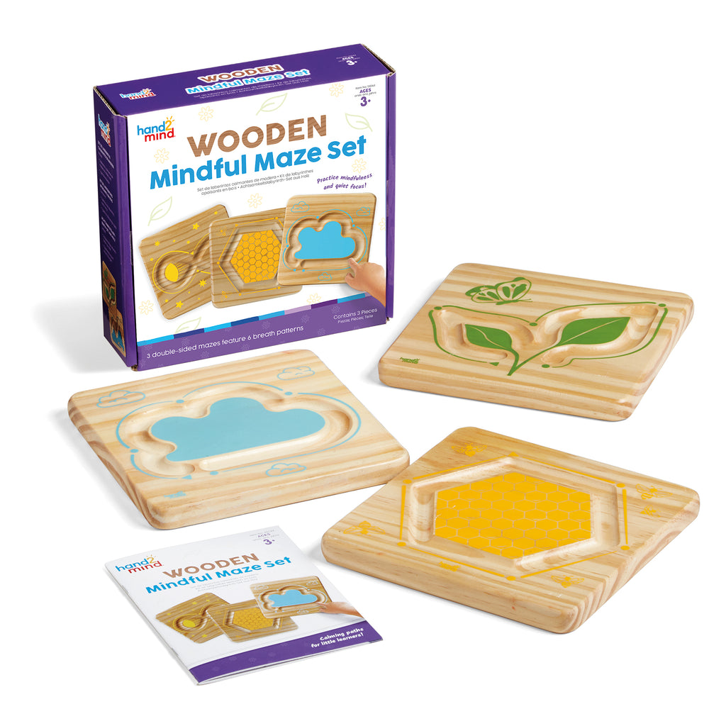
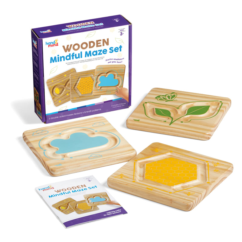
{"id":8691889537239,"title":"Mindful Maze, Naturals Set","handle":"mindful-maze-naturals-set","description":"MPN: 005083\u003cbr\u003e\u003cbr\u003eUPC: 848850120345\u003cbr\u003eHelp students practice mindfulness, quiet focus, and more with this unique set of double-sided breathing boards. Featuring 6 different wooden finger paths, Mindful Maze Naturals helps students understand how to navigate their emotions through relaxing breathing techniques. Includes a Getting Started Guide.\u003cbr\u003e\u003cbr\u003eKey Features : \u003cbr\u003e\u003cbr\u003ei : Introduce the natural power of calming breathing with the Wooden Mindful Maze Set! These double-sided breathing boards are designed with wide finger paths for multisensory learning and fine motor play.\u003cbr\u003eii : Featuring 6 nature-themed finger paths, this set teaches children how to navigate their emotions through relaxing breathing techniques.\u003cbr\u003eiii : Children will trace these smooth, carved paths with their finger and follow the indicators to learn breathing techniques, practice self-regulation, and improve focus!\u003cbr\u003eiv : Practice mindfulness, quiet focus, self-management, and more- skills that will support their social-emotional well-being for years to come. The Getting Started Guide features activities and more!\u003cbr\u003ev : These double-sided breathing boards are designed with wide finger paths for multisensory learning and fine motor play.\u003cbr\u003e\u003cbr\u003eSKU: ERSHTM96144","published_at":"2024-09-04T04:11:30-04:00","created_at":"2024-09-04T04:11:31-04:00","vendor":"Hand2mind","type":"Social Studies","tags":["3+ years","Multi","Self Awareness","Wood"],"price":3424,"price_min":3424,"price_max":3424,"available":true,"price_varies":false,"compare_at_price":null,"compare_at_price_min":0,"compare_at_price_max":0,"compare_at_price_varies":false,"variants":[{"id":45599923732695,"title":"Default Title","option1":"Default Title","option2":null,"option3":null,"sku":"ERSHTM96144","requires_shipping":true,"taxable":true,"featured_image":{"id":41534494081239,"product_id":8691889537239,"position":1,"created_at":"2024-09-04T04:11:32-04:00","updated_at":"2024-09-04T04:11:32-04:00","alt":null,"width":1800,"height":1800,"src":"\/\/shop.qualityucanafford.com\/cdn\/shop\/files\/ERSHTM96144.jpg?v=1725437492","variant_ids":[45599923732695]},"available":true,"name":"Mindful Maze, Naturals Set","public_title":null,"options":["Default Title"],"price":3424,"weight":798,"compare_at_price":null,"inventory_quantity":24,"inventory_management":"shopify","inventory_policy":"deny","barcode":"848850120345","featured_media":{"alt":null,"id":34114223866071,"position":1,"preview_image":{"aspect_ratio":1.0,"height":1800,"width":1800,"src":"\/\/shop.qualityucanafford.com\/cdn\/shop\/files\/ERSHTM96144.jpg?v=1725437492"}},"requires_selling_plan":false,"selling_plan_allocations":[]}],"images":["\/\/shop.qualityucanafford.com\/cdn\/shop\/files\/ERSHTM96144.jpg?v=1725437492","\/\/shop.qualityucanafford.com\/cdn\/shop\/files\/ERSHTM96144_1.jpg?v=1725437494","\/\/shop.qualityucanafford.com\/cdn\/shop\/files\/ERSHTM96144_2.jpg?v=1725437496","\/\/shop.qualityucanafford.com\/cdn\/shop\/files\/ERSHTM96144_3.jpg?v=1725437498","\/\/shop.qualityucanafford.com\/cdn\/shop\/files\/ERSHTM96144_4.jpg?v=1725437500"],"featured_image":"\/\/shop.qualityucanafford.com\/cdn\/shop\/files\/ERSHTM96144.jpg?v=1725437492","options":["Title"],"media":[{"alt":null,"id":34114223866071,"position":1,"preview_image":{"aspect_ratio":1.0,"height":1800,"width":1800,"src":"\/\/shop.qualityucanafford.com\/cdn\/shop\/files\/ERSHTM96144.jpg?v=1725437492"},"aspect_ratio":1.0,"height":1800,"media_type":"image","src":"\/\/shop.qualityucanafford.com\/cdn\/shop\/files\/ERSHTM96144.jpg?v=1725437492","width":1800},{"alt":null,"id":34114224095447,"position":2,"preview_image":{"aspect_ratio":1.0,"height":1800,"width":1800,"src":"\/\/shop.qualityucanafford.com\/cdn\/shop\/files\/ERSHTM96144_1.jpg?v=1725437494"},"aspect_ratio":1.0,"height":1800,"media_type":"image","src":"\/\/shop.qualityucanafford.com\/cdn\/shop\/files\/ERSHTM96144_1.jpg?v=1725437494","width":1800},{"alt":null,"id":34114224193751,"position":3,"preview_image":{"aspect_ratio":1.0,"height":1800,"width":1800,"src":"\/\/shop.qualityucanafford.com\/cdn\/shop\/files\/ERSHTM96144_2.jpg?v=1725437496"},"aspect_ratio":1.0,"height":1800,"media_type":"image","src":"\/\/shop.qualityucanafford.com\/cdn\/shop\/files\/ERSHTM96144_2.jpg?v=1725437496","width":1800},{"alt":null,"id":34114224390359,"position":4,"preview_image":{"aspect_ratio":1.0,"height":1800,"width":1800,"src":"\/\/shop.qualityucanafford.com\/cdn\/shop\/files\/ERSHTM96144_3.jpg?v=1725437498"},"aspect_ratio":1.0,"height":1800,"media_type":"image","src":"\/\/shop.qualityucanafford.com\/cdn\/shop\/files\/ERSHTM96144_3.jpg?v=1725437498","width":1800},{"alt":null,"id":34114225602775,"position":5,"preview_image":{"aspect_ratio":1.0,"height":1800,"width":1800,"src":"\/\/shop.qualityucanafford.com\/cdn\/shop\/files\/ERSHTM96144_4.jpg?v=1725437500"},"aspect_ratio":1.0,"height":1800,"media_type":"image","src":"\/\/shop.qualityucanafford.com\/cdn\/shop\/files\/ERSHTM96144_4.jpg?v=1725437500","width":1800}],"requires_selling_plan":false,"selling_plan_groups":[],"content":"MPN: 005083\u003cbr\u003e\u003cbr\u003eUPC: 848850120345\u003cbr\u003eHelp students practice mindfulness, quiet focus, and more with this unique set of double-sided breathing boards. Featuring 6 different wooden finger paths, Mindful Maze Naturals helps students understand how to navigate their emotions through relaxing breathing techniques. Includes a Getting Started Guide.\u003cbr\u003e\u003cbr\u003eKey Features : \u003cbr\u003e\u003cbr\u003ei : Introduce the natural power of calming breathing with the Wooden Mindful Maze Set! These double-sided breathing boards are designed with wide finger paths for multisensory learning and fine motor play.\u003cbr\u003eii : Featuring 6 nature-themed finger paths, this set teaches children how to navigate their emotions through relaxing breathing techniques.\u003cbr\u003eiii : Children will trace these smooth, carved paths with their finger and follow the indicators to learn breathing techniques, practice self-regulation, and improve focus!\u003cbr\u003eiv : Practice mindfulness, quiet focus, self-management, and more- skills that will support their social-emotional well-being for years to come. The Getting Started Guide features activities and more!\u003cbr\u003ev : These double-sided breathing boards are designed with wide finger paths for multisensory learning and fine motor play.\u003cbr\u003e\u003cbr\u003eSKU: ERSHTM96144"}
Mindful Maze, Naturals Set

Mindful Maze, Naturals Set

$34.24

MPN: 005083UPC: 848850120345Help students practice mindfulness, quiet focus, and more with this unique set of double-sided breathing boards. Featuring 6 different wooden finger paths, Mindful Maze Naturals helps students understand how to navigate their emotions through relaxing breathing techniques. Includes a Getting Started Guide.Key Features...


More Info
{"id":8637852025047,"title":"Emotion Token Stencils, 8 Per Pack, 2 Packs","handle":"emotion-token-stencils-8-per-pack-2-packs","description":"MPN: 005065\u003cbr\u003e\u003cbr\u003eUPC: 194629144105\u003cbr\u003eHelp children explore and understand their emotions by making pictures! This set of 8 stencils is designed to offer a hands-on way for kids to open up about their feelings, promoting empathy and emotional intelligence. By building a discussion around color choices, personal expression, smooth lines or jagged lines, Emotion Tokens can help facilitate difficult conversations. The activity becomes the focus, allowing communication to grow organically. The stencils are ideal for use with crayons or markers, and the durable plastic can be used over and over again. By guiding your discussions through this creative exercise, you can help children become more familiar with their own feelings while fostering better interpersonal relationships with others. Each pack includes 8 emotion token stencils, 4\" (10cm) diameter. Sold as 2 packs for a total of 16 stencils.\u003cbr\u003e\u003cbr\u003eKey Features : \u003cbr\u003e\u003cbr\u003ei : Encourage emotional exploration with emotion stencils.\u003cbr\u003eii : Promotes empathy and emotional intelligence.\u003cbr\u003eiii : Facilitates discussions about feelings, color choices, and personal expression.\u003cbr\u003eiv : Can be used repeatedly with crayons and markers.\u003cbr\u003ev : Sold as 2 packs for a total of 16 stencils, each pack includes 8 emotion token stencils, 4\" (10cm) diameter.\u003cbr\u003e\u003cbr\u003eSKU: ERSR-58637-2","published_at":"2024-07-17T09:03:25-04:00","created_at":"2024-07-17T09:03:25-04:00","vendor":"Roylco®","type":"Social Studies","tags":["4+ years","Multi","Plastic","Self Awareness"],"price":3559,"price_min":3559,"price_max":3559,"available":true,"price_varies":false,"compare_at_price":null,"compare_at_price_min":0,"compare_at_price_max":0,"compare_at_price_varies":false,"variants":[{"id":45429277491415,"title":"Default Title","option1":"Default Title","option2":null,"option3":null,"sku":"ERSR-58637-2","requires_shipping":true,"taxable":true,"featured_image":{"id":41162236625111,"product_id":8637852025047,"position":1,"created_at":"2024-07-17T10:14:28-04:00","updated_at":"2024-07-17T10:14:28-04:00","alt":null,"width":1800,"height":1800,"src":"\/\/shop.qualityucanafford.com\/cdn\/shop\/files\/ERSR-58637-2.jpg?v=1721225668","variant_ids":[45429277491415]},"available":true,"name":"Emotion Token Stencils, 8 Per Pack, 2 Packs","public_title":null,"options":["Default Title"],"price":3559,"weight":200,"compare_at_price":null,"inventory_quantity":4,"inventory_management":"shopify","inventory_policy":"deny","barcode":"194629144105","featured_media":{"alt":null,"id":33822466310359,"position":1,"preview_image":{"aspect_ratio":1.0,"height":1800,"width":1800,"src":"\/\/shop.qualityucanafford.com\/cdn\/shop\/files\/ERSR-58637-2.jpg?v=1721225668"}},"requires_selling_plan":false,"selling_plan_allocations":[]}],"images":["\/\/shop.qualityucanafford.com\/cdn\/shop\/files\/ERSR-58637-2.jpg?v=1721225668","\/\/shop.qualityucanafford.com\/cdn\/shop\/files\/ERSR-58637-2_1.jpg?v=1721225670","\/\/shop.qualityucanafford.com\/cdn\/shop\/files\/ERSR-58637-2_3.jpg?v=1721225672","\/\/shop.qualityucanafford.com\/cdn\/shop\/files\/ERSR-58637-2_2.jpg?v=1721225673"],"featured_image":"\/\/shop.qualityucanafford.com\/cdn\/shop\/files\/ERSR-58637-2.jpg?v=1721225668","options":["Title"],"media":[{"alt":null,"id":33822466310359,"position":1,"preview_image":{"aspect_ratio":1.0,"height":1800,"width":1800,"src":"\/\/shop.qualityucanafford.com\/cdn\/shop\/files\/ERSR-58637-2.jpg?v=1721225668"},"aspect_ratio":1.0,"height":1800,"media_type":"image","src":"\/\/shop.qualityucanafford.com\/cdn\/shop\/files\/ERSR-58637-2.jpg?v=1721225668","width":1800},{"alt":null,"id":33822466539735,"position":2,"preview_image":{"aspect_ratio":1.0,"height":1800,"width":1800,"src":"\/\/shop.qualityucanafford.com\/cdn\/shop\/files\/ERSR-58637-2_1.jpg?v=1721225670"},"aspect_ratio":1.0,"height":1800,"media_type":"image","src":"\/\/shop.qualityucanafford.com\/cdn\/shop\/files\/ERSR-58637-2_1.jpg?v=1721225670","width":1800},{"alt":null,"id":33822466834647,"position":3,"preview_image":{"aspect_ratio":1.0,"height":1500,"width":1500,"src":"\/\/shop.qualityucanafford.com\/cdn\/shop\/files\/ERSR-58637-2_3.jpg?v=1721225672"},"aspect_ratio":1.0,"height":1500,"media_type":"image","src":"\/\/shop.qualityucanafford.com\/cdn\/shop\/files\/ERSR-58637-2_3.jpg?v=1721225672","width":1500},{"alt":null,"id":33822466900183,"position":4,"preview_image":{"aspect_ratio":1.0,"height":1500,"width":1500,"src":"\/\/shop.qualityucanafford.com\/cdn\/shop\/files\/ERSR-58637-2_2.jpg?v=1721225673"},"aspect_ratio":1.0,"height":1500,"media_type":"image","src":"\/\/shop.qualityucanafford.com\/cdn\/shop\/files\/ERSR-58637-2_2.jpg?v=1721225673","width":1500}],"requires_selling_plan":false,"selling_plan_groups":[],"content":"MPN: 005065\u003cbr\u003e\u003cbr\u003eUPC: 194629144105\u003cbr\u003eHelp children explore and understand their emotions by making pictures! This set of 8 stencils is designed to offer a hands-on way for kids to open up about their feelings, promoting empathy and emotional intelligence. By building a discussion around color choices, personal expression, smooth lines or jagged lines, Emotion Tokens can help facilitate difficult conversations. The activity becomes the focus, allowing communication to grow organically. The stencils are ideal for use with crayons or markers, and the durable plastic can be used over and over again. By guiding your discussions through this creative exercise, you can help children become more familiar with their own feelings while fostering better interpersonal relationships with others. Each pack includes 8 emotion token stencils, 4\" (10cm) diameter. Sold as 2 packs for a total of 16 stencils.\u003cbr\u003e\u003cbr\u003eKey Features : \u003cbr\u003e\u003cbr\u003ei : Encourage emotional exploration with emotion stencils.\u003cbr\u003eii : Promotes empathy and emotional intelligence.\u003cbr\u003eiii : Facilitates discussions about feelings, color choices, and personal expression.\u003cbr\u003eiv : Can be used repeatedly with crayons and markers.\u003cbr\u003ev : Sold as 2 packs for a total of 16 stencils, each pack includes 8 emotion token stencils, 4\" (10cm) diameter.\u003cbr\u003e\u003cbr\u003eSKU: ERSR-58637-2"}
Emotion Token Stencils, 8 Per Pack, 2 Packs

Emotion Token Stencils, 8 Per Pack, 2 Packs

$35.59

MPN: 005065UPC: 194629144105Help children explore and understand their emotions by making pictures! This set of 8 stencils is designed to offer a hands-on way for kids to open up about their feelings, promoting empathy and emotional intelligence. By building a discussion around color choices, personal expression, smooth lines or jagged lines, Em...


More Info
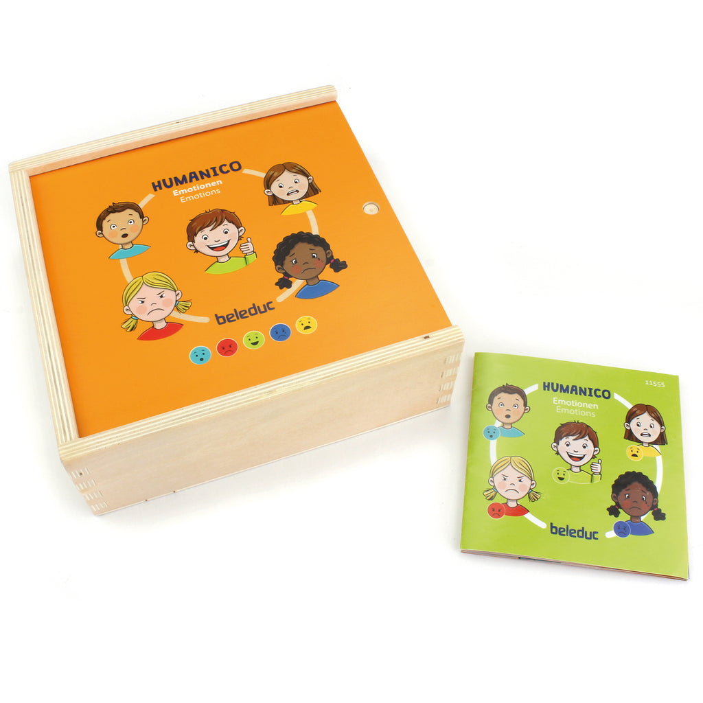
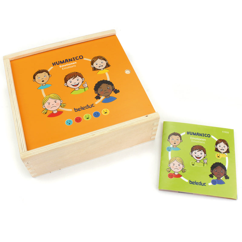
{"id":8631586816215,"title":"Humanico Emotions Puzzles","handle":"humanico-emotions-puzzles","description":"MPN: 006631\u003cbr\u003e\u003cbr\u003eUPC: 4014888115554\u003cbr\u003eIntroducing the Humanico Emotions Puzzles! This engaging 30-piece puzzle is designed to enhance social-emotional-learning (SEL) skills, while also fostering logical thinking and communication abilities. With its unique 5-layer design, each layer representing a different emotion, this wooden puzzle provides a wonderful opportunity to have meaningful conversations with children about their feelings. By matching the five situations to the corresponding emotion, children can explore and understand their emotions in a fun and interactive way. The contour of the puzzle pieces serves as a helpful guide, allowing children to self-check and see if they have correctly identified the emotions. Get ready to embark on a journey of emotional discovery with the Humanico Emotions Puzzles!\u003cbr\u003e\u003cbr\u003eKey Features : \u003cbr\u003e\u003cbr\u003ei : When I'm sad? When happy or fearful? With this wooden puzzle you can talk with the children about their emotions.\u003cbr\u003eii : Five situations are fitting to one emotion.\u003cbr\u003eiii : The contour of the pieces shows you, if you're right.\u003cbr\u003eiv : Includes guide booklet and practical storage box.\u003cbr\u003e\u003cbr\u003eSKU: ERSPLWB11555","published_at":"2024-07-12T08:00:04-04:00","created_at":"2024-07-12T08:00:06-04:00","vendor":"Beleduc","type":"Social Studies","tags":["4+ years","Humanico","Multi","Plywood","Self Awareness"],"price":3424,"price_min":3424,"price_max":3424,"available":true,"price_varies":false,"compare_at_price":null,"compare_at_price_min":0,"compare_at_price_max":0,"compare_at_price_varies":false,"variants":[{"id":45412629446871,"title":"Default Title","option1":"Default Title","option2":null,"option3":null,"sku":"ERSPLWB11555","requires_shipping":true,"taxable":true,"featured_image":{"id":41118710694103,"product_id":8631586816215,"position":1,"created_at":"2024-07-12T08:00:06-04:00","updated_at":"2024-07-12T08:00:06-04:00","alt":null,"width":1800,"height":1800,"src":"\/\/shop.qualityucanafford.com\/cdn\/shop\/files\/ERSPLWB11555.jpg?v=1720785606","variant_ids":[45412629446871]},"available":true,"name":"Humanico Emotions Puzzles","public_title":null,"options":["Default Title"],"price":3424,"weight":540,"compare_at_price":null,"inventory_quantity":19,"inventory_management":"shopify","inventory_policy":"deny","barcode":"4014888115554","featured_media":{"alt":null,"id":33787723350231,"position":1,"preview_image":{"aspect_ratio":1.0,"height":1800,"width":1800,"src":"\/\/shop.qualityucanafford.com\/cdn\/shop\/files\/ERSPLWB11555.jpg?v=1720785606"}},"requires_selling_plan":false,"selling_plan_allocations":[]}],"images":["\/\/shop.qualityucanafford.com\/cdn\/shop\/files\/ERSPLWB11555.jpg?v=1720785606","\/\/shop.qualityucanafford.com\/cdn\/shop\/files\/ERSPLWB11555_1.jpg?v=1720785608","\/\/shop.qualityucanafford.com\/cdn\/shop\/files\/ERSPLWB11555_2.jpg?v=1720785610","\/\/shop.qualityucanafford.com\/cdn\/shop\/files\/ERSPLWB11555_3.jpg?v=1720785612","\/\/shop.qualityucanafford.com\/cdn\/shop\/files\/ERSPLWB11555_4.jpg?v=1720785613","\/\/shop.qualityucanafford.com\/cdn\/shop\/files\/ERSPLWB11555_5.jpg?v=1720785615","\/\/shop.qualityucanafford.com\/cdn\/shop\/files\/ERSPLWB11555_6.jpg?v=1720785616","\/\/shop.qualityucanafford.com\/cdn\/shop\/files\/ERSPLWB11555_7.jpg?v=1720785618","\/\/shop.qualityucanafford.com\/cdn\/shop\/files\/ERSPLWB11555_8.jpg?v=1720785620","\/\/shop.qualityucanafford.com\/cdn\/shop\/files\/ERSPLWB11555_9.jpg?v=1720785621"],"featured_image":"\/\/shop.qualityucanafford.com\/cdn\/shop\/files\/ERSPLWB11555.jpg?v=1720785606","options":["Title"],"media":[{"alt":null,"id":33787723350231,"position":1,"preview_image":{"aspect_ratio":1.0,"height":1800,"width":1800,"src":"\/\/shop.qualityucanafford.com\/cdn\/shop\/files\/ERSPLWB11555.jpg?v=1720785606"},"aspect_ratio":1.0,"height":1800,"media_type":"image","src":"\/\/shop.qualityucanafford.com\/cdn\/shop\/files\/ERSPLWB11555.jpg?v=1720785606","width":1800},{"alt":null,"id":33787723579607,"position":2,"preview_image":{"aspect_ratio":1.0,"height":1800,"width":1800,"src":"\/\/shop.qualityucanafford.com\/cdn\/shop\/files\/ERSPLWB11555_1.jpg?v=1720785608"},"aspect_ratio":1.0,"height":1800,"media_type":"image","src":"\/\/shop.qualityucanafford.com\/cdn\/shop\/files\/ERSPLWB11555_1.jpg?v=1720785608","width":1800},{"alt":null,"id":33787723677911,"position":3,"preview_image":{"aspect_ratio":1.0,"height":1600,"width":1600,"src":"\/\/shop.qualityucanafford.com\/cdn\/shop\/files\/ERSPLWB11555_2.jpg?v=1720785610"},"aspect_ratio":1.0,"height":1600,"media_type":"image","src":"\/\/shop.qualityucanafford.com\/cdn\/shop\/files\/ERSPLWB11555_2.jpg?v=1720785610","width":1600},{"alt":null,"id":33787723841751,"position":4,"preview_image":{"aspect_ratio":1.0,"height":1800,"width":1800,"src":"\/\/shop.qualityucanafford.com\/cdn\/shop\/files\/ERSPLWB11555_3.jpg?v=1720785612"},"aspect_ratio":1.0,"height":1800,"media_type":"image","src":"\/\/shop.qualityucanafford.com\/cdn\/shop\/files\/ERSPLWB11555_3.jpg?v=1720785612","width":1800},{"alt":null,"id":33787724333271,"position":5,"preview_image":{"aspect_ratio":1.0,"height":1800,"width":1800,"src":"\/\/shop.qualityucanafford.com\/cdn\/shop\/files\/ERSPLWB11555_4.jpg?v=1720785613"},"aspect_ratio":1.0,"height":1800,"media_type":"image","src":"\/\/shop.qualityucanafford.com\/cdn\/shop\/files\/ERSPLWB11555_4.jpg?v=1720785613","width":1800},{"alt":null,"id":33787725119703,"position":6,"preview_image":{"aspect_ratio":1.0,"height":1800,"width":1800,"src":"\/\/shop.qualityucanafford.com\/cdn\/shop\/files\/ERSPLWB11555_5.jpg?v=1720785615"},"aspect_ratio":1.0,"height":1800,"media_type":"image","src":"\/\/shop.qualityucanafford.com\/cdn\/shop\/files\/ERSPLWB11555_5.jpg?v=1720785615","width":1800},{"alt":null,"id":33787725283543,"position":7,"preview_image":{"aspect_ratio":1.0,"height":1800,"width":1800,"src":"\/\/shop.qualityucanafford.com\/cdn\/shop\/files\/ERSPLWB11555_6.jpg?v=1720785616"},"aspect_ratio":1.0,"height":1800,"media_type":"image","src":"\/\/shop.qualityucanafford.com\/cdn\/shop\/files\/ERSPLWB11555_6.jpg?v=1720785616","width":1800},{"alt":null,"id":33787725349079,"position":8,"preview_image":{"aspect_ratio":1.0,"height":1800,"width":1800,"src":"\/\/shop.qualityucanafford.com\/cdn\/shop\/files\/ERSPLWB11555_7.jpg?v=1720785618"},"aspect_ratio":1.0,"height":1800,"media_type":"image","src":"\/\/shop.qualityucanafford.com\/cdn\/shop\/files\/ERSPLWB11555_7.jpg?v=1720785618","width":1800},{"alt":null,"id":33787725414615,"position":9,"preview_image":{"aspect_ratio":1.0,"height":1800,"width":1800,"src":"\/\/shop.qualityucanafford.com\/cdn\/shop\/files\/ERSPLWB11555_8.jpg?v=1720785620"},"aspect_ratio":1.0,"height":1800,"media_type":"image","src":"\/\/shop.qualityucanafford.com\/cdn\/shop\/files\/ERSPLWB11555_8.jpg?v=1720785620","width":1800},{"alt":null,"id":33787725512919,"position":10,"preview_image":{"aspect_ratio":1.0,"height":1800,"width":1800,"src":"\/\/shop.qualityucanafford.com\/cdn\/shop\/files\/ERSPLWB11555_9.jpg?v=1720785621"},"aspect_ratio":1.0,"height":1800,"media_type":"image","src":"\/\/shop.qualityucanafford.com\/cdn\/shop\/files\/ERSPLWB11555_9.jpg?v=1720785621","width":1800}],"requires_selling_plan":false,"selling_plan_groups":[],"content":"MPN: 006631\u003cbr\u003e\u003cbr\u003eUPC: 4014888115554\u003cbr\u003eIntroducing the Humanico Emotions Puzzles! This engaging 30-piece puzzle is designed to enhance social-emotional-learning (SEL) skills, while also fostering logical thinking and communication abilities. With its unique 5-layer design, each layer representing a different emotion, this wooden puzzle provides a wonderful opportunity to have meaningful conversations with children about their feelings. By matching the five situations to the corresponding emotion, children can explore and understand their emotions in a fun and interactive way. The contour of the puzzle pieces serves as a helpful guide, allowing children to self-check and see if they have correctly identified the emotions. Get ready to embark on a journey of emotional discovery with the Humanico Emotions Puzzles!\u003cbr\u003e\u003cbr\u003eKey Features : \u003cbr\u003e\u003cbr\u003ei : When I'm sad? When happy or fearful? With this wooden puzzle you can talk with the children about their emotions.\u003cbr\u003eii : Five situations are fitting to one emotion.\u003cbr\u003eiii : The contour of the pieces shows you, if you're right.\u003cbr\u003eiv : Includes guide booklet and practical storage box.\u003cbr\u003e\u003cbr\u003eSKU: ERSPLWB11555"}
Humanico Emotions Puzzles

Humanico Emotions Puzzles

$34.24

MPN: 006631UPC: 4014888115554Introducing the Humanico Emotions Puzzles! This engaging 30-piece puzzle is designed to enhance social-emotional-learning (SEL) skills, while also fostering logical thinking and communication abilities. With its unique 5-layer design, each layer representing a different emotion, this wooden puzzle provides a wonderfu...


More Info
{"id":8598758555863,"title":"Emotion Token Stencils, Pack of 8","handle":"emotion-token-stencils-pack-of-8","description":"MPN: 005065\u003cbr\u003e\u003cbr\u003eUPC: 066960586374\u003cbr\u003eHelp children explore and understand their emotions by making pictures! This set of 8 stencils is designed to offer a hands-on way for kids to open up about their feelings, promoting empathy and emotional intelligence. By building a discussion around color choices, personal expression, smooth lines or jagged lines, Emotion Tokens can help facilitate difficult conversations. The activity becomes the focus, allowing communication to grow organically. The stencils are ideal for use with crayons or markers, and the durable plastic can be used over and over again. By guiding your discussions through this creative exercise, you can help children become more familiar with their own feelings while fostering better interpersonal relationships with others. Includes: 8 emotion token stencils, 4\" (10cm) diameter.\u003cbr\u003e\u003cbr\u003eKey Features : \u003cbr\u003e\u003cbr\u003ei : Encourage emotional exploration with 8 stencils.\u003cbr\u003eii : Promotes empathy and emotional intelligence.\u003cbr\u003eiii : Facilitates discussions about feelings, color choices, and personal expression.\u003cbr\u003eiv : Can be used repeatedly with crayons and markers.\u003cbr\u003e\u003cbr\u003eSKU: ERSR-58637","published_at":"2024-06-24T01:19:09-04:00","created_at":"2024-06-24T01:19:09-04:00","vendor":"Roylco®","type":"Social Studies","tags":["4+ years","Multi","Plastic","Self Awareness"],"price":1780,"price_min":1780,"price_max":1780,"available":true,"price_varies":false,"compare_at_price":null,"compare_at_price_min":0,"compare_at_price_max":0,"compare_at_price_varies":false,"variants":[{"id":45336824971479,"title":"Default Title","option1":"Default Title","option2":null,"option3":null,"sku":"ERSR-58637","requires_shipping":true,"taxable":true,"featured_image":null,"available":true,"name":"Emotion Token Stencils, Pack of 8","public_title":null,"options":["Default Title"],"price":1780,"weight":100,"compare_at_price":null,"inventory_quantity":8,"inventory_management":"shopify","inventory_policy":"deny","barcode":"066960586374","requires_selling_plan":false,"selling_plan_allocations":[]}],"images":[],"featured_image":null,"options":["Title"],"requires_selling_plan":false,"selling_plan_groups":[],"content":"MPN: 005065\u003cbr\u003e\u003cbr\u003eUPC: 066960586374\u003cbr\u003eHelp children explore and understand their emotions by making pictures! This set of 8 stencils is designed to offer a hands-on way for kids to open up about their feelings, promoting empathy and emotional intelligence. By building a discussion around color choices, personal expression, smooth lines or jagged lines, Emotion Tokens can help facilitate difficult conversations. The activity becomes the focus, allowing communication to grow organically. The stencils are ideal for use with crayons or markers, and the durable plastic can be used over and over again. By guiding your discussions through this creative exercise, you can help children become more familiar with their own feelings while fostering better interpersonal relationships with others. Includes: 8 emotion token stencils, 4\" (10cm) diameter.\u003cbr\u003e\u003cbr\u003eKey Features : \u003cbr\u003e\u003cbr\u003ei : Encourage emotional exploration with 8 stencils.\u003cbr\u003eii : Promotes empathy and emotional intelligence.\u003cbr\u003eiii : Facilitates discussions about feelings, color choices, and personal expression.\u003cbr\u003eiv : Can be used repeatedly with crayons and markers.\u003cbr\u003e\u003cbr\u003eSKU: ERSR-58637"}

Emotion Token Stencils, Pack of 8

$17.80

MPN: 005065UPC: 066960586374Help children explore and understand their emotions by making pictures! This set of 8 stencils is designed to offer a hands-on way for kids to open up about their feelings, promoting empathy and emotional intelligence. By building a discussion around color choices, personal expression, smooth lines or jagged lines, Em...


More Info
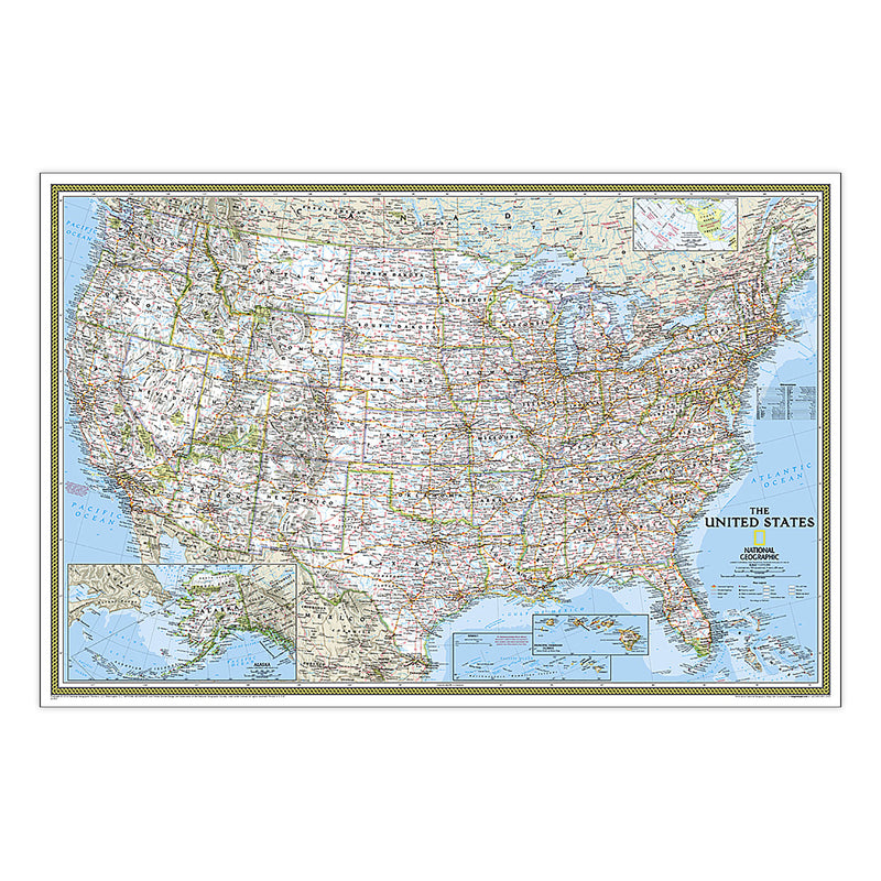
{"id":8592891642071,"title":"United States Classic Map, Enlarged and Laminated, 69.25\" x 48\"","handle":"united-states-classic-map-enlarged-and-laminated-69-25-x-48","description":"MPN: 006352\u003cbr\u003e\u003cbr\u003eUPC: 749717003699\u003cbr\u003eExpertly researched and designed, National Geographic's United States wall map is the standard by which other reference maps of the U.S. are measured. Signature Classic styling with bright, easy to read color palette with blue water and colorful state borders. All 50 states with insets for Hawaiian Islands and Alaska plus inset showing relative size of Alaska. Clearly defined state and country boundaries, cities, islands, national parks, and physical features. Thousands of place names carefully and artfully placed to maintain legibility in heavily populated areas. Background shows mountain ranges and valleys in subtle shaded relief with mountain ranges labeled. Major water bodies including rivers, lakes, gulfs, bays, straits, and ocean bathymetry. Transportation routes including interstate highways, major state routes, airports, waterways, canals, and ferries. Enlarged maps provide an immersive experience in any home or office environment. The exceptional cartography is even easier to appreciate at the larger size. The map is encapsulated in heavy-duty 1.6 mil laminate which makes the paper much more durable and resistant to the swelling and shrinking caused by changes in humidity. Laminated maps can be framed without the need for glass, so the frames can be much lighter and less expensive.\u003cbr\u003e\u003cbr\u003eKey Features : \u003cbr\u003e\u003cbr\u003ei : National Geographic's United States wall map is the standard by which other reference maps of the U.S. are measured\u003cbr\u003eii : Signature Classic styling with bright, easy to read color palette with blue water and colorful state borders. All 50 states with insets for Hawaiian Islands and Alaska plus inset showing relative size of Alaska\u003cbr\u003eiii : Enlarged maps provide an immersive experience in any home or office environment. The exceptional cartography is even easier to appreciate at the larger size\u003cbr\u003eiv : The map is encapsulated in heavy-duty 1.6 mil laminate which makes the paper much more durable and resistant to the swelling and shrinking caused by changes in humidity.\u003cbr\u003ev : Measures 69.25\" x 48\"\u003cbr\u003e\u003cbr\u003eSKU: ERSNGMRE00602987","published_at":"2024-06-21T01:44:07-04:00","created_at":"2024-06-21T01:44:07-04:00","vendor":"National Geographic","type":"Social Studies","tags":["8+ years","Maps \u0026 Map Skills","Multi","Paper","Plastic","Wall Maps"],"price":9583,"price_min":9583,"price_max":9583,"available":true,"price_varies":false,"compare_at_price":null,"compare_at_price_min":0,"compare_at_price_max":0,"compare_at_price_varies":false,"variants":[{"id":45324580749527,"title":"Default Title","option1":"Default Title","option2":null,"option3":null,"sku":"ERSNGMRE00602987","requires_shipping":true,"taxable":true,"featured_image":null,"available":true,"name":"United States Classic Map, Enlarged and Laminated, 69.25\" x 48\"","public_title":null,"options":["Default Title"],"price":9583,"weight":426,"compare_at_price":null,"inventory_quantity":9,"inventory_management":"shopify","inventory_policy":"deny","barcode":"749717003699","requires_selling_plan":false,"selling_plan_allocations":[]}],"images":[],"featured_image":null,"options":["Title"],"requires_selling_plan":false,"selling_plan_groups":[],"content":"MPN: 006352\u003cbr\u003e\u003cbr\u003eUPC: 749717003699\u003cbr\u003eExpertly researched and designed, National Geographic's United States wall map is the standard by which other reference maps of the U.S. are measured. Signature Classic styling with bright, easy to read color palette with blue water and colorful state borders. All 50 states with insets for Hawaiian Islands and Alaska plus inset showing relative size of Alaska. Clearly defined state and country boundaries, cities, islands, national parks, and physical features. Thousands of place names carefully and artfully placed to maintain legibility in heavily populated areas. Background shows mountain ranges and valleys in subtle shaded relief with mountain ranges labeled. Major water bodies including rivers, lakes, gulfs, bays, straits, and ocean bathymetry. Transportation routes including interstate highways, major state routes, airports, waterways, canals, and ferries. Enlarged maps provide an immersive experience in any home or office environment. The exceptional cartography is even easier to appreciate at the larger size. The map is encapsulated in heavy-duty 1.6 mil laminate which makes the paper much more durable and resistant to the swelling and shrinking caused by changes in humidity. Laminated maps can be framed without the need for glass, so the frames can be much lighter and less expensive.\u003cbr\u003e\u003cbr\u003eKey Features : \u003cbr\u003e\u003cbr\u003ei : National Geographic's United States wall map is the standard by which other reference maps of the U.S. are measured\u003cbr\u003eii : Signature Classic styling with bright, easy to read color palette with blue water and colorful state borders. All 50 states with insets for Hawaiian Islands and Alaska plus inset showing relative size of Alaska\u003cbr\u003eiii : Enlarged maps provide an immersive experience in any home or office environment. The exceptional cartography is even easier to appreciate at the larger size\u003cbr\u003eiv : The map is encapsulated in heavy-duty 1.6 mil laminate which makes the paper much more durable and resistant to the swelling and shrinking caused by changes in humidity.\u003cbr\u003ev : Measures 69.25\" x 48\"\u003cbr\u003e\u003cbr\u003eSKU: ERSNGMRE00602987"}

United States Classic Map, Enlarged and Laminated, 69.25" x 48"

$95.83

MPN: 006352UPC: 749717003699Expertly researched and designed, National Geographic's United States wall map is the standard by which other reference maps of the U.S. are measured. Signature Classic styling with bright, easy to read color palette with blue water and colorful state borders. All 50 states with insets for Hawaiian Islands and Alaska ...


More Info
{"id":8592851468503,"title":"World Physical Map, Enlarged and Laminated, 69.25\" x 46.25\"","handle":"world-physical-map-enlarged-and-laminated-69-25-x-46-25","description":"MPN: 006352\u003cbr\u003e\u003cbr\u003eUPC: 749717003941\u003cbr\u003eExpertly researched and designed, National Geographic's The Physical World map highlights the Earth's land and undersea forms with exquisite hand-painted relief. Drawn in the Winkel Tripel projection, distortions are minimized and unlike many other World maps, Greenland is show the same size as Argentina and not as the size of all of South America. Two corner inset maps show the Earth's crust and world climatic zones.\n\nEnlarged maps provide an immersive experience in any home or office environment. The exceptional cartography is even easier to appreciate at the larger size. The map is encapsulated in heavy-duty 1.6 mil laminate which makes the paper much more durable and resistant to the swelling and shrinking caused by changes in humidity. Laminated maps can be framed without the need for glass, so the frames can be much lighter and less expensive.\u003cbr\u003e\u003cbr\u003eKey Features : \u003cbr\u003e\u003cbr\u003ei : Expertly researched and designed, National Geographic's The Physical World map highlights the Earth's land and undersea forms with exquisite hand-painted relief.\u003cbr\u003eii : Two corner inset maps show the Earth's crust and world climatic zones.\u003cbr\u003eiii : Enlarged maps provide an immersive experience in any home or office environment. The exceptional cartography is even easier to appreciate at the larger size\u003cbr\u003eiv : The map is encapsulated in heavy-duty 1.6 mil laminate which makes the paper much more durable and resistant to the swelling and shrinking caused by changes in humidity.\u003cbr\u003ev : Measures 69.25\" x 46.25\"\u003cbr\u003e\u003cbr\u003eSKU: ERSNGMRE00620133","published_at":"2024-06-21T01:10:54-04:00","created_at":"2024-06-21T01:10:54-04:00","vendor":"National Geographic","type":"Social Studies","tags":["12+ years","Maps \u0026 Map Skills","Multi","Paper","Plastic","Wall Maps"],"price":9583,"price_min":9583,"price_max":9583,"available":true,"price_varies":false,"compare_at_price":null,"compare_at_price_min":0,"compare_at_price_max":0,"compare_at_price_varies":false,"variants":[{"id":45324469567703,"title":"Default Title","option1":"Default Title","option2":null,"option3":null,"sku":"ERSNGMRE00620133","requires_shipping":true,"taxable":true,"featured_image":null,"available":true,"name":"World Physical Map, Enlarged and Laminated, 69.25\" x 46.25\"","public_title":null,"options":["Default Title"],"price":9583,"weight":426,"compare_at_price":null,"inventory_quantity":14,"inventory_management":"shopify","inventory_policy":"deny","barcode":"749717003941","requires_selling_plan":false,"selling_plan_allocations":[]}],"images":[],"featured_image":null,"options":["Title"],"requires_selling_plan":false,"selling_plan_groups":[],"content":"MPN: 006352\u003cbr\u003e\u003cbr\u003eUPC: 749717003941\u003cbr\u003eExpertly researched and designed, National Geographic's The Physical World map highlights the Earth's land and undersea forms with exquisite hand-painted relief. Drawn in the Winkel Tripel projection, distortions are minimized and unlike many other World maps, Greenland is show the same size as Argentina and not as the size of all of South America. Two corner inset maps show the Earth's crust and world climatic zones.\n\nEnlarged maps provide an immersive experience in any home or office environment. The exceptional cartography is even easier to appreciate at the larger size. The map is encapsulated in heavy-duty 1.6 mil laminate which makes the paper much more durable and resistant to the swelling and shrinking caused by changes in humidity. Laminated maps can be framed without the need for glass, so the frames can be much lighter and less expensive.\u003cbr\u003e\u003cbr\u003eKey Features : \u003cbr\u003e\u003cbr\u003ei : Expertly researched and designed, National Geographic's The Physical World map highlights the Earth's land and undersea forms with exquisite hand-painted relief.\u003cbr\u003eii : Two corner inset maps show the Earth's crust and world climatic zones.\u003cbr\u003eiii : Enlarged maps provide an immersive experience in any home or office environment. The exceptional cartography is even easier to appreciate at the larger size\u003cbr\u003eiv : The map is encapsulated in heavy-duty 1.6 mil laminate which makes the paper much more durable and resistant to the swelling and shrinking caused by changes in humidity.\u003cbr\u003ev : Measures 69.25\" x 46.25\"\u003cbr\u003e\u003cbr\u003eSKU: ERSNGMRE00620133"}

World Physical Map, Enlarged and Laminated, 69.25" x 46.25"

$95.83

MPN: 006352UPC: 749717003941Expertly researched and designed, National Geographic's The Physical World map highlights the Earth's land and undersea forms with exquisite hand-painted relief. Drawn in the Winkel Tripel projection, distortions are minimized and unlike many other World maps, Greenland is show the same size as Argentina and not as th...


More Info
{"id":8592851337431,"title":"World Physical Map, Laminated, 45.75\" x 30.5\"","handle":"world-physical-map-laminated-45-75-x-30-5","description":"MPN: 006352\u003cbr\u003e\u003cbr\u003eUPC: 749717003934\u003cbr\u003eExpertly researched and designed, National Geographic's The Physical World map highlights the Earth's land and undersea forms with exquisite hand-painted relief. Drawn in the Winkel Tripel projection, distortions are minimized and unlike many other World maps, Greenland is show the same size as Argentina and not as the size of all of South America. Two corner inset maps show the Earth's crust and world climatic zones.\n\nThe map is encapsulated in heavy-duty 1.6 mil laminate which makes the paper much more durable and resistant to the swelling and shrinking caused by changes in humidity. Laminated maps can be framed without the need for glass, so the frames can be much lighter and less expensive.\u003cbr\u003e\u003cbr\u003eKey Features : \u003cbr\u003e\u003cbr\u003ei : Expertly researched and designed, National Geographic's The Physical World map highlights the Earth's land and undersea forms with exquisite hand-painted relief.\u003cbr\u003eii : Two corner inset maps show the Earth's crust and world climatic zones.\u003cbr\u003eiii : Drawn in the Winkel Tripel projection, distortions are minimized and unlike many other World maps, Greenland is show the same size as Argentina and not as the size of all of South America.\u003cbr\u003eiv : The map is encapsulated in heavy-duty 1.6 mil laminate which makes the paper much more durable and resistant to the swelling and shrinking caused by changes in humidity.\u003cbr\u003ev : Measures 45.75\" x 30.5\"\u003cbr\u003e\u003cbr\u003eSKU: ERSNGMRE00620132","published_at":"2024-06-21T01:10:44-04:00","created_at":"2024-06-21T01:10:44-04:00","vendor":"National Geographic","type":"Social Studies","tags":["12+ years","Maps \u0026 Map Skills","Multi","Paper","Plastic","Wall Maps"],"price":4103,"price_min":4103,"price_max":4103,"available":true,"price_varies":false,"compare_at_price":null,"compare_at_price_min":0,"compare_at_price_max":0,"compare_at_price_varies":false,"variants":[{"id":45324469436631,"title":"Default Title","option1":"Default Title","option2":null,"option3":null,"sku":"ERSNGMRE00620132","requires_shipping":true,"taxable":true,"featured_image":null,"available":true,"name":"World Physical Map, Laminated, 45.75\" x 30.5\"","public_title":null,"options":["Default Title"],"price":4103,"weight":172,"compare_at_price":null,"inventory_quantity":2,"inventory_management":"shopify","inventory_policy":"deny","barcode":"749717003934","requires_selling_plan":false,"selling_plan_allocations":[]}],"images":[],"featured_image":null,"options":["Title"],"requires_selling_plan":false,"selling_plan_groups":[],"content":"MPN: 006352\u003cbr\u003e\u003cbr\u003eUPC: 749717003934\u003cbr\u003eExpertly researched and designed, National Geographic's The Physical World map highlights the Earth's land and undersea forms with exquisite hand-painted relief. Drawn in the Winkel Tripel projection, distortions are minimized and unlike many other World maps, Greenland is show the same size as Argentina and not as the size of all of South America. Two corner inset maps show the Earth's crust and world climatic zones.\n\nThe map is encapsulated in heavy-duty 1.6 mil laminate which makes the paper much more durable and resistant to the swelling and shrinking caused by changes in humidity. Laminated maps can be framed without the need for glass, so the frames can be much lighter and less expensive.\u003cbr\u003e\u003cbr\u003eKey Features : \u003cbr\u003e\u003cbr\u003ei : Expertly researched and designed, National Geographic's The Physical World map highlights the Earth's land and undersea forms with exquisite hand-painted relief.\u003cbr\u003eii : Two corner inset maps show the Earth's crust and world climatic zones.\u003cbr\u003eiii : Drawn in the Winkel Tripel projection, distortions are minimized and unlike many other World maps, Greenland is show the same size as Argentina and not as the size of all of South America.\u003cbr\u003eiv : The map is encapsulated in heavy-duty 1.6 mil laminate which makes the paper much more durable and resistant to the swelling and shrinking caused by changes in humidity.\u003cbr\u003ev : Measures 45.75\" x 30.5\"\u003cbr\u003e\u003cbr\u003eSKU: ERSNGMRE00620132"}

World Physical Map, Laminated, 45.75" x 30.5"

$41.03

MPN: 006352UPC: 749717003934Expertly researched and designed, National Geographic's The Physical World map highlights the Earth's land and undersea forms with exquisite hand-painted relief. Drawn in the Winkel Tripel projection, distortions are minimized and unlike many other World maps, Greenland is show the same size as Argentina and not as th...


More Info
{"id":8592850911447,"title":"United States Executive Map, Enlarged and Laminated, 69.25\" x 48\"","handle":"united-states-executive-map-enlarged-and-laminated-69-25-x-48","description":"MPN: 006352\u003cbr\u003e\u003cbr\u003eUPC: 749717003927\u003cbr\u003eExpertly researched and designed, National Geographic's United States wall map is the standard by which other reference maps of the U.S. are measured. Antique-style \"executive\" color palette. All 50 states with insets for Hawaiian Islands and Alaska plus inset showing relative size of Alaska. Clearly defined state and country boundaries, cities, islands, national parks, and physical features. Thousands of place names carefully and artfully placed to maintain legibility in heavily populated areas. Background shows mountain ranges and valleys in subtle shaded relief with mountain ranges labeled. Major water bodies including rivers, lakes, gulfs, bays, straits, and ocean bathymetry. Transportation routes including interstate highways, major state routes, airports, waterways, canals, and ferries. Enlarged maps provide an immersive experience in any home or office environment. The exceptional cartography is even easier to appreciate at the larger size. The map is encapsulated in heavy-duty 1.6 mil laminate which makes the paper much more durable and resistant to the swelling and shrinking caused by changes in humidity. Laminated maps can be framed without the need for glass, so the frames can be much lighter and less expensive.\u003cbr\u003e\u003cbr\u003eKey Features : \u003cbr\u003e\u003cbr\u003ei : National Geographic United States Wall Map is expertly researched and designed, National Geographic's United States wall map is the standard by which other reference maps of the U.S. are measured.\u003cbr\u003eii : Antique-style \"executive\" color palette\u003cbr\u003eiii : Enlarged maps provide an immersive experience in any home or office environment. The exceptional cartography is even easier to appreciate at the larger size\u003cbr\u003eiv : The map is encapsulated in heavy-duty 1.6 mil laminate which makes the paper much more durable and resistant to the swelling and shrinking caused by changes in humidity.\u003cbr\u003ev : Measures 69.25\" x 48\"\u003cbr\u003e\u003cbr\u003eSKU: ERSNGMRE00620117","published_at":"2024-06-21T01:10:28-04:00","created_at":"2024-06-21T01:10:28-04:00","vendor":"National Geographic","type":"Social Studies","tags":["14+ years","Maps \u0026 Map Skills","Multi","Paper","Plastic","Wall Maps"],"price":9583,"price_min":9583,"price_max":9583,"available":true,"price_varies":false,"compare_at_price":null,"compare_at_price_min":0,"compare_at_price_max":0,"compare_at_price_varies":false,"variants":[{"id":45324468093143,"title":"Default Title","option1":"Default Title","option2":null,"option3":null,"sku":"ERSNGMRE00620117","requires_shipping":true,"taxable":true,"featured_image":null,"available":true,"name":"United States Executive Map, Enlarged and Laminated, 69.25\" x 48\"","public_title":null,"options":["Default Title"],"price":9583,"weight":426,"compare_at_price":null,"inventory_quantity":11,"inventory_management":"shopify","inventory_policy":"deny","barcode":"749717003927","requires_selling_plan":false,"selling_plan_allocations":[]}],"images":[],"featured_image":null,"options":["Title"],"requires_selling_plan":false,"selling_plan_groups":[],"content":"MPN: 006352\u003cbr\u003e\u003cbr\u003eUPC: 749717003927\u003cbr\u003eExpertly researched and designed, National Geographic's United States wall map is the standard by which other reference maps of the U.S. are measured. Antique-style \"executive\" color palette. All 50 states with insets for Hawaiian Islands and Alaska plus inset showing relative size of Alaska. Clearly defined state and country boundaries, cities, islands, national parks, and physical features. Thousands of place names carefully and artfully placed to maintain legibility in heavily populated areas. Background shows mountain ranges and valleys in subtle shaded relief with mountain ranges labeled. Major water bodies including rivers, lakes, gulfs, bays, straits, and ocean bathymetry. Transportation routes including interstate highways, major state routes, airports, waterways, canals, and ferries. Enlarged maps provide an immersive experience in any home or office environment. The exceptional cartography is even easier to appreciate at the larger size. The map is encapsulated in heavy-duty 1.6 mil laminate which makes the paper much more durable and resistant to the swelling and shrinking caused by changes in humidity. Laminated maps can be framed without the need for glass, so the frames can be much lighter and less expensive.\u003cbr\u003e\u003cbr\u003eKey Features : \u003cbr\u003e\u003cbr\u003ei : National Geographic United States Wall Map is expertly researched and designed, National Geographic's United States wall map is the standard by which other reference maps of the U.S. are measured.\u003cbr\u003eii : Antique-style \"executive\" color palette\u003cbr\u003eiii : Enlarged maps provide an immersive experience in any home or office environment. The exceptional cartography is even easier to appreciate at the larger size\u003cbr\u003eiv : The map is encapsulated in heavy-duty 1.6 mil laminate which makes the paper much more durable and resistant to the swelling and shrinking caused by changes in humidity.\u003cbr\u003ev : Measures 69.25\" x 48\"\u003cbr\u003e\u003cbr\u003eSKU: ERSNGMRE00620117"}

United States Executive Map, Enlarged and Laminated, 69.25" x 48"

$95.83

MPN: 006352UPC: 749717003927Expertly researched and designed, National Geographic's United States wall map is the standard by which other reference maps of the U.S. are measured. Antique-style "executive" color palette. All 50 states with insets for Hawaiian Islands and Alaska plus inset showing relative size of Alaska. Clearly defined state and...


More Info
{"id":8592850518231,"title":"The Solar System: 2-Sided Map, Laminated, 24.25\" x 18.25\"","handle":"the-solar-system-2-sided-map-laminated-24-25-x-18-25","description":"MPN: 006352\u003cbr\u003e\u003cbr\u003eUPC: 749717003996\u003cbr\u003eThe Solar System, Our Sun's Family, has two sides. The first side includes a description of how our solar system was formed, and shows a map of our solar system, with each planet's orbit in relation to the Sun and to the other planets. Interesting facts and figures accompany each planet's description. Side two is a stunning poster that shows images of each planet.\n\nThe map is encapsulated in heavy-duty 1.6 mil laminate which makes the paper much more durable and resistant to the swelling and shrinking caused by changes in humidity. Laminated maps can be framed without the need for glass, so the frames can be much lighter and less expensive.\u003cbr\u003e\u003cbr\u003eKey Features : \u003cbr\u003e\u003cbr\u003ei : National Geographic's The Solar System, Our Sun's Family, has two sides.\u003cbr\u003eii : The first side includes a description of how our solar system was formed, and shows a map of our solar system, with each planet's orbit in relation to the Sun and to the other planets.\u003cbr\u003eiii : Side two is a stunning poster that shows images of each planet.\u003cbr\u003eiv : The map is encapsulated in heavy-duty 1.6 mil laminate which makes the paper much more durable and resistant to the swelling and shrinking caused by changes in humidity.\u003cbr\u003ev : Measures 24.25\" x 18.25\"\u003cbr\u003e\u003cbr\u003eSKU: ERSNGMRE00620138","published_at":"2024-06-21T01:10:12-04:00","created_at":"2024-06-21T01:10:12-04:00","vendor":"National Geographic","type":"Social Studies","tags":["12+ years","Maps \u0026 Map Skills","Multi","Paper","Plastic","Wall Maps"],"price":3418,"price_min":3418,"price_max":3418,"available":true,"price_varies":false,"compare_at_price":null,"compare_at_price_min":0,"compare_at_price_max":0,"compare_at_price_varies":false,"variants":[{"id":45324466815191,"title":"Default Title","option1":"Default Title","option2":null,"option3":null,"sku":"ERSNGMRE00620138","requires_shipping":true,"taxable":true,"featured_image":null,"available":true,"name":"The Solar System: 2-Sided Map, Laminated, 24.25\" x 18.25\"","public_title":null,"options":["Default Title"],"price":3418,"weight":59,"compare_at_price":null,"inventory_quantity":14,"inventory_management":"shopify","inventory_policy":"deny","barcode":"749717003996","requires_selling_plan":false,"selling_plan_allocations":[]}],"images":[],"featured_image":null,"options":["Title"],"requires_selling_plan":false,"selling_plan_groups":[],"content":"MPN: 006352\u003cbr\u003e\u003cbr\u003eUPC: 749717003996\u003cbr\u003eThe Solar System, Our Sun's Family, has two sides. The first side includes a description of how our solar system was formed, and shows a map of our solar system, with each planet's orbit in relation to the Sun and to the other planets. Interesting facts and figures accompany each planet's description. Side two is a stunning poster that shows images of each planet.\n\nThe map is encapsulated in heavy-duty 1.6 mil laminate which makes the paper much more durable and resistant to the swelling and shrinking caused by changes in humidity. Laminated maps can be framed without the need for glass, so the frames can be much lighter and less expensive.\u003cbr\u003e\u003cbr\u003eKey Features : \u003cbr\u003e\u003cbr\u003ei : National Geographic's The Solar System, Our Sun's Family, has two sides.\u003cbr\u003eii : The first side includes a description of how our solar system was formed, and shows a map of our solar system, with each planet's orbit in relation to the Sun and to the other planets.\u003cbr\u003eiii : Side two is a stunning poster that shows images of each planet.\u003cbr\u003eiv : The map is encapsulated in heavy-duty 1.6 mil laminate which makes the paper much more durable and resistant to the swelling and shrinking caused by changes in humidity.\u003cbr\u003ev : Measures 24.25\" x 18.25\"\u003cbr\u003e\u003cbr\u003eSKU: ERSNGMRE00620138"}

The Solar System: 2-Sided Map, Laminated, 24.25" x 18.25"

$34.18

MPN: 006352UPC: 749717003996The Solar System, Our Sun's Family, has two sides. The first side includes a description of how our solar system was formed, and shows a map of our solar system, with each planet's orbit in relation to the Sun and to the other planets. Interesting facts and figures accompany each planet's description. Side two is a st...


More Info
{"id":8592850485463,"title":"Earth's Moon Map, Laminated, 42.5\" x 28.5\"","handle":"earths-moon-map-laminated-42-5-x-28-5","description":"MPN: 006352\u003cbr\u003e\u003cbr\u003eUPC: 749717003989\u003cbr\u003eNational Geographic's \"The Earth's Moon\" is like having an atlas and almanac in one. This incredibly informative wall map features detailed depictions of the entire surface of the moon with a selective index showing the named physical features. Diagrams show the moon's orbital paths, rotation around Earth, librations, how solar and lunar eclipses occur, and how the moon affects Earth's tides. The phases of the moon are detailed along with the features visible in each phase. Craters, mountain ranges, highlands, seas, rays, and other physical features are described, as are the moon's physical properties, moon lore, and more. Comparisons to the moons of other planets in our solar system and information on the Apollo Missions is included as well. This map is both an attractive object of art and a handy reference tool for anyone interested in astronomy.\n\nThe map is encapsulated in heavy-duty 1.6 mil laminate which makes the paper much more durable and resistant to the swelling and shrinking caused by changes in humidity. Laminated maps can be framed without the need for glass, so the frames can be much lighter and less expensive.\u003cbr\u003e\u003cbr\u003eKey Features : \u003cbr\u003e\u003cbr\u003ei : National Geographic's \"The Earth's Moon\" is like having an atlas and almanac in one.\u003cbr\u003eii : This incredibly informative wall map features detailed depictions of the entire surface of the moon with a selective index showing the named physical features.\u003cbr\u003eiii : Diagrams show the moon's orbital paths, rotation around Earth, librations, how solar and lunar eclipses occur, how the moon affects Earth's tides, and more.\u003cbr\u003eiv : The map is encapsulated in heavy-duty 1.6 mil laminate which makes the paper much more durable and resistant to the swelling and shrinking caused by changes in humidity.\u003cbr\u003ev : Measures 42.5\" x 28.5\"\u003cbr\u003e\u003cbr\u003eSKU: ERSNGMRE00620137","published_at":"2024-06-21T01:10:11-04:00","created_at":"2024-06-21T01:10:11-04:00","vendor":"National Geographic","type":"Social Studies","tags":["12+ years","Maps \u0026 Map Skills","Multi","Paper","Plastic","Wall Maps"],"price":4788,"price_min":4788,"price_max":4788,"available":true,"price_varies":false,"compare_at_price":null,"compare_at_price_min":0,"compare_at_price_max":0,"compare_at_price_varies":false,"variants":[{"id":45324466782423,"title":"Default Title","option1":"Default Title","option2":null,"option3":null,"sku":"ERSNGMRE00620137","requires_shipping":true,"taxable":true,"featured_image":null,"available":true,"name":"Earth's Moon Map, Laminated, 42.5\" x 28.5\"","public_title":null,"options":["Default Title"],"price":4788,"weight":172,"compare_at_price":null,"inventory_quantity":10,"inventory_management":"shopify","inventory_policy":"deny","barcode":"749717003989","requires_selling_plan":false,"selling_plan_allocations":[]}],"images":[],"featured_image":null,"options":["Title"],"requires_selling_plan":false,"selling_plan_groups":[],"content":"MPN: 006352\u003cbr\u003e\u003cbr\u003eUPC: 749717003989\u003cbr\u003eNational Geographic's \"The Earth's Moon\" is like having an atlas and almanac in one. This incredibly informative wall map features detailed depictions of the entire surface of the moon with a selective index showing the named physical features. Diagrams show the moon's orbital paths, rotation around Earth, librations, how solar and lunar eclipses occur, and how the moon affects Earth's tides. The phases of the moon are detailed along with the features visible in each phase. Craters, mountain ranges, highlands, seas, rays, and other physical features are described, as are the moon's physical properties, moon lore, and more. Comparisons to the moons of other planets in our solar system and information on the Apollo Missions is included as well. This map is both an attractive object of art and a handy reference tool for anyone interested in astronomy.\n\nThe map is encapsulated in heavy-duty 1.6 mil laminate which makes the paper much more durable and resistant to the swelling and shrinking caused by changes in humidity. Laminated maps can be framed without the need for glass, so the frames can be much lighter and less expensive.\u003cbr\u003e\u003cbr\u003eKey Features : \u003cbr\u003e\u003cbr\u003ei : National Geographic's \"The Earth's Moon\" is like having an atlas and almanac in one.\u003cbr\u003eii : This incredibly informative wall map features detailed depictions of the entire surface of the moon with a selective index showing the named physical features.\u003cbr\u003eiii : Diagrams show the moon's orbital paths, rotation around Earth, librations, how solar and lunar eclipses occur, how the moon affects Earth's tides, and more.\u003cbr\u003eiv : The map is encapsulated in heavy-duty 1.6 mil laminate which makes the paper much more durable and resistant to the swelling and shrinking caused by changes in humidity.\u003cbr\u003ev : Measures 42.5\" x 28.5\"\u003cbr\u003e\u003cbr\u003eSKU: ERSNGMRE00620137"}

Earth's Moon Map, Laminated, 42.5" x 28.5"

$47.88

MPN: 006352UPC: 749717003989National Geographic's "The Earth's Moon" is like having an atlas and almanac in one. This incredibly informative wall map features detailed depictions of the entire surface of the moon with a selective index showing the named physical features. Diagrams show the moon's orbital paths, rotation around Earth, librations,...


More Info
{"id":8592850223319,"title":"The Heavens Map, Laminated, 30.5\" x 22.75\"","handle":"the-heavens-map-laminated-30-5-x-22-75","description":"MPN: 006352\u003cbr\u003e\u003cbr\u003eUPC: 749717003972\u003cbr\u003eThe stars of earth's night sky seem to hang like tranquil lanterns, filling us with wonder. They inspire great works of art, and tempt our imaginations into creating stories and myths from the shapes we see. The Heavens shows star charts and constellations for both the Northern and Southern Hemispheres. All 2,844 of the stars on the chart, plus nebulae and star clusters, can be seen with the unaided eye, making this chart a perfect companion for viewing the night sky.\n\nThe map is encapsulated in heavy-duty 1.6 mil laminate which makes the paper much more durable and resistant to the swelling and shrinking caused by changes in humidity. Laminated maps can be framed without the need for glass, so the frames can be much lighter and less expensive.\u003cbr\u003e\u003cbr\u003eKey Features : \u003cbr\u003e\u003cbr\u003ei : National Geographic's The Heavens shows star charts and constellations for both the Northern and Southern Hemispheres.\u003cbr\u003eii : All 2,844 of the stars on the chart, plus nebulae and star clusters, can be seen with the unaided eye, making this chart a perfect companion for viewing the night sky.\u003cbr\u003eiii : They inspire great works of art, and tempt our imaginations into creating stories and myths from the shapes we see.\u003cbr\u003eiv : The map is encapsulated in heavy-duty 1.6 mil laminate which makes the paper much more durable and resistant to the swelling and shrinking caused by changes in humidity.\u003cbr\u003ev : Measures 30.5\" x 22.75\"\u003cbr\u003e\u003cbr\u003eSKU: ERSNGMRE00620136","published_at":"2024-06-21T01:10:00-04:00","created_at":"2024-06-21T01:10:00-04:00","vendor":"National Geographic","type":"Social Studies","tags":["12+ years","Maps \u0026 Map Skills","Multi","Paper","Plastic","Wall Maps"],"price":4103,"price_min":4103,"price_max":4103,"available":true,"price_varies":false,"compare_at_price":null,"compare_at_price_min":0,"compare_at_price_max":0,"compare_at_price_varies":false,"variants":[{"id":45324466061527,"title":"Default Title","option1":"Default Title","option2":null,"option3":null,"sku":"ERSNGMRE00620136","requires_shipping":true,"taxable":true,"featured_image":null,"available":true,"name":"The Heavens Map, Laminated, 30.5\" x 22.75\"","public_title":null,"options":["Default Title"],"price":4103,"weight":86,"compare_at_price":null,"inventory_quantity":14,"inventory_management":"shopify","inventory_policy":"deny","barcode":"749717003972","requires_selling_plan":false,"selling_plan_allocations":[]}],"images":[],"featured_image":null,"options":["Title"],"requires_selling_plan":false,"selling_plan_groups":[],"content":"MPN: 006352\u003cbr\u003e\u003cbr\u003eUPC: 749717003972\u003cbr\u003eThe stars of earth's night sky seem to hang like tranquil lanterns, filling us with wonder. They inspire great works of art, and tempt our imaginations into creating stories and myths from the shapes we see. The Heavens shows star charts and constellations for both the Northern and Southern Hemispheres. All 2,844 of the stars on the chart, plus nebulae and star clusters, can be seen with the unaided eye, making this chart a perfect companion for viewing the night sky.\n\nThe map is encapsulated in heavy-duty 1.6 mil laminate which makes the paper much more durable and resistant to the swelling and shrinking caused by changes in humidity. Laminated maps can be framed without the need for glass, so the frames can be much lighter and less expensive.\u003cbr\u003e\u003cbr\u003eKey Features : \u003cbr\u003e\u003cbr\u003ei : National Geographic's The Heavens shows star charts and constellations for both the Northern and Southern Hemispheres.\u003cbr\u003eii : All 2,844 of the stars on the chart, plus nebulae and star clusters, can be seen with the unaided eye, making this chart a perfect companion for viewing the night sky.\u003cbr\u003eiii : They inspire great works of art, and tempt our imaginations into creating stories and myths from the shapes we see.\u003cbr\u003eiv : The map is encapsulated in heavy-duty 1.6 mil laminate which makes the paper much more durable and resistant to the swelling and shrinking caused by changes in humidity.\u003cbr\u003ev : Measures 30.5\" x 22.75\"\u003cbr\u003e\u003cbr\u003eSKU: ERSNGMRE00620136"}

The Heavens Map, Laminated, 30.5" x 22.75"

$41.03

MPN: 006352UPC: 749717003972The stars of earth's night sky seem to hang like tranquil lanterns, filling us with wonder. They inspire great works of art, and tempt our imaginations into creating stories and myths from the shapes we see. The Heavens shows star charts and constellations for both the Northern and Southern Hemispheres. All 2,844 of t...


More Info
{"id":8592850190551,"title":"The Universe Map, Laminated, 31.25\" x 20.25\"","handle":"the-universe-map-laminated-31-25-x-20-25","description":"MPN: 006352\u003cbr\u003e\u003cbr\u003eUPC: 749717004085\u003cbr\u003eAs far as we can see with our ever-improving telescopes, there are at least a hundred billion galaxies arrayed throughout the universe. Each, like the Milky Way, is an island galaxy containing billions of stars. This map uses graphic leaps of scales to show how our solar system fits within the vastness of the universe. The map also includes a universe timeline and a description of its evolution.\n\nThe map is encapsulated in heavy-duty 1.6 mil laminate which makes the paper much more durable and resistant to the swelling and shrinking caused by changes in humidity. Laminated maps can be framed without the need for glass, so the frames can be much lighter and less expensive.\u003cbr\u003e\u003cbr\u003eKey Features : \u003cbr\u003e\u003cbr\u003ei : National Geographic's Universe Wall Map, shows as far as we can see with our ever-improving telescope, at least a hundred billion galaxies arrayed throughout the universe.\u003cbr\u003eii : This map uses graphic leaps of scales to show how our solar system fits within the vastness of the universe.\u003cbr\u003eiii : The map also includes a universe timeline and a description of its evolution.\u003cbr\u003eiv : The map is encapsulated in heavy-duty 1.6 mil laminate which makes the paper much more durable and resistant to the swelling and shrinking caused by changes in humidity.\u003cbr\u003ev : Measures 31.25\" x 20.25\"\u003cbr\u003e\u003cbr\u003eSKU: ERSNGMRE00620139","published_at":"2024-06-21T01:09:59-04:00","created_at":"2024-06-21T01:09:59-04:00","vendor":"National Geographic","type":"Social Studies","tags":["12+ years","Maps \u0026 Map Skills","Multi","Paper","Plastic","Wall Maps"],"price":4103,"price_min":4103,"price_max":4103,"available":true,"price_varies":false,"compare_at_price":null,"compare_at_price_min":0,"compare_at_price_max":0,"compare_at_price_varies":false,"variants":[{"id":45324466028759,"title":"Default Title","option1":"Default Title","option2":null,"option3":null,"sku":"ERSNGMRE00620139","requires_shipping":true,"taxable":true,"featured_image":null,"available":true,"name":"The Universe Map, Laminated, 31.25\" x 20.25\"","public_title":null,"options":["Default Title"],"price":4103,"weight":86,"compare_at_price":null,"inventory_quantity":11,"inventory_management":"shopify","inventory_policy":"deny","barcode":"749717004085","requires_selling_plan":false,"selling_plan_allocations":[]}],"images":[],"featured_image":null,"options":["Title"],"requires_selling_plan":false,"selling_plan_groups":[],"content":"MPN: 006352\u003cbr\u003e\u003cbr\u003eUPC: 749717004085\u003cbr\u003eAs far as we can see with our ever-improving telescopes, there are at least a hundred billion galaxies arrayed throughout the universe. Each, like the Milky Way, is an island galaxy containing billions of stars. This map uses graphic leaps of scales to show how our solar system fits within the vastness of the universe. The map also includes a universe timeline and a description of its evolution.\n\nThe map is encapsulated in heavy-duty 1.6 mil laminate which makes the paper much more durable and resistant to the swelling and shrinking caused by changes in humidity. Laminated maps can be framed without the need for glass, so the frames can be much lighter and less expensive.\u003cbr\u003e\u003cbr\u003eKey Features : \u003cbr\u003e\u003cbr\u003ei : National Geographic's Universe Wall Map, shows as far as we can see with our ever-improving telescope, at least a hundred billion galaxies arrayed throughout the universe.\u003cbr\u003eii : This map uses graphic leaps of scales to show how our solar system fits within the vastness of the universe.\u003cbr\u003eiii : The map also includes a universe timeline and a description of its evolution.\u003cbr\u003eiv : The map is encapsulated in heavy-duty 1.6 mil laminate which makes the paper much more durable and resistant to the swelling and shrinking caused by changes in humidity.\u003cbr\u003ev : Measures 31.25\" x 20.25\"\u003cbr\u003e\u003cbr\u003eSKU: ERSNGMRE00620139"}

The Universe Map, Laminated, 31.25" x 20.25"

$41.03

MPN: 006352UPC: 749717004085As far as we can see with our ever-improving telescopes, there are at least a hundred billion galaxies arrayed throughout the universe. Each, like the Milky Way, is an island galaxy containing billions of stars. This map uses graphic leaps of scales to show how our solar system fits within the vastness of the universe...


More Info
{"id":8592850157783,"title":"Destination Mars: 2-Sided Map, Laminated, 31.25\" x 20.25\"","handle":"destination-mars-2-sided-map-laminated-31-25-x-20-25","description":"MPN: 006352\u003cbr\u003e\u003cbr\u003eUPC: 749717004115\u003cbr\u003eSee Mars as it really looks, from the heights of Olympus Mons (nearly 70,000 feet above the surface), to ancient canyons, to Hellas Planitia, the lowest point on Mars, where a meteorite punched a hole in the surface 1,300 miles wide and five miles deep. Destination Mars was created for National Geographic with over 1,000 images taken by the Mars Orbiter Camera, and merged with 330 million elevation points to create the sharpest view yet of Mars and its spectacular terrain.\n\nThe map is encapsulated in heavy-duty 1.6 mil laminate which makes the paper much more durable and resistant to the swelling and shrinking caused by changes in humidity. Laminated maps can be framed without the need for glass, so the frames can be much lighter and less expensive.\u003cbr\u003e\u003cbr\u003eKey Features : \u003cbr\u003e\u003cbr\u003ei : Destination Mars was created for National Geographic with over 1,000 images taken by the Mars Orbiter Camera, and merged with 330 million elevation points to create the sharpest view yet of Mars and its spectacular terrain.\u003cbr\u003eii : See Mars as it really looks, from the heights of Olympus Mons (nearly 70,000 feet above the surface), to ancient canyons, to Hellas Planitia, the lowest point on Mars, where a meteorite punched a hole in the surface 1,300 miles wide and five miles deep.\u003cbr\u003eiii : Measures 31.25\" x 20.25\"\u003cbr\u003eiv : The map is encapsulated in heavy-duty 1.6 mil laminate which makes the paper much more durable and resistant to the swelling and shrinking caused by changes in humidity.\u003cbr\u003e\u003cbr\u003eSKU: ERSNGMRE00620141","published_at":"2024-06-21T01:09:57-04:00","created_at":"2024-06-21T01:09:57-04:00","vendor":"National Geographic","type":"Social Studies","tags":["12+ years","Maps \u0026 Map Skills","Multi","Paper","Plastic","Wall Maps"],"price":4103,"price_min":4103,"price_max":4103,"available":true,"price_varies":false,"compare_at_price":null,"compare_at_price_min":0,"compare_at_price_max":0,"compare_at_price_varies":false,"variants":[{"id":45324465995991,"title":"Default Title","option1":"Default Title","option2":null,"option3":null,"sku":"ERSNGMRE00620141","requires_shipping":true,"taxable":true,"featured_image":null,"available":true,"name":"Destination Mars: 2-Sided Map, Laminated, 31.25\" x 20.25\"","public_title":null,"options":["Default Title"],"price":4103,"weight":86,"compare_at_price":null,"inventory_quantity":16,"inventory_management":"shopify","inventory_policy":"deny","barcode":"749717004115","requires_selling_plan":false,"selling_plan_allocations":[]}],"images":[],"featured_image":null,"options":["Title"],"requires_selling_plan":false,"selling_plan_groups":[],"content":"MPN: 006352\u003cbr\u003e\u003cbr\u003eUPC: 749717004115\u003cbr\u003eSee Mars as it really looks, from the heights of Olympus Mons (nearly 70,000 feet above the surface), to ancient canyons, to Hellas Planitia, the lowest point on Mars, where a meteorite punched a hole in the surface 1,300 miles wide and five miles deep. Destination Mars was created for National Geographic with over 1,000 images taken by the Mars Orbiter Camera, and merged with 330 million elevation points to create the sharpest view yet of Mars and its spectacular terrain.\n\nThe map is encapsulated in heavy-duty 1.6 mil laminate which makes the paper much more durable and resistant to the swelling and shrinking caused by changes in humidity. Laminated maps can be framed without the need for glass, so the frames can be much lighter and less expensive.\u003cbr\u003e\u003cbr\u003eKey Features : \u003cbr\u003e\u003cbr\u003ei : Destination Mars was created for National Geographic with over 1,000 images taken by the Mars Orbiter Camera, and merged with 330 million elevation points to create the sharpest view yet of Mars and its spectacular terrain.\u003cbr\u003eii : See Mars as it really looks, from the heights of Olympus Mons (nearly 70,000 feet above the surface), to ancient canyons, to Hellas Planitia, the lowest point on Mars, where a meteorite punched a hole in the surface 1,300 miles wide and five miles deep.\u003cbr\u003eiii : Measures 31.25\" x 20.25\"\u003cbr\u003eiv : The map is encapsulated in heavy-duty 1.6 mil laminate which makes the paper much more durable and resistant to the swelling and shrinking caused by changes in humidity.\u003cbr\u003e\u003cbr\u003eSKU: ERSNGMRE00620141"}

Destination Mars: 2-Sided Map, Laminated, 31.25" x 20.25"

$41.03

MPN: 006352UPC: 749717004115See Mars as it really looks, from the heights of Olympus Mons (nearly 70,000 feet above the surface), to ancient canyons, to Hellas Planitia, the lowest point on Mars, where a meteorite punched a hole in the surface 1,300 miles wide and five miles deep. Destination Mars was created for National Geographic with over 1,...


More Info
{"id":8592850092247,"title":"The Milky Way Map, Laminated, 31.25\" x 20.25\"","handle":"the-milky-way-map-laminated-31-25-x-20-25","description":"MPN: 006352\u003cbr\u003e\u003cbr\u003eUPC: 749717004092\u003cbr\u003eThis computer-generated image of the Milky Way shows the entire galaxy in one perspective of a 3-D model compiled specially for National Geographic. The model incorporates the positions of hundreds of thousands of stars and nebulae within the galaxy, shows Earth's location, and includes additional photographs, descriptions and locations of fascinating phenomena throughout the Milky Way.\n\nThe map is encapsulated in heavy-duty 1.6 mil laminate which makes the paper much more durable and resistant to the swelling and shrinking caused by changes in humidity. Laminated maps can be framed without the need for glass, so the frames can be much lighter and less expensive.\u003cbr\u003e\u003cbr\u003eKey Features : \u003cbr\u003e\u003cbr\u003ei : This computer-generated image of the Milky Way shows the entire galaxy in one perspective of a 3-D model compiled specially for National Geographic.\u003cbr\u003eii : The model incorporates the positions of hundreds of thousands of stars and nebulae within the galaxy, shows Earth's location.\u003cbr\u003eiii : Includes additional photographs, descriptions and locations of fascinating phenomena throughout the Milky Way.\u003cbr\u003eiv : The map is encapsulated in heavy-duty 1.6 mil laminate which makes the paper much more durable and resistant to the swelling and shrinking caused by changes in humidity.\u003cbr\u003ev : Measures 31.25\" x 20.25\"\u003cbr\u003e\u003cbr\u003eSKU: ERSNGMRE00620140","published_at":"2024-06-21T01:09:56-04:00","created_at":"2024-06-21T01:09:56-04:00","vendor":"National Geographic","type":"Social Studies","tags":["12+ years","Maps \u0026 Map Skills","Multi","Paper","Plastic","Wall Maps"],"price":4103,"price_min":4103,"price_max":4103,"available":true,"price_varies":false,"compare_at_price":null,"compare_at_price_min":0,"compare_at_price_max":0,"compare_at_price_varies":false,"variants":[{"id":45324465897687,"title":"Default Title","option1":"Default Title","option2":null,"option3":null,"sku":"ERSNGMRE00620140","requires_shipping":true,"taxable":true,"featured_image":null,"available":true,"name":"The Milky Way Map, Laminated, 31.25\" x 20.25\"","public_title":null,"options":["Default Title"],"price":4103,"weight":86,"compare_at_price":null,"inventory_quantity":15,"inventory_management":"shopify","inventory_policy":"deny","barcode":"749717004092","requires_selling_plan":false,"selling_plan_allocations":[]}],"images":[],"featured_image":null,"options":["Title"],"requires_selling_plan":false,"selling_plan_groups":[],"content":"MPN: 006352\u003cbr\u003e\u003cbr\u003eUPC: 749717004092\u003cbr\u003eThis computer-generated image of the Milky Way shows the entire galaxy in one perspective of a 3-D model compiled specially for National Geographic. The model incorporates the positions of hundreds of thousands of stars and nebulae within the galaxy, shows Earth's location, and includes additional photographs, descriptions and locations of fascinating phenomena throughout the Milky Way.\n\nThe map is encapsulated in heavy-duty 1.6 mil laminate which makes the paper much more durable and resistant to the swelling and shrinking caused by changes in humidity. Laminated maps can be framed without the need for glass, so the frames can be much lighter and less expensive.\u003cbr\u003e\u003cbr\u003eKey Features : \u003cbr\u003e\u003cbr\u003ei : This computer-generated image of the Milky Way shows the entire galaxy in one perspective of a 3-D model compiled specially for National Geographic.\u003cbr\u003eii : The model incorporates the positions of hundreds of thousands of stars and nebulae within the galaxy, shows Earth's location.\u003cbr\u003eiii : Includes additional photographs, descriptions and locations of fascinating phenomena throughout the Milky Way.\u003cbr\u003eiv : The map is encapsulated in heavy-duty 1.6 mil laminate which makes the paper much more durable and resistant to the swelling and shrinking caused by changes in humidity.\u003cbr\u003ev : Measures 31.25\" x 20.25\"\u003cbr\u003e\u003cbr\u003eSKU: ERSNGMRE00620140"}

The Milky Way Map, Laminated, 31.25" x 20.25"

$41.03

MPN: 006352UPC: 749717004092This computer-generated image of the Milky Way shows the entire galaxy in one perspective of a 3-D model compiled specially for National Geographic. The model incorporates the positions of hundreds of thousands of stars and nebulae within the galaxy, shows Earth's location, and includes additional photographs, descrip...


More Info
{"id":8592848257239,"title":"Night Sky, Stargazer folded Map Pack Bundle, Folded: 4.25\" x 9.25\" ; Flat: 25.25\" x 18.5\"","handle":"night-sky-stargazer-folded-map-pack-bundle-folded-4-25-x-9-25-flat-25-25-x-18-5","description":"MPN: 006352\u003cbr\u003e\u003cbr\u003eUPC: 749717055995\u003cbr\u003eThe Night Sky - Stargazer Map Pack contains two maps, the Northern Hemisphere is centered on Polaris, the North Star, the Southern Hemisphere is centered near Crux, the Southern Cross. The constellations and brighter stars are labeled with their latin names. The map also includes a table of star magnitude or brightness.\n\nAs the Earth moves in its orbit around the Sun the constellations in the sky change. The Night Sky maps include four seasonal charts that are specific for each season; spring, summer, autumn, and winter.\n\nThe Stargazer Map and Guides are the ideal resource for exploring space from the comfort of your back yard. Each Stargazer Map and Guide is printed on waterproof and tear-resistant material and includes awe-inspiring images of the moon, planets, and deep space. Wherever your eyes wander the sky at night, these maps will help guide you.\n\nNight Sky Map Pack includes:\nNight Sky - Northern Hemisphere\nNight Sky - Southern Hemisphere\n\nEvery Stargazer Map is printed on durable synthetic paper, making them waterproof, tear-resistant and tough — capable of withstanding the rigors of repeated outdoor use.\u003cbr\u003e\u003cbr\u003eKey Features : \u003cbr\u003e\u003cbr\u003ei : National Geographic's The Night Sky - Stargazer Map Pack, contains two maps, the Northern Hemisphere is centered on Polaris, the North Star, the Southern Hemisphere is centered near Crux, the Southern Cross.\u003cbr\u003eii : As the Earth moves in its orbit around the Sun the constellations in the sky change. The Night Sky maps include four seasonal charts that are specific for each season: spring, summer, autumn, and winter.\u003cbr\u003eiii : Night Sky Map Pack includes: Night Sky - Northern Hemisphere and Night Sky - Southern Hemisphere\u003cbr\u003eiv : Every Space Reference map is printed on \"Classroom Tough\" waterproof, tear-resistant paper.\u003cbr\u003ev : Measures 4.25\" x 9.25\" folded and 25.25\" x 18.5\" flat\u003cbr\u003e\u003cbr\u003eSKU: ERSNGMRE01021310B","published_at":"2024-06-21T01:08:14-04:00","created_at":"2024-06-21T01:08:14-04:00","vendor":"National Geographic","type":"Social Studies","tags":["12+ years","Maps \u0026 Map Skills","Multi","Paper","Plastic","Wall Maps"],"price":3418,"price_min":3418,"price_max":3418,"available":true,"price_varies":false,"compare_at_price":null,"compare_at_price_min":0,"compare_at_price_max":0,"compare_at_price_varies":false,"variants":[{"id":45324461834455,"title":"Default Title","option1":"Default Title","option2":null,"option3":null,"sku":"ERSNGMRE01021310B","requires_shipping":true,"taxable":true,"featured_image":null,"available":true,"name":"Night Sky, Stargazer folded Map Pack Bundle, Folded: 4.25\" x 9.25\" ; Flat: 25.25\" x 18.5\"","public_title":null,"options":["Default Title"],"price":3418,"weight":113,"compare_at_price":null,"inventory_quantity":14,"inventory_management":"shopify","inventory_policy":"deny","barcode":"749717055995","requires_selling_plan":false,"selling_plan_allocations":[]}],"images":[],"featured_image":null,"options":["Title"],"requires_selling_plan":false,"selling_plan_groups":[],"content":"MPN: 006352\u003cbr\u003e\u003cbr\u003eUPC: 749717055995\u003cbr\u003eThe Night Sky - Stargazer Map Pack contains two maps, the Northern Hemisphere is centered on Polaris, the North Star, the Southern Hemisphere is centered near Crux, the Southern Cross. The constellations and brighter stars are labeled with their latin names. The map also includes a table of star magnitude or brightness.\n\nAs the Earth moves in its orbit around the Sun the constellations in the sky change. The Night Sky maps include four seasonal charts that are specific for each season; spring, summer, autumn, and winter.\n\nThe Stargazer Map and Guides are the ideal resource for exploring space from the comfort of your back yard. Each Stargazer Map and Guide is printed on waterproof and tear-resistant material and includes awe-inspiring images of the moon, planets, and deep space. Wherever your eyes wander the sky at night, these maps will help guide you.\n\nNight Sky Map Pack includes:\nNight Sky - Northern Hemisphere\nNight Sky - Southern Hemisphere\n\nEvery Stargazer Map is printed on durable synthetic paper, making them waterproof, tear-resistant and tough — capable of withstanding the rigors of repeated outdoor use.\u003cbr\u003e\u003cbr\u003eKey Features : \u003cbr\u003e\u003cbr\u003ei : National Geographic's The Night Sky - Stargazer Map Pack, contains two maps, the Northern Hemisphere is centered on Polaris, the North Star, the Southern Hemisphere is centered near Crux, the Southern Cross.\u003cbr\u003eii : As the Earth moves in its orbit around the Sun the constellations in the sky change. The Night Sky maps include four seasonal charts that are specific for each season: spring, summer, autumn, and winter.\u003cbr\u003eiii : Night Sky Map Pack includes: Night Sky - Northern Hemisphere and Night Sky - Southern Hemisphere\u003cbr\u003eiv : Every Space Reference map is printed on \"Classroom Tough\" waterproof, tear-resistant paper.\u003cbr\u003ev : Measures 4.25\" x 9.25\" folded and 25.25\" x 18.5\" flat\u003cbr\u003e\u003cbr\u003eSKU: ERSNGMRE01021310B"}

Night Sky, Stargazer folded Map Pack Bundle, Folded: 4.25" x 9.25" ; Flat: 25.25" x 18.5"

$34.18

MPN: 006352UPC: 749717055995The Night Sky - Stargazer Map Pack contains two maps, the Northern Hemisphere is centered on Polaris, the North Star, the Southern Hemisphere is centered near Crux, the Southern Cross. The constellations and brighter stars are labeled with their latin names. The map also includes a table of star magnitude or brightnes...


More Info
{"id":8592846880983,"title":"World Executive Map, Mural, 110\" x 76.5\"","handle":"world-executive-map-mural-110-x-76-5","description":"MPN: 006352\u003cbr\u003e\u003cbr\u003eUPC: 749717055063\u003cbr\u003eExpertly researched and designed, National Geographic's World Wall Map is the authoritative map of the world by which other reference maps are measured. Antique-style \"executive\" color palette. Background shows mountain ranges and valleys in subtle shaded relief with mountain ranges labeled. Major water bodies including rivers, lakes, glaciers, oceans, seas, gulfs, bays, straits, and bathymetry. Clearly defined international boundaries, cities, islands, airports, and physical features. Thousands of place names carefully and artfully placed to maintain legibility in heavily populated areas. Up-to-date international boundaries and territorial control reflect de facto status on the ground. Meticulously researched using multiple authoritative sources including the U.N., U.S. Board on Geographic Names, and policies of individual governments. Accurate place names use a combination of conventional English names, official national names, and standard transliterations for non-Latin alphabets. Drawn in Winkel Tripel projection with distortions minimized unlike other World maps (e.g. Greenland is shown the same size as Argentina, not South America). Corner inset maps feature vegetation, land use, population density, and north and south polar regions. Mural maps are printed on a tear-resistant, coated paper for strength, color protection, and long life. The coating resists dirt and dust and may be cleaned with a slightly dampened cloth. The mural can be hung using heavy duty (clay based) wallpaper paste.\u003cbr\u003e\u003cbr\u003eKey Features : \u003cbr\u003e\u003cbr\u003ei : National Geographic World Wall Map - Executive is expertly researched and designed, National Geographic's World Wall Map is the authoritative map of the world by which other reference maps are measured.\u003cbr\u003eii : Antique-style \"executive\" color palette\u003cbr\u003eiii : Thousands of place names carefully and artfully placed to maintain legibility in heavily populated areas\u003cbr\u003eiv : Mural maps are printed on a tear-resistant, coated paper for strength, color protection, and long life. The coating resists dirt and dust and may be cleaned with a slightly dampened cloth. The mural can be hung using heavy duty (clay based) wallpaper paste.\u003cbr\u003ev : Measures 110\" x 76.5\"\u003cbr\u003e\u003cbr\u003eSKU: ERSNGMRE00620092","published_at":"2024-06-21T01:06:44-04:00","created_at":"2024-06-21T01:06:44-04:00","vendor":"National Geographic","type":"Social Studies","tags":["14+ years","Maps \u0026 Map Skills","Multi","Paper","Wall Maps"],"price":17118,"price_min":17118,"price_max":17118,"available":true,"price_varies":false,"compare_at_price":null,"compare_at_price_min":0,"compare_at_price_max":0,"compare_at_price_varies":false,"variants":[{"id":45324450136279,"title":"Default Title","option1":"Default Title","option2":null,"option3":null,"sku":"ERSNGMRE00620092","requires_shipping":true,"taxable":true,"featured_image":null,"available":true,"name":"World Executive Map, Mural, 110\" x 76.5\"","public_title":null,"options":["Default Title"],"price":17118,"weight":1247,"compare_at_price":null,"inventory_quantity":19,"inventory_management":"shopify","inventory_policy":"deny","barcode":"749717055063","requires_selling_plan":false,"selling_plan_allocations":[]}],"images":[],"featured_image":null,"options":["Title"],"requires_selling_plan":false,"selling_plan_groups":[],"content":"MPN: 006352\u003cbr\u003e\u003cbr\u003eUPC: 749717055063\u003cbr\u003eExpertly researched and designed, National Geographic's World Wall Map is the authoritative map of the world by which other reference maps are measured. Antique-style \"executive\" color palette. Background shows mountain ranges and valleys in subtle shaded relief with mountain ranges labeled. Major water bodies including rivers, lakes, glaciers, oceans, seas, gulfs, bays, straits, and bathymetry. Clearly defined international boundaries, cities, islands, airports, and physical features. Thousands of place names carefully and artfully placed to maintain legibility in heavily populated areas. Up-to-date international boundaries and territorial control reflect de facto status on the ground. Meticulously researched using multiple authoritative sources including the U.N., U.S. Board on Geographic Names, and policies of individual governments. Accurate place names use a combination of conventional English names, official national names, and standard transliterations for non-Latin alphabets. Drawn in Winkel Tripel projection with distortions minimized unlike other World maps (e.g. Greenland is shown the same size as Argentina, not South America). Corner inset maps feature vegetation, land use, population density, and north and south polar regions. Mural maps are printed on a tear-resistant, coated paper for strength, color protection, and long life. The coating resists dirt and dust and may be cleaned with a slightly dampened cloth. The mural can be hung using heavy duty (clay based) wallpaper paste.\u003cbr\u003e\u003cbr\u003eKey Features : \u003cbr\u003e\u003cbr\u003ei : National Geographic World Wall Map - Executive is expertly researched and designed, National Geographic's World Wall Map is the authoritative map of the world by which other reference maps are measured.\u003cbr\u003eii : Antique-style \"executive\" color palette\u003cbr\u003eiii : Thousands of place names carefully and artfully placed to maintain legibility in heavily populated areas\u003cbr\u003eiv : Mural maps are printed on a tear-resistant, coated paper for strength, color protection, and long life. The coating resists dirt and dust and may be cleaned with a slightly dampened cloth. The mural can be hung using heavy duty (clay based) wallpaper paste.\u003cbr\u003ev : Measures 110\" x 76.5\"\u003cbr\u003e\u003cbr\u003eSKU: ERSNGMRE00620092"}

World Executive Map, Mural, 110" x 76.5"

$171.18

MPN: 006352UPC: 749717055063Expertly researched and designed, National Geographic's World Wall Map is the authoritative map of the world by which other reference maps are measured. Antique-style "executive" color palette. Background shows mountain ranges and valleys in subtle shaded relief with mountain ranges labeled. Major water bodies includi...


More Info
{"id":8592834527447,"title":"Space, Stargazer folded Map Pack Bundle, Folded: 4.25\" x 9.25\" ; Flat: 25.25\" x 18.5\"","handle":"space-stargazer-folded-map-pack-bundle-folded-4-25-x-9-25-flat-25-25-x-18-5","description":"MPN: 006352\u003cbr\u003e\u003cbr\u003eUPC: 749717055988\u003cbr\u003eNational Geographic's Stargazer Map and Guides Map Pack Bundle of Space includes maps that get progressively further from Earth on four waterproof tear-resistant maps. Each Stargazer Map and Guide shows detailed maps and graphics to help locate features on the moon, planets, and stars.\n\nThe Stargazer Map and Guides are the ideal resource for exploring space from our nearest neighbor, the moon, to the farthest reaches of the visible universe. Each Stargazer Map and Guide is printed on waterproof and tear-resistant material and includes awe-inspiring images of the moon, planets, and deep space. Wherever your eyes wander the sky at night, these maps will help guide you.\n\nThe Space Stargazer Map Pack includes:\nSolar System\nMoon\nNight Sky - Northern Hemisphere\nNight Sky - Southern Hemisphere\n\nEvery Stargazer Map is printed on durable synthetic paper, making them waterproof, tear-resistant and tough — capable of withstanding the rigors of repeated outdoor use.\u003cbr\u003e\u003cbr\u003eKey Features : \u003cbr\u003e\u003cbr\u003ei : National Geographic's Stargazer Map and Guides Map Pack Bundle of Space includes maps that get progressively further from Earth on four waterproof tear-resistant maps.\u003cbr\u003eii : Each Stargazer Map and Guide shows detailed maps and graphics to help locate features on the moon, planets, and stars.\u003cbr\u003eiii : The Space Stargazer Map Pack includes: Solar System, Moon, Night Sky - Northern Hemisphere, and Night Sky - Southern Hemisphere.\u003cbr\u003eiv : Every Space Reference map is printed on \"Classroom Tough\" waterproof, tear-resistant paper.\u003cbr\u003ev : Measures 4.25\" x 9.25\" folded and 25.25\" x 18.5\" flat\u003cbr\u003e\u003cbr\u003eSKU: ERSNGMRE01021309B","published_at":"2024-06-21T00:53:15-04:00","created_at":"2024-06-21T00:53:15-04:00","vendor":"National Geographic","type":"Social Studies","tags":["12+ years","Maps \u0026 Map Skills","Multi","Paper","Plastic","Wall Maps"],"price":5473,"price_min":5473,"price_max":5473,"available":true,"price_varies":false,"compare_at_price":null,"compare_at_price_min":0,"compare_at_price_max":0,"compare_at_price_varies":false,"variants":[{"id":45324419399895,"title":"Default Title","option1":"Default Title","option2":null,"option3":null,"sku":"ERSNGMRE01021309B","requires_shipping":true,"taxable":true,"featured_image":null,"available":true,"name":"Space, Stargazer folded Map Pack Bundle, Folded: 4.25\" x 9.25\" ; Flat: 25.25\" x 18.5\"","public_title":null,"options":["Default Title"],"price":5473,"weight":227,"compare_at_price":null,"inventory_quantity":14,"inventory_management":"shopify","inventory_policy":"deny","barcode":"749717055988","requires_selling_plan":false,"selling_plan_allocations":[]}],"images":[],"featured_image":null,"options":["Title"],"requires_selling_plan":false,"selling_plan_groups":[],"content":"MPN: 006352\u003cbr\u003e\u003cbr\u003eUPC: 749717055988\u003cbr\u003eNational Geographic's Stargazer Map and Guides Map Pack Bundle of Space includes maps that get progressively further from Earth on four waterproof tear-resistant maps. Each Stargazer Map and Guide shows detailed maps and graphics to help locate features on the moon, planets, and stars.\n\nThe Stargazer Map and Guides are the ideal resource for exploring space from our nearest neighbor, the moon, to the farthest reaches of the visible universe. Each Stargazer Map and Guide is printed on waterproof and tear-resistant material and includes awe-inspiring images of the moon, planets, and deep space. Wherever your eyes wander the sky at night, these maps will help guide you.\n\nThe Space Stargazer Map Pack includes:\nSolar System\nMoon\nNight Sky - Northern Hemisphere\nNight Sky - Southern Hemisphere\n\nEvery Stargazer Map is printed on durable synthetic paper, making them waterproof, tear-resistant and tough — capable of withstanding the rigors of repeated outdoor use.\u003cbr\u003e\u003cbr\u003eKey Features : \u003cbr\u003e\u003cbr\u003ei : National Geographic's Stargazer Map and Guides Map Pack Bundle of Space includes maps that get progressively further from Earth on four waterproof tear-resistant maps.\u003cbr\u003eii : Each Stargazer Map and Guide shows detailed maps and graphics to help locate features on the moon, planets, and stars.\u003cbr\u003eiii : The Space Stargazer Map Pack includes: Solar System, Moon, Night Sky - Northern Hemisphere, and Night Sky - Southern Hemisphere.\u003cbr\u003eiv : Every Space Reference map is printed on \"Classroom Tough\" waterproof, tear-resistant paper.\u003cbr\u003ev : Measures 4.25\" x 9.25\" folded and 25.25\" x 18.5\" flat\u003cbr\u003e\u003cbr\u003eSKU: ERSNGMRE01021309B"}

Space, Stargazer folded Map Pack Bundle, Folded: 4.25" x 9.25" ; Flat: 25.25" x 18.5"

$54.73

MPN: 006352UPC: 749717055988National Geographic's Stargazer Map and Guides Map Pack Bundle of Space includes maps that get progressively further from Earth on four waterproof tear-resistant maps. Each Stargazer Map and Guide shows detailed maps and graphics to help locate features on the moon, planets, and stars. The Stargazer Map and Guides ar...


More Info
{"id":8592818766039,"title":"Pacific Crest Trail Map, Laminated, 18\" x 48\"","handle":"pacific-crest-trail-map-laminated-18-x-48","description":"MPN: 006352\u003cbr\u003e\u003cbr\u003eUPC: 749717007697\u003cbr\u003eExpertly researched and designed, National Geographic's map of the Pacific Crest Trail is ideal for fans and hikers of this magnificent National Scenic Trail. It makes a great planning tool or as reference to track progress on the 2,600 plus mile length. This beautiful map shows the entire length of the trail from Mexico to Canada through California, Oregon, and Washington. A unique elevation profile highlights the trail's peaks and valleys, and an informative mileage chart shows the distance between key locations. Also highlighted on this map are passes, peaks, national forests, national parks, state parks, and Indian reservations. Additional points of interest include lodges and campgrounds near the trail.\n\nThe map is encapsulated in heavy-duty 1.6 mil laminate which makes the paper much more durable and resistant to the swelling and shrinking caused by changes in humidity. Laminated maps can be framed without the need for glass, so the frames can be much lighter and less expensive.\u003cbr\u003e\u003cbr\u003eKey Features : \u003cbr\u003e\u003cbr\u003ei : Expertly researched and designed, National Geographic's map of the Pacific Crest Trail is ideal for fans and hikers of this magnificent National Scenic Trail.\u003cbr\u003eii : It makes a great planning tool or as reference to track progress on the 2,600 plus mile length.\u003cbr\u003eiii : A unique elevation profile highlights the trail's peaks and valleys, and an informative mileage chart shows the distance between key locations.\u003cbr\u003eiv : The map is encapsulated in heavy-duty 1.6 mil laminate which makes the paper much more durable and resistant to the swelling and shrinking caused by changes in humidity.\u003cbr\u003ev : Measures 18\" x 48\"\u003cbr\u003e\u003cbr\u003eSKU: ERSNGMRE01020759","published_at":"2024-06-21T00:36:53-04:00","created_at":"2024-06-21T00:36:53-04:00","vendor":"National Geographic","type":"Social Studies","tags":["14+ years","Maps \u0026 Map Skills","Multi","Paper","Plastic","Wall Maps"],"price":4103,"price_min":4103,"price_max":4103,"available":true,"price_varies":false,"compare_at_price":null,"compare_at_price_min":0,"compare_at_price_max":0,"compare_at_price_varies":false,"variants":[{"id":45324385190103,"title":"Default Title","option1":"Default Title","option2":null,"option3":null,"sku":"ERSNGMRE01020759","requires_shipping":true,"taxable":true,"featured_image":null,"available":true,"name":"Pacific Crest Trail Map, Laminated, 18\" x 48\"","public_title":null,"options":["Default Title"],"price":4103,"weight":113,"compare_at_price":null,"inventory_quantity":15,"inventory_management":"shopify","inventory_policy":"deny","barcode":"749717007697","requires_selling_plan":false,"selling_plan_allocations":[]}],"images":[],"featured_image":null,"options":["Title"],"requires_selling_plan":false,"selling_plan_groups":[],"content":"MPN: 006352\u003cbr\u003e\u003cbr\u003eUPC: 749717007697\u003cbr\u003eExpertly researched and designed, National Geographic's map of the Pacific Crest Trail is ideal for fans and hikers of this magnificent National Scenic Trail. It makes a great planning tool or as reference to track progress on the 2,600 plus mile length. This beautiful map shows the entire length of the trail from Mexico to Canada through California, Oregon, and Washington. A unique elevation profile highlights the trail's peaks and valleys, and an informative mileage chart shows the distance between key locations. Also highlighted on this map are passes, peaks, national forests, national parks, state parks, and Indian reservations. Additional points of interest include lodges and campgrounds near the trail.\n\nThe map is encapsulated in heavy-duty 1.6 mil laminate which makes the paper much more durable and resistant to the swelling and shrinking caused by changes in humidity. Laminated maps can be framed without the need for glass, so the frames can be much lighter and less expensive.\u003cbr\u003e\u003cbr\u003eKey Features : \u003cbr\u003e\u003cbr\u003ei : Expertly researched and designed, National Geographic's map of the Pacific Crest Trail is ideal for fans and hikers of this magnificent National Scenic Trail.\u003cbr\u003eii : It makes a great planning tool or as reference to track progress on the 2,600 plus mile length.\u003cbr\u003eiii : A unique elevation profile highlights the trail's peaks and valleys, and an informative mileage chart shows the distance between key locations.\u003cbr\u003eiv : The map is encapsulated in heavy-duty 1.6 mil laminate which makes the paper much more durable and resistant to the swelling and shrinking caused by changes in humidity.\u003cbr\u003ev : Measures 18\" x 48\"\u003cbr\u003e\u003cbr\u003eSKU: ERSNGMRE01020759"}

Pacific Crest Trail Map, Laminated, 18" x 48"

$41.03

MPN: 006352UPC: 749717007697Expertly researched and designed, National Geographic's map of the Pacific Crest Trail is ideal for fans and hikers of this magnificent National Scenic Trail. It makes a great planning tool or as reference to track progress on the 2,600 plus mile length. This beautiful map shows the entire length of the trail from Mex...
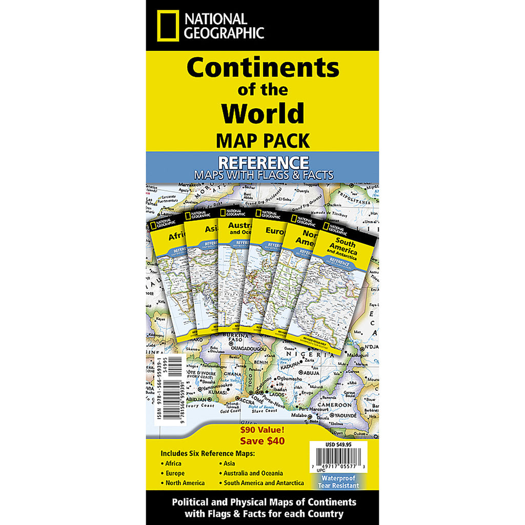

More Info
{"id":8592785309911,"title":"Continents of the World Flags and Facts, folded, Map Pack Bundle, Folded: 4.25\" x 9.25\" ; Flat: 25.25\" x 18.5\"","handle":"continents-of-the-world-flags-and-facts-folded-map-pack-bundle-folded-4-25-x-9-25-flat-25-25-x-18-5","description":"MPN: 006352\u003cbr\u003e\u003cbr\u003eUPC: 749717055773\u003cbr\u003eNational Geographic's Reference maps with Flags \u0026amp; Facts Map Pack Bundle of Continents includes the seven continents on six waterproof tear-resistant maps. Each continent map includes a political map with countries and cities carefully placed for maximum readability. Each map also includes a physical map of the continent artistically representing the mountains, valley, plains, rivers, lakes and other physical features. The flags and facts for every country, enhanced with representative photographs portraying themes and regions are also included.\n\nThe maps are printed on waterproof, tear-resistant material which can be folded and unfolded hundreds of times making them perfect for quick reference to the news of the day or classroom use. The world-class cartography of National Geographic is now available in a format that will easily fit in a drawer without the need for an enormous table or wall space for a quick and easy reference source.\n\nThe Continents of the World Map Pack includes:\nAfrica with Flags \u0026amp; Facts\nAsia with Flags \u0026amp; Facts\nAustralia and Oceania with Flags \u0026amp; Facts\nEurope with Flags \u0026amp; Facts\nNorth America with Flags \u0026amp; Facts\nSouth America and Antarctica with Flags \u0026amp; Facts\n\nEvery Flags \u0026amp; Facts Reference map is printed on \"Classroom Tough\" waterproof, tear-resistant paper.\u003cbr\u003e\u003cbr\u003eKey Features : \u003cbr\u003e\u003cbr\u003ei : National Geographic's Reference maps with Flags \u0026amp; Facts Map Pack Bundle of Continents includes the seven continents on six waterproof tear-resistant maps.\u003cbr\u003eii : Each continent map includes a political map with countries and cities carefully placed for maximum readability.\u003cbr\u003eiii : The maps are printed on waterproof, tear-resistant material which can be folded and unfolded hundreds of times making them perfect for quick reference to the news of the day or classroom use.\u003cbr\u003eiv : Every Flags \u0026amp; Facts Reference map is printed on \"Classroom Tough\" waterproof, tear-resistant paper.\u003cbr\u003ev : Measures 4.25\" x 9.25\" folded and 25.25\" x 18.5\" flat\u003cbr\u003e\u003cbr\u003eSKU: ERSNGMRE01021236B","published_at":"2024-06-20T23:59:25-04:00","created_at":"2024-06-20T23:59:27-04:00","vendor":"National Geographic","type":"Social Studies","tags":["8+ years","Maps \u0026 Map Skills","Multi","Paper","Plastic","Travel Maps"],"price":6843,"price_min":6843,"price_max":6843,"available":true,"price_varies":false,"compare_at_price":null,"compare_at_price_min":0,"compare_at_price_max":0,"compare_at_price_varies":false,"variants":[{"id":45324310446295,"title":"Default Title","option1":"Default Title","option2":null,"option3":null,"sku":"ERSNGMRE01021236B","requires_shipping":true,"taxable":true,"featured_image":{"id":40957013098711,"product_id":8592785309911,"position":1,"created_at":"2024-06-20T23:59:27-04:00","updated_at":"2024-06-20T23:59:27-04:00","alt":null,"width":1500,"height":1500,"src":"\/\/shop.qualityucanafford.com\/cdn\/shop\/files\/ERSNGMRE01021236B.jpg?v=1718942367","variant_ids":[45324310446295]},"available":true,"name":"Continents of the World Flags and Facts, folded, Map Pack Bundle, Folded: 4.25\" x 9.25\" ; Flat: 25.25\" x 18.5\"","public_title":null,"options":["Default Title"],"price":6843,"weight":340,"compare_at_price":null,"inventory_quantity":13,"inventory_management":"shopify","inventory_policy":"deny","barcode":"749717055773","featured_media":{"alt":null,"id":33635266134231,"position":1,"preview_image":{"aspect_ratio":1.0,"height":1500,"width":1500,"src":"\/\/shop.qualityucanafford.com\/cdn\/shop\/files\/ERSNGMRE01021236B.jpg?v=1718942367"}},"requires_selling_plan":false,"selling_plan_allocations":[]}],"images":["\/\/shop.qualityucanafford.com\/cdn\/shop\/files\/ERSNGMRE01021236B.jpg?v=1718942367","\/\/shop.qualityucanafford.com\/cdn\/shop\/files\/ERSNGMRE01021236B_1.jpg?v=1718942369","\/\/shop.qualityucanafford.com\/cdn\/shop\/files\/ERSNGMRE01021236B_2.jpg?v=1718942371","\/\/shop.qualityucanafford.com\/cdn\/shop\/files\/ERSNGMRE01021236B_3.jpg?v=1718942373","\/\/shop.qualityucanafford.com\/cdn\/shop\/files\/ERSNGMRE01021236B_4.jpg?v=1718942375","\/\/shop.qualityucanafford.com\/cdn\/shop\/files\/ERSNGMRE01021236B_5.jpg?v=1718942377","\/\/shop.qualityucanafford.com\/cdn\/shop\/files\/ERSNGMRE01021236B_6.jpg?v=1718942379"],"featured_image":"\/\/shop.qualityucanafford.com\/cdn\/shop\/files\/ERSNGMRE01021236B.jpg?v=1718942367","options":["Title"],"media":[{"alt":null,"id":33635266134231,"position":1,"preview_image":{"aspect_ratio":1.0,"height":1500,"width":1500,"src":"\/\/shop.qualityucanafford.com\/cdn\/shop\/files\/ERSNGMRE01021236B.jpg?v=1718942367"},"aspect_ratio":1.0,"height":1500,"media_type":"image","src":"\/\/shop.qualityucanafford.com\/cdn\/shop\/files\/ERSNGMRE01021236B.jpg?v=1718942367","width":1500},{"alt":null,"id":33635266199767,"position":2,"preview_image":{"aspect_ratio":1.0,"height":1500,"width":1500,"src":"\/\/shop.qualityucanafford.com\/cdn\/shop\/files\/ERSNGMRE01021236B_1.jpg?v=1718942369"},"aspect_ratio":1.0,"height":1500,"media_type":"image","src":"\/\/shop.qualityucanafford.com\/cdn\/shop\/files\/ERSNGMRE01021236B_1.jpg?v=1718942369","width":1500},{"alt":null,"id":33635266265303,"position":3,"preview_image":{"aspect_ratio":1.0,"height":1500,"width":1500,"src":"\/\/shop.qualityucanafford.com\/cdn\/shop\/files\/ERSNGMRE01021236B_2.jpg?v=1718942371"},"aspect_ratio":1.0,"height":1500,"media_type":"image","src":"\/\/shop.qualityucanafford.com\/cdn\/shop\/files\/ERSNGMRE01021236B_2.jpg?v=1718942371","width":1500},{"alt":null,"id":33635266330839,"position":4,"preview_image":{"aspect_ratio":1.0,"height":1500,"width":1500,"src":"\/\/shop.qualityucanafford.com\/cdn\/shop\/files\/ERSNGMRE01021236B_3.jpg?v=1718942373"},"aspect_ratio":1.0,"height":1500,"media_type":"image","src":"\/\/shop.qualityucanafford.com\/cdn\/shop\/files\/ERSNGMRE01021236B_3.jpg?v=1718942373","width":1500},{"alt":null,"id":33635266560215,"position":5,"preview_image":{"aspect_ratio":1.0,"height":1800,"width":1800,"src":"\/\/shop.qualityucanafford.com\/cdn\/shop\/files\/ERSNGMRE01021236B_4.jpg?v=1718942375"},"aspect_ratio":1.0,"height":1800,"media_type":"image","src":"\/\/shop.qualityucanafford.com\/cdn\/shop\/files\/ERSNGMRE01021236B_4.jpg?v=1718942375","width":1800},{"alt":null,"id":33635266658519,"position":6,"preview_image":{"aspect_ratio":1.0,"height":1800,"width":1800,"src":"\/\/shop.qualityucanafford.com\/cdn\/shop\/files\/ERSNGMRE01021236B_5.jpg?v=1718942377"},"aspect_ratio":1.0,"height":1800,"media_type":"image","src":"\/\/shop.qualityucanafford.com\/cdn\/shop\/files\/ERSNGMRE01021236B_5.jpg?v=1718942377","width":1800},{"alt":null,"id":33635266724055,"position":7,"preview_image":{"aspect_ratio":1.0,"height":1500,"width":1500,"src":"\/\/shop.qualityucanafford.com\/cdn\/shop\/files\/ERSNGMRE01021236B_6.jpg?v=1718942379"},"aspect_ratio":1.0,"height":1500,"media_type":"image","src":"\/\/shop.qualityucanafford.com\/cdn\/shop\/files\/ERSNGMRE01021236B_6.jpg?v=1718942379","width":1500}],"requires_selling_plan":false,"selling_plan_groups":[],"content":"MPN: 006352\u003cbr\u003e\u003cbr\u003eUPC: 749717055773\u003cbr\u003eNational Geographic's Reference maps with Flags \u0026amp; Facts Map Pack Bundle of Continents includes the seven continents on six waterproof tear-resistant maps. Each continent map includes a political map with countries and cities carefully placed for maximum readability. Each map also includes a physical map of the continent artistically representing the mountains, valley, plains, rivers, lakes and other physical features. The flags and facts for every country, enhanced with representative photographs portraying themes and regions are also included.\n\nThe maps are printed on waterproof, tear-resistant material which can be folded and unfolded hundreds of times making them perfect for quick reference to the news of the day or classroom use. The world-class cartography of National Geographic is now available in a format that will easily fit in a drawer without the need for an enormous table or wall space for a quick and easy reference source.\n\nThe Continents of the World Map Pack includes:\nAfrica with Flags \u0026amp; Facts\nAsia with Flags \u0026amp; Facts\nAustralia and Oceania with Flags \u0026amp; Facts\nEurope with Flags \u0026amp; Facts\nNorth America with Flags \u0026amp; Facts\nSouth America and Antarctica with Flags \u0026amp; Facts\n\nEvery Flags \u0026amp; Facts Reference map is printed on \"Classroom Tough\" waterproof, tear-resistant paper.\u003cbr\u003e\u003cbr\u003eKey Features : \u003cbr\u003e\u003cbr\u003ei : National Geographic's Reference maps with Flags \u0026amp; Facts Map Pack Bundle of Continents includes the seven continents on six waterproof tear-resistant maps.\u003cbr\u003eii : Each continent map includes a political map with countries and cities carefully placed for maximum readability.\u003cbr\u003eiii : The maps are printed on waterproof, tear-resistant material which can be folded and unfolded hundreds of times making them perfect for quick reference to the news of the day or classroom use.\u003cbr\u003eiv : Every Flags \u0026amp; Facts Reference map is printed on \"Classroom Tough\" waterproof, tear-resistant paper.\u003cbr\u003ev : Measures 4.25\" x 9.25\" folded and 25.25\" x 18.5\" flat\u003cbr\u003e\u003cbr\u003eSKU: ERSNGMRE01021236B"}
Continents of the World Flags and Facts, folded, Map Pack Bundle, Folded: 4.25" x 9.25" ; Flat: 25.25" x 18.5"

Continents of the World Flags and Facts, folded, Map Pack Bundle, Folded: 4.25" x 9.25" ; Flat: 25.25" x 18.5"

$68.43

MPN: 006352UPC: 749717055773National Geographic's Reference maps with Flags & Facts Map Pack Bundle of Continents includes the seven continents on six waterproof tear-resistant maps. Each continent map includes a political map with countries and cities carefully placed for maximum readability. Each map also includes a physical map of the con...


More Info
{"id":8580345921751,"title":"World Decorator Map, Laminated, 46\" x 30.5\"","handle":"world-decorator-map-laminated-46-x-30-5","description":"MPN: 006352\u003cbr\u003e\u003cbr\u003eUPC: 749717004696\u003cbr\u003eExpertly researched and designed, National Geographic's World Wall Map is the authoritative map of the world by which other reference maps are measured. Colorful Decorator style map with vibrant color palette that fills each country for easy identification. Background shows mountain ranges and valleys in subtle shaded relief with mountain ranges labeled. Major water bodies including rivers, lakes, glaciers, oceans, seas, gulfs, bays, straits, and bathymetry. Clearly defined international boundaries, cities, islands, airports, and physical features. Thousands of place names carefully and artfully placed to maintain legibility in heavily populated areas. Up-to-date international boundaries and territorial control reflect de facto status on the ground. Meticulously researched using multiple authoritative sources including the U.N., U.S. Board on Geographic Names, and policies of individual governments. Accurate place names use a combination of conventional English names, official national names, and standard transliterations for non-Latin alphabets. Drawn in Winkel Tripel projection with distortions minimized unlike other World maps (e.g. Greenland is shown the same size as Argentina, not South America). Corner inset maps feature vegetation, land use, population density, and north and south polar regions. The map is encapsulated in heavy-duty 1.6 mil laminate which makes the paper much more durable and resistant to the swelling and shrinking caused by changes in humidity. Laminated maps can be framed without the need for glass, so the frames can be much lighter and less expensive.\u003cbr\u003e\u003cbr\u003eKey Features : \u003cbr\u003e\u003cbr\u003ei : Expertly researched and designed, National Geographic's World Wall Map is the authoritative map of the world by which other reference maps are measured.\u003cbr\u003eii : Colorful Decorator style map with vibrant color palette that fills each country for easy identification\u003cbr\u003eiii : The map clearly highlights the differences in the urban and physical geography of each state, and national parks are outlined with eye-catching green vignettes.\u003cbr\u003eiv : The map is encapsulated in heavy-duty 1.6 mil laminate which makes the paper much more durable and resistant to the swelling and shrinking caused by changes in humidity.\u003cbr\u003ev : Measures 46\" x 30.5\"\u003cbr\u003e\u003cbr\u003eSKU: ERSNGMRE00622079","published_at":"2024-06-14T05:44:43-04:00","created_at":"2024-06-14T05:44:43-04:00","vendor":"National Geographic","type":"Social Studies","tags":["12+ years","Maps \u0026 Map Skills","Multi","Paper","Plastic","Wall Maps"],"price":4103,"price_min":4103,"price_max":4103,"available":true,"price_varies":false,"compare_at_price":null,"compare_at_price_min":0,"compare_at_price_max":0,"compare_at_price_varies":false,"variants":[{"id":45287749779671,"title":"Default Title","option1":"Default Title","option2":null,"option3":null,"sku":"ERSNGMRE00622079","requires_shipping":true,"taxable":true,"featured_image":null,"available":true,"name":"World Decorator Map, Laminated, 46\" x 30.5\"","public_title":null,"options":["Default Title"],"price":4103,"weight":172,"compare_at_price":null,"inventory_quantity":11,"inventory_management":"shopify","inventory_policy":"deny","barcode":"749717004696","requires_selling_plan":false,"selling_plan_allocations":[]}],"images":[],"featured_image":null,"options":["Title"],"requires_selling_plan":false,"selling_plan_groups":[],"content":"MPN: 006352\u003cbr\u003e\u003cbr\u003eUPC: 749717004696\u003cbr\u003eExpertly researched and designed, National Geographic's World Wall Map is the authoritative map of the world by which other reference maps are measured. Colorful Decorator style map with vibrant color palette that fills each country for easy identification. Background shows mountain ranges and valleys in subtle shaded relief with mountain ranges labeled. Major water bodies including rivers, lakes, glaciers, oceans, seas, gulfs, bays, straits, and bathymetry. Clearly defined international boundaries, cities, islands, airports, and physical features. Thousands of place names carefully and artfully placed to maintain legibility in heavily populated areas. Up-to-date international boundaries and territorial control reflect de facto status on the ground. Meticulously researched using multiple authoritative sources including the U.N., U.S. Board on Geographic Names, and policies of individual governments. Accurate place names use a combination of conventional English names, official national names, and standard transliterations for non-Latin alphabets. Drawn in Winkel Tripel projection with distortions minimized unlike other World maps (e.g. Greenland is shown the same size as Argentina, not South America). Corner inset maps feature vegetation, land use, population density, and north and south polar regions. The map is encapsulated in heavy-duty 1.6 mil laminate which makes the paper much more durable and resistant to the swelling and shrinking caused by changes in humidity. Laminated maps can be framed without the need for glass, so the frames can be much lighter and less expensive.\u003cbr\u003e\u003cbr\u003eKey Features : \u003cbr\u003e\u003cbr\u003ei : Expertly researched and designed, National Geographic's World Wall Map is the authoritative map of the world by which other reference maps are measured.\u003cbr\u003eii : Colorful Decorator style map with vibrant color palette that fills each country for easy identification\u003cbr\u003eiii : The map clearly highlights the differences in the urban and physical geography of each state, and national parks are outlined with eye-catching green vignettes.\u003cbr\u003eiv : The map is encapsulated in heavy-duty 1.6 mil laminate which makes the paper much more durable and resistant to the swelling and shrinking caused by changes in humidity.\u003cbr\u003ev : Measures 46\" x 30.5\"\u003cbr\u003e\u003cbr\u003eSKU: ERSNGMRE00622079"}

World Decorator Map, Laminated, 46" x 30.5"

$41.03

MPN: 006352UPC: 749717004696Expertly researched and designed, National Geographic's World Wall Map is the authoritative map of the world by which other reference maps are measured. Colorful Decorator style map with vibrant color palette that fills each country for easy identification. Background shows mountain ranges and valleys in subtle shaded...


More Info
{"id":8580345856215,"title":"World Executive Map, Laminated, 46\" x 30.5\"","handle":"world-executive-map-laminated-46-x-30-5","description":"MPN: 006352\u003cbr\u003e\u003cbr\u003eUPC: 749717004771\u003cbr\u003eExpertly researched and designed, National Geographic's World Wall Map is the authoritative map of the world by which other reference maps are measured. Antique-style \"executive\" color palette. Background shows mountain ranges and valleys in subtle shaded relief with mountain ranges labeled. Major water bodies including rivers, lakes, glaciers, oceans, seas, gulfs, bays, straits, and bathymetry. Clearly defined international boundaries, cities, islands, airports, and physical features. Thousands of place names carefully and artfully placed to maintain legibility in heavily populated areas. Up-to-date international boundaries and territorial control reflect de facto status on the ground. Meticulously researched using multiple authoritative sources including the U.N., U.S. Board on Geographic Names, and policies of individual governments. Accurate place names use a combination of conventional English names, official national names, and standard transliterations for non-Latin alphabets. Drawn in Winkel Tripel projection with distortions minimized unlike other World maps (e.g. Greenland is shown the same size as Argentina, not South America). Corner inset maps feature vegetation, land use, population density, and north and south polar regions. The map is encapsulated in heavy-duty 1.6 mil laminate which makes the paper much more durable and resistant to the swelling and shrinking caused by changes in humidity. Laminated maps can be framed without the need for glass, so the frames can be much lighter and less expensive.\u003cbr\u003e\u003cbr\u003eKey Features : \u003cbr\u003e\u003cbr\u003ei : Expertly researched and designed, National Geographic's World Wall Map is the authoritative map of the world by which other reference maps are measured.\u003cbr\u003eii : Antique-style \"executive\" color palette\u003cbr\u003eiii : Meticulously researched using multiple authoritative sources including the U.N., U.S. Board on Geographic Names, and policies of individual governments.\u003cbr\u003eiv : The map is encapsulated in heavy-duty 1.6 mil laminate which makes the paper much more durable and resistant to the swelling and shrinking caused by changes in humidity.\u003cbr\u003ev : Measures 46\" x 30.5\"\u003cbr\u003e\u003cbr\u003eSKU: ERSNGMRE00622087","published_at":"2024-06-14T05:44:42-04:00","created_at":"2024-06-14T05:44:42-04:00","vendor":"National Geographic","type":"Social Studies","tags":["14+ years","Maps \u0026 Map Skills","Multi","Paper","Plastic","Wall Maps"],"price":4103,"price_min":4103,"price_max":4103,"available":true,"price_varies":false,"compare_at_price":null,"compare_at_price_min":0,"compare_at_price_max":0,"compare_at_price_varies":false,"variants":[{"id":45287749714135,"title":"Default Title","option1":"Default Title","option2":null,"option3":null,"sku":"ERSNGMRE00622087","requires_shipping":true,"taxable":true,"featured_image":null,"available":true,"name":"World Executive Map, Laminated, 46\" x 30.5\"","public_title":null,"options":["Default Title"],"price":4103,"weight":172,"compare_at_price":null,"inventory_quantity":2,"inventory_management":"shopify","inventory_policy":"deny","barcode":"749717004771","requires_selling_plan":false,"selling_plan_allocations":[]}],"images":[],"featured_image":null,"options":["Title"],"requires_selling_plan":false,"selling_plan_groups":[],"content":"MPN: 006352\u003cbr\u003e\u003cbr\u003eUPC: 749717004771\u003cbr\u003eExpertly researched and designed, National Geographic's World Wall Map is the authoritative map of the world by which other reference maps are measured. Antique-style \"executive\" color palette. Background shows mountain ranges and valleys in subtle shaded relief with mountain ranges labeled. Major water bodies including rivers, lakes, glaciers, oceans, seas, gulfs, bays, straits, and bathymetry. Clearly defined international boundaries, cities, islands, airports, and physical features. Thousands of place names carefully and artfully placed to maintain legibility in heavily populated areas. Up-to-date international boundaries and territorial control reflect de facto status on the ground. Meticulously researched using multiple authoritative sources including the U.N., U.S. Board on Geographic Names, and policies of individual governments. Accurate place names use a combination of conventional English names, official national names, and standard transliterations for non-Latin alphabets. Drawn in Winkel Tripel projection with distortions minimized unlike other World maps (e.g. Greenland is shown the same size as Argentina, not South America). Corner inset maps feature vegetation, land use, population density, and north and south polar regions. The map is encapsulated in heavy-duty 1.6 mil laminate which makes the paper much more durable and resistant to the swelling and shrinking caused by changes in humidity. Laminated maps can be framed without the need for glass, so the frames can be much lighter and less expensive.\u003cbr\u003e\u003cbr\u003eKey Features : \u003cbr\u003e\u003cbr\u003ei : Expertly researched and designed, National Geographic's World Wall Map is the authoritative map of the world by which other reference maps are measured.\u003cbr\u003eii : Antique-style \"executive\" color palette\u003cbr\u003eiii : Meticulously researched using multiple authoritative sources including the U.N., U.S. Board on Geographic Names, and policies of individual governments.\u003cbr\u003eiv : The map is encapsulated in heavy-duty 1.6 mil laminate which makes the paper much more durable and resistant to the swelling and shrinking caused by changes in humidity.\u003cbr\u003ev : Measures 46\" x 30.5\"\u003cbr\u003e\u003cbr\u003eSKU: ERSNGMRE00622087"}

World Executive Map, Laminated, 46" x 30.5"

$41.03

MPN: 006352UPC: 749717004771Expertly researched and designed, National Geographic's World Wall Map is the authoritative map of the world by which other reference maps are measured. Antique-style "executive" color palette. Background shows mountain ranges and valleys in subtle shaded relief with mountain ranges labeled. Major water bodies includi...


More Info
{"id":8580345823447,"title":"World Executive Map, Enlarged and Laminated, 73\" x 48\"","handle":"world-executive-map-enlarged-and-laminated-73-x-48","description":"MPN: 006352\u003cbr\u003e\u003cbr\u003eUPC: 749717004788\u003cbr\u003eExpertly researched and designed, National Geographic's World Wall Map is the authoritative map of the world by which other reference maps are measured. Antique-style \"executive\" color palette. Background shows mountain ranges and valleys in subtle shaded relief with mountain ranges labeled. Major water bodies including rivers, lakes, glaciers, oceans, seas, gulfs, bays, straits, and bathymetry. Clearly defined international boundaries, cities, islands, airports, and physical features. Thousands of place names carefully and artfully placed to maintain legibility in heavily populated areas. Up-to-date international boundaries and territorial control reflect de facto status on the ground. Meticulously researched using multiple authoritative sources including the U.N., U.S. Board on Geographic Names, and policies of individual governments. Accurate place names use a combination of conventional English names, official national names, and standard transliterations for non-Latin alphabets. Drawn in Winkel Tripel projection with distortions minimized unlike other World maps (e.g. Greenland is shown the same size as Argentina, not South America). Corner inset maps feature vegetation, land use, population density, and north and south polar regions. Enlarged maps provide an immersive experience in any home or office environment. The exceptional cartography is even easier to appreciate at the larger size. The map is encapsulated in heavy-duty 1.6 mil laminate which makes the paper much more durable and resistant to the swelling and shrinking caused by changes in humidity. Laminated maps can be framed without the need for glass, so the frames can be much lighter and less expensive.\u003cbr\u003e\u003cbr\u003eKey Features : \u003cbr\u003e\u003cbr\u003ei : Expertly researched and designed, National Geographic's World Wall Map is the authoritative map of the world by which other reference maps are measured.\u003cbr\u003eii : Antique-style \"executive\" color palette\u003cbr\u003eiii : Enlarged maps provide an immersive experience in any home or office environment. The exceptional cartography is even easier to appreciate at the larger size\u003cbr\u003eiv : The map is encapsulated in heavy-duty 1.6 mil laminate which makes the paper much more durable and resistant to the swelling and shrinking caused by changes in humidity.\u003cbr\u003ev : Measures 73\" x 48\"\u003cbr\u003e\u003cbr\u003eSKU: ERSNGMRE00622088","published_at":"2024-06-14T05:44:41-04:00","created_at":"2024-06-14T05:44:41-04:00","vendor":"National Geographic","type":"Social Studies","tags":["14+ years","Maps \u0026 Map Skills","Multi","Paper","Plastic","Wall Maps"],"price":9583,"price_min":9583,"price_max":9583,"available":true,"price_varies":false,"compare_at_price":null,"compare_at_price_min":0,"compare_at_price_max":0,"compare_at_price_varies":false,"variants":[{"id":45287749681367,"title":"Default Title","option1":"Default Title","option2":null,"option3":null,"sku":"ERSNGMRE00622088","requires_shipping":true,"taxable":true,"featured_image":null,"available":true,"name":"World Executive Map, Enlarged and Laminated, 73\" x 48\"","public_title":null,"options":["Default Title"],"price":9583,"weight":426,"compare_at_price":null,"inventory_quantity":7,"inventory_management":"shopify","inventory_policy":"deny","barcode":"749717004788","requires_selling_plan":false,"selling_plan_allocations":[]}],"images":[],"featured_image":null,"options":["Title"],"requires_selling_plan":false,"selling_plan_groups":[],"content":"MPN: 006352\u003cbr\u003e\u003cbr\u003eUPC: 749717004788\u003cbr\u003eExpertly researched and designed, National Geographic's World Wall Map is the authoritative map of the world by which other reference maps are measured. Antique-style \"executive\" color palette. Background shows mountain ranges and valleys in subtle shaded relief with mountain ranges labeled. Major water bodies including rivers, lakes, glaciers, oceans, seas, gulfs, bays, straits, and bathymetry. Clearly defined international boundaries, cities, islands, airports, and physical features. Thousands of place names carefully and artfully placed to maintain legibility in heavily populated areas. Up-to-date international boundaries and territorial control reflect de facto status on the ground. Meticulously researched using multiple authoritative sources including the U.N., U.S. Board on Geographic Names, and policies of individual governments. Accurate place names use a combination of conventional English names, official national names, and standard transliterations for non-Latin alphabets. Drawn in Winkel Tripel projection with distortions minimized unlike other World maps (e.g. Greenland is shown the same size as Argentina, not South America). Corner inset maps feature vegetation, land use, population density, and north and south polar regions. Enlarged maps provide an immersive experience in any home or office environment. The exceptional cartography is even easier to appreciate at the larger size. The map is encapsulated in heavy-duty 1.6 mil laminate which makes the paper much more durable and resistant to the swelling and shrinking caused by changes in humidity. Laminated maps can be framed without the need for glass, so the frames can be much lighter and less expensive.\u003cbr\u003e\u003cbr\u003eKey Features : \u003cbr\u003e\u003cbr\u003ei : Expertly researched and designed, National Geographic's World Wall Map is the authoritative map of the world by which other reference maps are measured.\u003cbr\u003eii : Antique-style \"executive\" color palette\u003cbr\u003eiii : Enlarged maps provide an immersive experience in any home or office environment. The exceptional cartography is even easier to appreciate at the larger size\u003cbr\u003eiv : The map is encapsulated in heavy-duty 1.6 mil laminate which makes the paper much more durable and resistant to the swelling and shrinking caused by changes in humidity.\u003cbr\u003ev : Measures 73\" x 48\"\u003cbr\u003e\u003cbr\u003eSKU: ERSNGMRE00622088"}

World Executive Map, Enlarged and Laminated, 73" x 48"

$95.83

MPN: 006352UPC: 749717004788Expertly researched and designed, National Geographic's World Wall Map is the authoritative map of the world by which other reference maps are measured. Antique-style "executive" color palette. Background shows mountain ranges and valleys in subtle shaded relief with mountain ranges labeled. Major water bodies includi...


More Info
{"id":8580345790679,"title":"World Decorator Map, Enlarged and Laminated, 73\" x 48\"","handle":"world-decorator-map-enlarged-and-laminated-73-x-48","description":"MPN: 006352\u003cbr\u003e\u003cbr\u003eUPC: 749717004702\u003cbr\u003eExpertly researched and designed, National Geographic's World Wall Map is the authoritative map of the world by which other reference maps are measured. Colorful Decorator style map with vibrant color palette that fills each country for easy identification.\nBackground shows mountain ranges and valleys in subtle shaded relief with mountain ranges labeled. Major water bodies including rivers, lakes, glaciers, oceans, seas, gulfs, bays, straits, and bathymetry. Clearly defined international boundaries, cities, islands, airports, and physical features. Thousands of place names carefully and artfully placed to maintain legibility in heavily populated areas. Up-to-date international boundaries and territorial control reflect de facto status on the ground. Meticulously researched using multiple authoritative sources including the U.N., U.S. Board on Geographic Names, and policies of individual governments. Accurate place names use a combination of conventional English names, official national names, and standard transliterations for non-Latin alphabets. Drawn in Winkel Tripel projection with distortions minimized unlike other World maps (e.g. Greenland is shown the same size as Argentina, not South America). Corner inset maps feature vegetation, land use, population density, and north and south polar regions. Enlarged maps provide an immersive experience in any home or office environment. The exceptional cartography is even easier to appreciate at the larger size. The map is encapsulated in heavy-duty 1.6 mil laminate which makes the paper much more durable and resistant to the swelling and shrinking caused by changes in humidity. Laminated maps can be framed without the need for glass, so the frames can be much lighter and less expensive.\u003cbr\u003e\u003cbr\u003eKey Features : \u003cbr\u003e\u003cbr\u003ei : Expertly researched and designed, National Geographic's World Wall Map is the authoritative map of the world by which other reference maps are measured.\u003cbr\u003eii : Colorful Decorator style map with vibrant color palette that fills each country for easy identification\u003cbr\u003eiii : Enlarged maps provide an immersive experience in any home or office environment. The exceptional cartography is even easier to appreciate at the larger size\u003cbr\u003eiv : The map is encapsulated in heavy-duty 1.6 mil laminate which makes the paper much more durable and resistant to the swelling and shrinking caused by changes in humidity.\u003cbr\u003ev : Measures 73\" x 48\"\u003cbr\u003e\u003cbr\u003eSKU: ERSNGMRE00622080","published_at":"2024-06-14T05:44:41-04:00","created_at":"2024-06-14T05:44:41-04:00","vendor":"National Geographic","type":"Social Studies","tags":["12+ years","Maps \u0026 Map Skills","Multi","Paper","Plastic","Wall Maps"],"price":9583,"price_min":9583,"price_max":9583,"available":true,"price_varies":false,"compare_at_price":null,"compare_at_price_min":0,"compare_at_price_max":0,"compare_at_price_varies":false,"variants":[{"id":45287749648599,"title":"Default Title","option1":"Default Title","option2":null,"option3":null,"sku":"ERSNGMRE00622080","requires_shipping":true,"taxable":true,"featured_image":null,"available":true,"name":"World Decorator Map, Enlarged and Laminated, 73\" x 48\"","public_title":null,"options":["Default Title"],"price":9583,"weight":426,"compare_at_price":null,"inventory_quantity":14,"inventory_management":"shopify","inventory_policy":"deny","barcode":"749717004702","requires_selling_plan":false,"selling_plan_allocations":[]}],"images":[],"featured_image":null,"options":["Title"],"requires_selling_plan":false,"selling_plan_groups":[],"content":"MPN: 006352\u003cbr\u003e\u003cbr\u003eUPC: 749717004702\u003cbr\u003eExpertly researched and designed, National Geographic's World Wall Map is the authoritative map of the world by which other reference maps are measured. Colorful Decorator style map with vibrant color palette that fills each country for easy identification.\nBackground shows mountain ranges and valleys in subtle shaded relief with mountain ranges labeled. Major water bodies including rivers, lakes, glaciers, oceans, seas, gulfs, bays, straits, and bathymetry. Clearly defined international boundaries, cities, islands, airports, and physical features. Thousands of place names carefully and artfully placed to maintain legibility in heavily populated areas. Up-to-date international boundaries and territorial control reflect de facto status on the ground. Meticulously researched using multiple authoritative sources including the U.N., U.S. Board on Geographic Names, and policies of individual governments. Accurate place names use a combination of conventional English names, official national names, and standard transliterations for non-Latin alphabets. Drawn in Winkel Tripel projection with distortions minimized unlike other World maps (e.g. Greenland is shown the same size as Argentina, not South America). Corner inset maps feature vegetation, land use, population density, and north and south polar regions. Enlarged maps provide an immersive experience in any home or office environment. The exceptional cartography is even easier to appreciate at the larger size. The map is encapsulated in heavy-duty 1.6 mil laminate which makes the paper much more durable and resistant to the swelling and shrinking caused by changes in humidity. Laminated maps can be framed without the need for glass, so the frames can be much lighter and less expensive.\u003cbr\u003e\u003cbr\u003eKey Features : \u003cbr\u003e\u003cbr\u003ei : Expertly researched and designed, National Geographic's World Wall Map is the authoritative map of the world by which other reference maps are measured.\u003cbr\u003eii : Colorful Decorator style map with vibrant color palette that fills each country for easy identification\u003cbr\u003eiii : Enlarged maps provide an immersive experience in any home or office environment. The exceptional cartography is even easier to appreciate at the larger size\u003cbr\u003eiv : The map is encapsulated in heavy-duty 1.6 mil laminate which makes the paper much more durable and resistant to the swelling and shrinking caused by changes in humidity.\u003cbr\u003ev : Measures 73\" x 48\"\u003cbr\u003e\u003cbr\u003eSKU: ERSNGMRE00622080"}

World Decorator Map, Enlarged and Laminated, 73" x 48"

$95.83

MPN: 006352UPC: 749717004702Expertly researched and designed, National Geographic's World Wall Map is the authoritative map of the world by which other reference maps are measured. Colorful Decorator style map with vibrant color palette that fills each country for easy identification. Background shows mountain ranges and valleys in subtle shaded...


More Info
{"id":8580345725143,"title":"United States Decorator Map, Laminated, 43.5\" x 30.5\"","handle":"united-states-decorator-map-laminated-43-5-x-30-5","description":"MPN: 006352\u003cbr\u003e\u003cbr\u003eUPC: 749717004733\u003cbr\u003eNational Geographic's Decorator style map of the United States features rich, attractive color fills that bring any room or classroom to life. The map clearly highlights the differences in the urban and physical geography of each state, and national parks are outlined with eye-catching green vignettes. All 50 States are featured including insets for Alaska and the Hawaiian Islands. An inset demonstrating the relative size of Alaska is shown as well. All major cities, transportation routes, State boundaries, inland waterways, and mountain ranges are clearly displayed and labeled.\n\nThe map is encapsulated in heavy-duty 1.6 mil laminate which makes the paper much more durable and resistant to the swelling and shrinking caused by changes in humidity. Laminated maps can be framed without the need for glass, so the frames can be much lighter and less expensive.\u003cbr\u003e\u003cbr\u003eKey Features : \u003cbr\u003e\u003cbr\u003ei : National Geographic's Decorator style map of the United States features rich, attractive color fills that bring any room or classroom to life.\u003cbr\u003eii : Colorful Decorator style map with vibrant color palette that fills each country for easy identification\u003cbr\u003eiii : The map clearly highlights the differences in the urban and physical geography of each state, and national parks are outlined with eye-catching green vignettes.\u003cbr\u003eiv : The map is encapsulated in heavy-duty 1.6 mil laminate which makes the paper much more durable and resistant to the swelling and shrinking caused by changes in humidity.\u003cbr\u003ev : Measures 43.5\" x 30.5\"\u003cbr\u003e\u003cbr\u003eSKU: ERSNGMRE00622083","published_at":"2024-06-14T05:44:40-04:00","created_at":"2024-06-14T05:44:40-04:00","vendor":"National Geographic","type":"Social Studies","tags":["10+ years","Maps \u0026 Map Skills","Multi","Paper","Plastic","Wall Maps"],"price":4103,"price_min":4103,"price_max":4103,"available":true,"price_varies":false,"compare_at_price":null,"compare_at_price_min":0,"compare_at_price_max":0,"compare_at_price_varies":false,"variants":[{"id":45287749550295,"title":"Default Title","option1":"Default Title","option2":null,"option3":null,"sku":"ERSNGMRE00622083","requires_shipping":true,"taxable":true,"featured_image":null,"available":true,"name":"United States Decorator Map, Laminated, 43.5\" x 30.5\"","public_title":null,"options":["Default Title"],"price":4103,"weight":172,"compare_at_price":null,"inventory_quantity":13,"inventory_management":"shopify","inventory_policy":"deny","barcode":"749717004733","requires_selling_plan":false,"selling_plan_allocations":[]}],"images":[],"featured_image":null,"options":["Title"],"requires_selling_plan":false,"selling_plan_groups":[],"content":"MPN: 006352\u003cbr\u003e\u003cbr\u003eUPC: 749717004733\u003cbr\u003eNational Geographic's Decorator style map of the United States features rich, attractive color fills that bring any room or classroom to life. The map clearly highlights the differences in the urban and physical geography of each state, and national parks are outlined with eye-catching green vignettes. All 50 States are featured including insets for Alaska and the Hawaiian Islands. An inset demonstrating the relative size of Alaska is shown as well. All major cities, transportation routes, State boundaries, inland waterways, and mountain ranges are clearly displayed and labeled.\n\nThe map is encapsulated in heavy-duty 1.6 mil laminate which makes the paper much more durable and resistant to the swelling and shrinking caused by changes in humidity. Laminated maps can be framed without the need for glass, so the frames can be much lighter and less expensive.\u003cbr\u003e\u003cbr\u003eKey Features : \u003cbr\u003e\u003cbr\u003ei : National Geographic's Decorator style map of the United States features rich, attractive color fills that bring any room or classroom to life.\u003cbr\u003eii : Colorful Decorator style map with vibrant color palette that fills each country for easy identification\u003cbr\u003eiii : The map clearly highlights the differences in the urban and physical geography of each state, and national parks are outlined with eye-catching green vignettes.\u003cbr\u003eiv : The map is encapsulated in heavy-duty 1.6 mil laminate which makes the paper much more durable and resistant to the swelling and shrinking caused by changes in humidity.\u003cbr\u003ev : Measures 43.5\" x 30.5\"\u003cbr\u003e\u003cbr\u003eSKU: ERSNGMRE00622083"}

United States Decorator Map, Laminated, 43.5" x 30.5"

$41.03

MPN: 006352UPC: 749717004733National Geographic's Decorator style map of the United States features rich, attractive color fills that bring any room or classroom to life. The map clearly highlights the differences in the urban and physical geography of each state, and national parks are outlined with eye-catching green vignettes. All 50 States a...


More Info
{"id":8580345692375,"title":"United States Decorator Map, Enlarged and Laminated, 43.5\" x 30.5\"","handle":"united-states-decorator-map-enlarged-and-laminated-43-5-x-30-5","description":"MPN: 006352\u003cbr\u003e\u003cbr\u003eUPC: 749717004740\u003cbr\u003eNational Geographic's Decorator style map of the United States features rich, attractive color fills that bring any room or classroom to life. The map clearly highlights the differences in the urban and physical geography of each state, and national parks are outlined with eye-catching green vignettes. All 50 States are featured including insets for Alaska and the Hawaiian Islands. An inset demonstrating the relative size of Alaska is shown as well. All major cities, transportation routes, State boundaries, inland waterways, and mountain ranges are clearly displayed and labeled.\n\nEnlarged maps provide an immersive experience in any home or office environment. The exceptional cartography is even easier to appreciate at the larger size. The map is encapsulated in heavy-duty 1.6 mil laminate which makes the paper much more durable and resistant to the swelling and shrinking caused by changes in humidity. Laminated maps can be framed without the need for glass, so the frames can be much lighter and less expensive.\u003cbr\u003e\u003cbr\u003eKey Features : \u003cbr\u003e\u003cbr\u003ei : National Geographic's Decorator style map of the United States features rich, attractive color fills that bring any room or classroom to life.\u003cbr\u003eii : Colorful Decorator style map with vibrant color palette that fills each country for easy identification\u003cbr\u003eiii : Enlarged maps provide an immersive experience in any home or office environment. The exceptional cartography is even easier to appreciate at the larger size\u003cbr\u003eiv : The map is encapsulated in heavy-duty 1.6 mil laminate which makes the paper much more durable and resistant to the swelling and shrinking caused by changes in humidity.\u003cbr\u003ev : Measures 43.5\" x 30.5\"\u003cbr\u003e\u003cbr\u003eSKU: ERSNGMRE00622084","published_at":"2024-06-14T05:44:39-04:00","created_at":"2024-06-14T05:44:39-04:00","vendor":"National Geographic","type":"Social Studies","tags":["10+ years","Maps \u0026 Map Skills","Multi","Paper","Plastic","Wall Maps"],"price":9583,"price_min":9583,"price_max":9583,"available":true,"price_varies":false,"compare_at_price":null,"compare_at_price_min":0,"compare_at_price_max":0,"compare_at_price_varies":false,"variants":[{"id":45287749517527,"title":"Default Title","option1":"Default Title","option2":null,"option3":null,"sku":"ERSNGMRE00622084","requires_shipping":true,"taxable":true,"featured_image":null,"available":true,"name":"United States Decorator Map, Enlarged and Laminated, 43.5\" x 30.5\"","public_title":null,"options":["Default Title"],"price":9583,"weight":426,"compare_at_price":null,"inventory_quantity":12,"inventory_management":"shopify","inventory_policy":"deny","barcode":"749717004740","requires_selling_plan":false,"selling_plan_allocations":[]}],"images":[],"featured_image":null,"options":["Title"],"requires_selling_plan":false,"selling_plan_groups":[],"content":"MPN: 006352\u003cbr\u003e\u003cbr\u003eUPC: 749717004740\u003cbr\u003eNational Geographic's Decorator style map of the United States features rich, attractive color fills that bring any room or classroom to life. The map clearly highlights the differences in the urban and physical geography of each state, and national parks are outlined with eye-catching green vignettes. All 50 States are featured including insets for Alaska and the Hawaiian Islands. An inset demonstrating the relative size of Alaska is shown as well. All major cities, transportation routes, State boundaries, inland waterways, and mountain ranges are clearly displayed and labeled.\n\nEnlarged maps provide an immersive experience in any home or office environment. The exceptional cartography is even easier to appreciate at the larger size. The map is encapsulated in heavy-duty 1.6 mil laminate which makes the paper much more durable and resistant to the swelling and shrinking caused by changes in humidity. Laminated maps can be framed without the need for glass, so the frames can be much lighter and less expensive.\u003cbr\u003e\u003cbr\u003eKey Features : \u003cbr\u003e\u003cbr\u003ei : National Geographic's Decorator style map of the United States features rich, attractive color fills that bring any room or classroom to life.\u003cbr\u003eii : Colorful Decorator style map with vibrant color palette that fills each country for easy identification\u003cbr\u003eiii : Enlarged maps provide an immersive experience in any home or office environment. The exceptional cartography is even easier to appreciate at the larger size\u003cbr\u003eiv : The map is encapsulated in heavy-duty 1.6 mil laminate which makes the paper much more durable and resistant to the swelling and shrinking caused by changes in humidity.\u003cbr\u003ev : Measures 43.5\" x 30.5\"\u003cbr\u003e\u003cbr\u003eSKU: ERSNGMRE00622084"}

United States Decorator Map, Enlarged and Laminated, 43.5" x 30.5"

$95.83

MPN: 006352UPC: 749717004740National Geographic's Decorator style map of the United States features rich, attractive color fills that bring any room or classroom to life. The map clearly highlights the differences in the urban and physical geography of each state, and national parks are outlined with eye-catching green vignettes. All 50 States a...


More Info
{"id":8580345626839,"title":"World Satellite Map, Laminated, 43.5\" x 30.5\"","handle":"world-satellite-map-laminated-43-5-x-30-5","description":"MPN: 006352\u003cbr\u003e\u003cbr\u003eUPC: 749717004610\u003cbr\u003eNational Geographic's striking satellite map of The World is a visually stunning image that makes a wonderful addition to the wall of any office or study. This detailed composite map draws from more than 500 satellite images to give one-kilometer detail and consistent representation of Earth's natural colors and terrain. Inset maps detail the biosphere, surface temperature, and the polar regions. The beauty and complexity of Earth's landscapes, both above and below the oceans, is revealed with the Global Satellite Mosaic which was produced for National Geographic Society by NASA's Jet Propulsion Laboratory.\n\nThe map is encapsulated in heavy-duty 1.6 mil laminate which makes the paper much more durable and resistant to the swelling and shrinking caused by changes in humidity. Laminated maps can be framed without the need for glass, so the frames can be much lighter and less expensive.\u003cbr\u003e\u003cbr\u003eKey Features : \u003cbr\u003e\u003cbr\u003ei : National Geographic's striking satellite map of The World is a visually stunning image that makes a wonderful addition.\u003cbr\u003eii : The beauty and complexity of Earth's landscapes, both above and below the oceans, is revealed with the Global Satellite Mosaic which was produced for National Geographic Society by NASA's Jet Propulsion Laboratory.\u003cbr\u003eiii : This detailed composite map draws from more than 500 satellite images to give one-kilometer detail and consistent representation of Earth's natural colors and terrain.\u003cbr\u003eiv : The map is encapsulated in heavy-duty 1.6 mil laminate which makes the paper much more durable and resistant to the swelling and shrinking caused by changes in humidity.\u003cbr\u003ev : Measures 43.5\" x 30.5\"\u003cbr\u003e\u003cbr\u003eSKU: ERSNGMRE00622011","published_at":"2024-06-14T05:44:38-04:00","created_at":"2024-06-14T05:44:39-04:00","vendor":"National Geographic","type":"Social Studies","tags":["14+ years","Maps \u0026 Map Skills","Multi","Paper","Plastic","Wall Maps"],"price":4103,"price_min":4103,"price_max":4103,"available":true,"price_varies":false,"compare_at_price":null,"compare_at_price_min":0,"compare_at_price_max":0,"compare_at_price_varies":false,"variants":[{"id":45287749419223,"title":"Default Title","option1":"Default Title","option2":null,"option3":null,"sku":"ERSNGMRE00622011","requires_shipping":true,"taxable":true,"featured_image":null,"available":true,"name":"World Satellite Map, Laminated, 43.5\" x 30.5\"","public_title":null,"options":["Default Title"],"price":4103,"weight":172,"compare_at_price":null,"inventory_quantity":14,"inventory_management":"shopify","inventory_policy":"deny","barcode":"749717004610","requires_selling_plan":false,"selling_plan_allocations":[]}],"images":[],"featured_image":null,"options":["Title"],"requires_selling_plan":false,"selling_plan_groups":[],"content":"MPN: 006352\u003cbr\u003e\u003cbr\u003eUPC: 749717004610\u003cbr\u003eNational Geographic's striking satellite map of The World is a visually stunning image that makes a wonderful addition to the wall of any office or study. This detailed composite map draws from more than 500 satellite images to give one-kilometer detail and consistent representation of Earth's natural colors and terrain. Inset maps detail the biosphere, surface temperature, and the polar regions. The beauty and complexity of Earth's landscapes, both above and below the oceans, is revealed with the Global Satellite Mosaic which was produced for National Geographic Society by NASA's Jet Propulsion Laboratory.\n\nThe map is encapsulated in heavy-duty 1.6 mil laminate which makes the paper much more durable and resistant to the swelling and shrinking caused by changes in humidity. Laminated maps can be framed without the need for glass, so the frames can be much lighter and less expensive.\u003cbr\u003e\u003cbr\u003eKey Features : \u003cbr\u003e\u003cbr\u003ei : National Geographic's striking satellite map of The World is a visually stunning image that makes a wonderful addition.\u003cbr\u003eii : The beauty and complexity of Earth's landscapes, both above and below the oceans, is revealed with the Global Satellite Mosaic which was produced for National Geographic Society by NASA's Jet Propulsion Laboratory.\u003cbr\u003eiii : This detailed composite map draws from more than 500 satellite images to give one-kilometer detail and consistent representation of Earth's natural colors and terrain.\u003cbr\u003eiv : The map is encapsulated in heavy-duty 1.6 mil laminate which makes the paper much more durable and resistant to the swelling and shrinking caused by changes in humidity.\u003cbr\u003ev : Measures 43.5\" x 30.5\"\u003cbr\u003e\u003cbr\u003eSKU: ERSNGMRE00622011"}

World Satellite Map, Laminated, 43.5" x 30.5"

$41.03

MPN: 006352UPC: 749717004610National Geographic's striking satellite map of The World is a visually stunning image that makes a wonderful addition to the wall of any office or study. This detailed composite map draws from more than 500 satellite images to give one-kilometer detail and consistent representation of Earth's natural colors and terra...


More Info
{"id":8580345528535,"title":"World Classic Map, Laminated, 43.5\" x 30.5\"","handle":"world-classic-map-laminated-43-5-x-30-5","description":"MPN: 006352\u003cbr\u003e\u003cbr\u003eUPC: 749717004542\u003cbr\u003eExpertly researched and designed, National Geographic's World Wall Map is the authoritative map of the world by which other reference maps are measured. Signature Classic style map with bright, easy to read color palette with blue oceans and colorful borders. Background shows mountain ranges and valleys in subtle shaded relief with mountain ranges labeled. Major water bodies including rivers, lakes, glaciers, oceans, seas, gulfs, bays, straits, and bathymetry. Clearly defined international boundaries, cities, islands, airports, and physical features. Thousands of place names carefully and artfully placed to maintain legibility in heavily populated areas. Up-to-date international boundaries and territorial control reflect de facto status on the ground. Meticulously researched using multiple authoritative sources including the U.N., U.S. Board on Geographic Names, and policies of individual governments. Accurate place names use a combination of conventional English names, official national names, and standard transliterations for non-Latin alphabets. Drawn in Winkel Tripel projection with distortions minimized unlike other World maps (e.g. Greenland is shown the same size as Argentina, not South America). Corner inset maps feature vegetation, land use, population density, and north and south polar regions. The map is encapsulated in heavy-duty 1.6 mil laminate which makes the paper much more durable and resistant to the swelling and shrinking caused by changes in humidity. Laminated maps can be framed without the need for glass, so the frames can be much lighter and less expensive.\u003cbr\u003e\u003cbr\u003eKey Features : \u003cbr\u003e\u003cbr\u003ei : Expertly researched and designed, National Geographic's World Wall Map is the authoritative map of the world by which other reference maps are measured.\u003cbr\u003eii : Signature Classic style map with bright, easy to read color palette with blue oceans and colorful borders\u003cbr\u003eiii : Meticulously researched using multiple authoritative sources including the U.N., U.S. Board on Geographic Names, and policies of individual governments.\u003cbr\u003eiv : The map is encapsulated in heavy-duty 1.6 mil laminate which makes the paper much more durable and resistant to the swelling and shrinking caused by changes in humidity.\u003cbr\u003ev : Measures 43.5\" x 30.5\"\u003cbr\u003e\u003cbr\u003eSKU: ERSNGMRE00622002","published_at":"2024-06-14T05:44:37-04:00","created_at":"2024-06-14T05:44:38-04:00","vendor":"National Geographic","type":"Social Studies","tags":["8+ years","Maps \u0026 Map Skills","Multi","Paper","Plastic","Wall Maps"],"price":4103,"price_min":4103,"price_max":4103,"available":true,"price_varies":false,"compare_at_price":null,"compare_at_price_min":0,"compare_at_price_max":0,"compare_at_price_varies":false,"variants":[{"id":45287749320919,"title":"Default Title","option1":"Default Title","option2":null,"option3":null,"sku":"ERSNGMRE00622002","requires_shipping":true,"taxable":true,"featured_image":null,"available":true,"name":"World Classic Map, Laminated, 43.5\" x 30.5\"","public_title":null,"options":["Default Title"],"price":4103,"weight":172,"compare_at_price":null,"inventory_quantity":14,"inventory_management":"shopify","inventory_policy":"deny","barcode":"749717004542","requires_selling_plan":false,"selling_plan_allocations":[]}],"images":[],"featured_image":null,"options":["Title"],"requires_selling_plan":false,"selling_plan_groups":[],"content":"MPN: 006352\u003cbr\u003e\u003cbr\u003eUPC: 749717004542\u003cbr\u003eExpertly researched and designed, National Geographic's World Wall Map is the authoritative map of the world by which other reference maps are measured. Signature Classic style map with bright, easy to read color palette with blue oceans and colorful borders. Background shows mountain ranges and valleys in subtle shaded relief with mountain ranges labeled. Major water bodies including rivers, lakes, glaciers, oceans, seas, gulfs, bays, straits, and bathymetry. Clearly defined international boundaries, cities, islands, airports, and physical features. Thousands of place names carefully and artfully placed to maintain legibility in heavily populated areas. Up-to-date international boundaries and territorial control reflect de facto status on the ground. Meticulously researched using multiple authoritative sources including the U.N., U.S. Board on Geographic Names, and policies of individual governments. Accurate place names use a combination of conventional English names, official national names, and standard transliterations for non-Latin alphabets. Drawn in Winkel Tripel projection with distortions minimized unlike other World maps (e.g. Greenland is shown the same size as Argentina, not South America). Corner inset maps feature vegetation, land use, population density, and north and south polar regions. The map is encapsulated in heavy-duty 1.6 mil laminate which makes the paper much more durable and resistant to the swelling and shrinking caused by changes in humidity. Laminated maps can be framed without the need for glass, so the frames can be much lighter and less expensive.\u003cbr\u003e\u003cbr\u003eKey Features : \u003cbr\u003e\u003cbr\u003ei : Expertly researched and designed, National Geographic's World Wall Map is the authoritative map of the world by which other reference maps are measured.\u003cbr\u003eii : Signature Classic style map with bright, easy to read color palette with blue oceans and colorful borders\u003cbr\u003eiii : Meticulously researched using multiple authoritative sources including the U.N., U.S. Board on Geographic Names, and policies of individual governments.\u003cbr\u003eiv : The map is encapsulated in heavy-duty 1.6 mil laminate which makes the paper much more durable and resistant to the swelling and shrinking caused by changes in humidity.\u003cbr\u003ev : Measures 43.5\" x 30.5\"\u003cbr\u003e\u003cbr\u003eSKU: ERSNGMRE00622002"}

World Classic Map, Laminated, 43.5" x 30.5"

$41.03

MPN: 006352UPC: 749717004542Expertly researched and designed, National Geographic's World Wall Map is the authoritative map of the world by which other reference maps are measured. Signature Classic style map with bright, easy to read color palette with blue oceans and colorful borders. Background shows mountain ranges and valleys in subtle shad...


More Info
{"id":8580345266391,"title":"Bird Migration, Western Hemisphere Map, Laminated, 20.25\" x 31.25\"","handle":"bird-migration-western-hemisphere-map-laminated-20-25-x-31-25","description":"MPN: 006352\u003cbr\u003e\u003cbr\u003eUPC: 749717004863\u003cbr\u003eThis National Geographic classic shows the mystery of bird migration and the incredible journeys that birds undertake in the Americas each year. 67 types of birds that migrate are shown on a map of the Americas that is overlaid with pathways that show migration routes from nesting grounds to wintering areas. Full-color bird paintings by noted illustrator Arthur Singer show each of the 67 species, making it easy to identify birds as they fly their amazing journeys.\n\nThe map is encapsulated in heavy-duty 1.6 mil laminate which makes the paper much more durable and resistant to the swelling and shrinking caused by changes in humidity. Laminated maps can be framed without the need for glass, so the frames can be much lighter and less expensive.\u003cbr\u003e\u003cbr\u003eKey Features : \u003cbr\u003e\u003cbr\u003ei : National Geographic Bird Migration, Western Hemisphere Wall Map shows the mystery of bird migration and the incredible journeys that birds undertake in the Americas each year.\u003cbr\u003eii : 67 types of birds that migrate are shown on a map of the Americas that is overlaid with pathways that show migration routes from nesting grounds to wintering areas.\u003cbr\u003eiii : Full-color bird paintings by noted illustrator Arthur Singer show each of the 67 species, making it easy to identify birds as they fly their amazing journeys.\u003cbr\u003eiv : The map is encapsulated in heavy-duty 1.6 mil laminate which makes the paper much more durable and resistant to the swelling and shrinking caused by changes in humidity.\u003cbr\u003ev : Measures 20.25\" x 31.25\"\u003cbr\u003e\u003cbr\u003eSKU: ERSNGMRE01020306","published_at":"2024-06-14T05:44:21-04:00","created_at":"2024-06-14T05:44:21-04:00","vendor":"National Geographic","type":"Social Studies","tags":["14+ years","Maps \u0026 Map Skills","Multi","Paper","Plastic","Wall Maps"],"price":3418,"price_min":3418,"price_max":3418,"available":true,"price_varies":false,"compare_at_price":null,"compare_at_price_min":0,"compare_at_price_max":0,"compare_at_price_varies":false,"variants":[{"id":45287748993239,"title":"Default Title","option1":"Default Title","option2":null,"option3":null,"sku":"ERSNGMRE01020306","requires_shipping":true,"taxable":true,"featured_image":null,"available":true,"name":"Bird Migration, Western Hemisphere Map, Laminated, 20.25\" x 31.25\"","public_title":null,"options":["Default Title"],"price":3418,"weight":86,"compare_at_price":null,"inventory_quantity":13,"inventory_management":"shopify","inventory_policy":"deny","barcode":"749717004863","requires_selling_plan":false,"selling_plan_allocations":[]}],"images":[],"featured_image":null,"options":["Title"],"requires_selling_plan":false,"selling_plan_groups":[],"content":"MPN: 006352\u003cbr\u003e\u003cbr\u003eUPC: 749717004863\u003cbr\u003eThis National Geographic classic shows the mystery of bird migration and the incredible journeys that birds undertake in the Americas each year. 67 types of birds that migrate are shown on a map of the Americas that is overlaid with pathways that show migration routes from nesting grounds to wintering areas. Full-color bird paintings by noted illustrator Arthur Singer show each of the 67 species, making it easy to identify birds as they fly their amazing journeys.\n\nThe map is encapsulated in heavy-duty 1.6 mil laminate which makes the paper much more durable and resistant to the swelling and shrinking caused by changes in humidity. Laminated maps can be framed without the need for glass, so the frames can be much lighter and less expensive.\u003cbr\u003e\u003cbr\u003eKey Features : \u003cbr\u003e\u003cbr\u003ei : National Geographic Bird Migration, Western Hemisphere Wall Map shows the mystery of bird migration and the incredible journeys that birds undertake in the Americas each year.\u003cbr\u003eii : 67 types of birds that migrate are shown on a map of the Americas that is overlaid with pathways that show migration routes from nesting grounds to wintering areas.\u003cbr\u003eiii : Full-color bird paintings by noted illustrator Arthur Singer show each of the 67 species, making it easy to identify birds as they fly their amazing journeys.\u003cbr\u003eiv : The map is encapsulated in heavy-duty 1.6 mil laminate which makes the paper much more durable and resistant to the swelling and shrinking caused by changes in humidity.\u003cbr\u003ev : Measures 20.25\" x 31.25\"\u003cbr\u003e\u003cbr\u003eSKU: ERSNGMRE01020306"}

Bird Migration, Western Hemisphere Map, Laminated, 20.25" x 31.25"

$34.18

MPN: 006352UPC: 749717004863This National Geographic classic shows the mystery of bird migration and the incredible journeys that birds undertake in the Americas each year. 67 types of birds that migrate are shown on a map of the Americas that is overlaid with pathways that show migration routes from nesting grounds to wintering areas. Full-colo...


More Info
{"id":8580345200855,"title":"World Executive Map, Poster Size and Laminated, 36\" x 24\"","handle":"world-executive-map-poster-size-and-laminated-36-x-24","description":"MPN: 006352\u003cbr\u003e\u003cbr\u003eUPC: 749717005204\u003cbr\u003eExpertly researched and designed, National Geographic's World Wall Map is the authoritative map of the world by which other reference maps are measured. Antique-style \"executive\" color palette. Background shows mountain ranges and valleys in subtle shaded relief with mountain ranges labeled. Major water bodies including rivers, lakes, glaciers, oceans, seas, gulfs, bays, straits, and bathymetry. Clearly defined international boundaries, cities, islands, airports, and physical features. Thousands of place names carefully and artfully placed to maintain legibility in heavily populated areas. Up-to-date international boundaries and territorial control reflect de facto status on the ground. Meticulously researched using multiple authoritative sources including the U.N., U.S. Board on Geographic Names, and policies of individual governments. Accurate place names use a combination of conventional English names, official national names, and standard transliterations for non-Latin alphabets. Drawn in Winkel Tripel projection with distortions minimized unlike other World maps (e.g. Greenland is shown the same size as Argentina, not South America). Corner inset maps feature vegetation, land use, population density, and north and south polar regions. The 36\" x 24\" poster size supports easy and affordable framing and mounting, and takes less wall space than standard wall maps. The map is encapsulated in heavy-duty 1.6 mil laminate which makes the paper much more durable and resistant to the swelling and shrinking caused by changes in humidity. Laminated maps can be framed without the need for glass, so the frames can be much lighter and less expensive.\u003cbr\u003e\u003cbr\u003eKey Features : \u003cbr\u003e\u003cbr\u003ei : Expertly researched and designed, National Geographic's World Wall Map is the authoritative map of the world by which other reference maps are measured.\u003cbr\u003eii : Antique-style \"executive\" color palette\u003cbr\u003eiii : The 36\" x 24\" poster size supports easy and affordable framing and mounting, and takes less wall space than standard wall maps.\u003cbr\u003eiv : The map is encapsulated in heavy-duty 1.6 mil laminate which makes the paper much more durable and resistant to the swelling and shrinking caused by changes in humidity.\u003cbr\u003e\u003cbr\u003eSKU: ERSNGMRE01020376","published_at":"2024-06-14T05:44:21-04:00","created_at":"2024-06-14T05:44:21-04:00","vendor":"National Geographic","type":"Social Studies","tags":["14+ years","Maps \u0026 Map Skills","Multi","Paper","Plastic","Wall Maps"],"price":4103,"price_min":4103,"price_max":4103,"available":true,"price_varies":false,"compare_at_price":null,"compare_at_price_min":0,"compare_at_price_max":0,"compare_at_price_varies":false,"variants":[{"id":45287748927703,"title":"Default Title","option1":"Default Title","option2":null,"option3":null,"sku":"ERSNGMRE01020376","requires_shipping":true,"taxable":true,"featured_image":null,"available":true,"name":"World Executive Map, Poster Size and Laminated, 36\" x 24\"","public_title":null,"options":["Default Title"],"price":4103,"weight":113,"compare_at_price":null,"inventory_quantity":17,"inventory_management":"shopify","inventory_policy":"deny","barcode":"749717005204","requires_selling_plan":false,"selling_plan_allocations":[]}],"images":[],"featured_image":null,"options":["Title"],"requires_selling_plan":false,"selling_plan_groups":[],"content":"MPN: 006352\u003cbr\u003e\u003cbr\u003eUPC: 749717005204\u003cbr\u003eExpertly researched and designed, National Geographic's World Wall Map is the authoritative map of the world by which other reference maps are measured. Antique-style \"executive\" color palette. Background shows mountain ranges and valleys in subtle shaded relief with mountain ranges labeled. Major water bodies including rivers, lakes, glaciers, oceans, seas, gulfs, bays, straits, and bathymetry. Clearly defined international boundaries, cities, islands, airports, and physical features. Thousands of place names carefully and artfully placed to maintain legibility in heavily populated areas. Up-to-date international boundaries and territorial control reflect de facto status on the ground. Meticulously researched using multiple authoritative sources including the U.N., U.S. Board on Geographic Names, and policies of individual governments. Accurate place names use a combination of conventional English names, official national names, and standard transliterations for non-Latin alphabets. Drawn in Winkel Tripel projection with distortions minimized unlike other World maps (e.g. Greenland is shown the same size as Argentina, not South America). Corner inset maps feature vegetation, land use, population density, and north and south polar regions. The 36\" x 24\" poster size supports easy and affordable framing and mounting, and takes less wall space than standard wall maps. The map is encapsulated in heavy-duty 1.6 mil laminate which makes the paper much more durable and resistant to the swelling and shrinking caused by changes in humidity. Laminated maps can be framed without the need for glass, so the frames can be much lighter and less expensive.\u003cbr\u003e\u003cbr\u003eKey Features : \u003cbr\u003e\u003cbr\u003ei : Expertly researched and designed, National Geographic's World Wall Map is the authoritative map of the world by which other reference maps are measured.\u003cbr\u003eii : Antique-style \"executive\" color palette\u003cbr\u003eiii : The 36\" x 24\" poster size supports easy and affordable framing and mounting, and takes less wall space than standard wall maps.\u003cbr\u003eiv : The map is encapsulated in heavy-duty 1.6 mil laminate which makes the paper much more durable and resistant to the swelling and shrinking caused by changes in humidity.\u003cbr\u003e\u003cbr\u003eSKU: ERSNGMRE01020376"}

World Executive Map, Poster Size and Laminated, 36" x 24"

$41.03

MPN: 006352UPC: 749717005204Expertly researched and designed, National Geographic's World Wall Map is the authoritative map of the world by which other reference maps are measured. Antique-style "executive" color palette. Background shows mountain ranges and valleys in subtle shaded relief with mountain ranges labeled. Major water bodies includi...


More Info
{"id":8580345168087,"title":"World Classic Map, Poster Size and Laminated, 36\" x 24\"","handle":"world-classic-map-poster-size-and-laminated-36-x-24","description":"MPN: 006352\u003cbr\u003e\u003cbr\u003eUPC: 749717005235\u003cbr\u003eExpertly researched and designed, National Geographic's World Wall Map is the authoritative map of the world by which other reference maps are measured. Signature Classic style map with bright, easy to read color palette with blue oceans and colorful borders. Background shows mountain ranges and valleys in subtle shaded relief with mountain ranges labeled. Major water bodies including rivers, lakes, glaciers, oceans, seas, gulfs, bays, straits, and bathymetry. Clearly defined international boundaries, cities, islands, airports, and physical features. Thousands of place names carefully and artfully placed to maintain legibility in heavily populated areas. Up-to-date international boundaries and territorial control reflect de facto status on the ground. Meticulously researched using multiple authoritative sources including the U.N., U.S. Board on Geographic Names, and policies of individual governments. Accurate place names use a combination of conventional English names, official national names, and standard transliterations for non-Latin alphabets.. Drawn in Winkel Tripel projection with distortions minimized unlike other World maps (e.g. Greenland is shown the same size as Argentina, not South America). Corner inset maps feature vegetation, land use, population density, and north and south polar regions. The 36\" x 24\" poster size supports easy and affordable framing and mounting, and takes less wall space than standard wall maps. The map is encapsulated in heavy-duty 1.6 mil laminate which makes the paper much more durable and resistant to the swelling and shrinking caused by changes in humidity. Laminated maps can be framed without the need for glass, so the frames can be much lighter and less expensive.\u003cbr\u003e\u003cbr\u003eKey Features : \u003cbr\u003e\u003cbr\u003ei : Expertly researched and designed, National Geographic's World Wall Map is the authoritative map of the world by which other reference maps are measured.\u003cbr\u003eii : Signature Classic style map with bright, easy to read color palette with blue oceans and colorful borders\u003cbr\u003eiii : The 36\" x 24\" poster size supports easy and affordable framing and mounting, and takes less wall space than standard wall maps.\u003cbr\u003eiv : The map is encapsulated in heavy-duty 1.6 mil laminate which makes the paper much more durable and resistant to the swelling and shrinking caused by changes in humidity.\u003cbr\u003e\u003cbr\u003eSKU: ERSNGMRE01020381","published_at":"2024-06-14T05:44:20-04:00","created_at":"2024-06-14T05:44:20-04:00","vendor":"National Geographic","type":"Social Studies","tags":["8+ years","Maps \u0026 Map Skills","Multi","Paper","Plastic","Wall Maps"],"price":4103,"price_min":4103,"price_max":4103,"available":true,"price_varies":false,"compare_at_price":null,"compare_at_price_min":0,"compare_at_price_max":0,"compare_at_price_varies":false,"variants":[{"id":45287748894935,"title":"Default Title","option1":"Default Title","option2":null,"option3":null,"sku":"ERSNGMRE01020381","requires_shipping":true,"taxable":true,"featured_image":null,"available":true,"name":"World Classic Map, Poster Size and Laminated, 36\" x 24\"","public_title":null,"options":["Default Title"],"price":4103,"weight":113,"compare_at_price":null,"inventory_quantity":7,"inventory_management":"shopify","inventory_policy":"deny","barcode":"749717005235","requires_selling_plan":false,"selling_plan_allocations":[]}],"images":[],"featured_image":null,"options":["Title"],"requires_selling_plan":false,"selling_plan_groups":[],"content":"MPN: 006352\u003cbr\u003e\u003cbr\u003eUPC: 749717005235\u003cbr\u003eExpertly researched and designed, National Geographic's World Wall Map is the authoritative map of the world by which other reference maps are measured. Signature Classic style map with bright, easy to read color palette with blue oceans and colorful borders. Background shows mountain ranges and valleys in subtle shaded relief with mountain ranges labeled. Major water bodies including rivers, lakes, glaciers, oceans, seas, gulfs, bays, straits, and bathymetry. Clearly defined international boundaries, cities, islands, airports, and physical features. Thousands of place names carefully and artfully placed to maintain legibility in heavily populated areas. Up-to-date international boundaries and territorial control reflect de facto status on the ground. Meticulously researched using multiple authoritative sources including the U.N., U.S. Board on Geographic Names, and policies of individual governments. Accurate place names use a combination of conventional English names, official national names, and standard transliterations for non-Latin alphabets.. Drawn in Winkel Tripel projection with distortions minimized unlike other World maps (e.g. Greenland is shown the same size as Argentina, not South America). Corner inset maps feature vegetation, land use, population density, and north and south polar regions. The 36\" x 24\" poster size supports easy and affordable framing and mounting, and takes less wall space than standard wall maps. The map is encapsulated in heavy-duty 1.6 mil laminate which makes the paper much more durable and resistant to the swelling and shrinking caused by changes in humidity. Laminated maps can be framed without the need for glass, so the frames can be much lighter and less expensive.\u003cbr\u003e\u003cbr\u003eKey Features : \u003cbr\u003e\u003cbr\u003ei : Expertly researched and designed, National Geographic's World Wall Map is the authoritative map of the world by which other reference maps are measured.\u003cbr\u003eii : Signature Classic style map with bright, easy to read color palette with blue oceans and colorful borders\u003cbr\u003eiii : The 36\" x 24\" poster size supports easy and affordable framing and mounting, and takes less wall space than standard wall maps.\u003cbr\u003eiv : The map is encapsulated in heavy-duty 1.6 mil laminate which makes the paper much more durable and resistant to the swelling and shrinking caused by changes in humidity.\u003cbr\u003e\u003cbr\u003eSKU: ERSNGMRE01020381"}

World Classic Map, Poster Size and Laminated, 36" x 24"

$41.03

MPN: 006352UPC: 749717005235Expertly researched and designed, National Geographic's World Wall Map is the authoritative map of the world by which other reference maps are measured. Signature Classic style map with bright, easy to read color palette with blue oceans and colorful borders. Background shows mountain ranges and valleys in subtle shad...
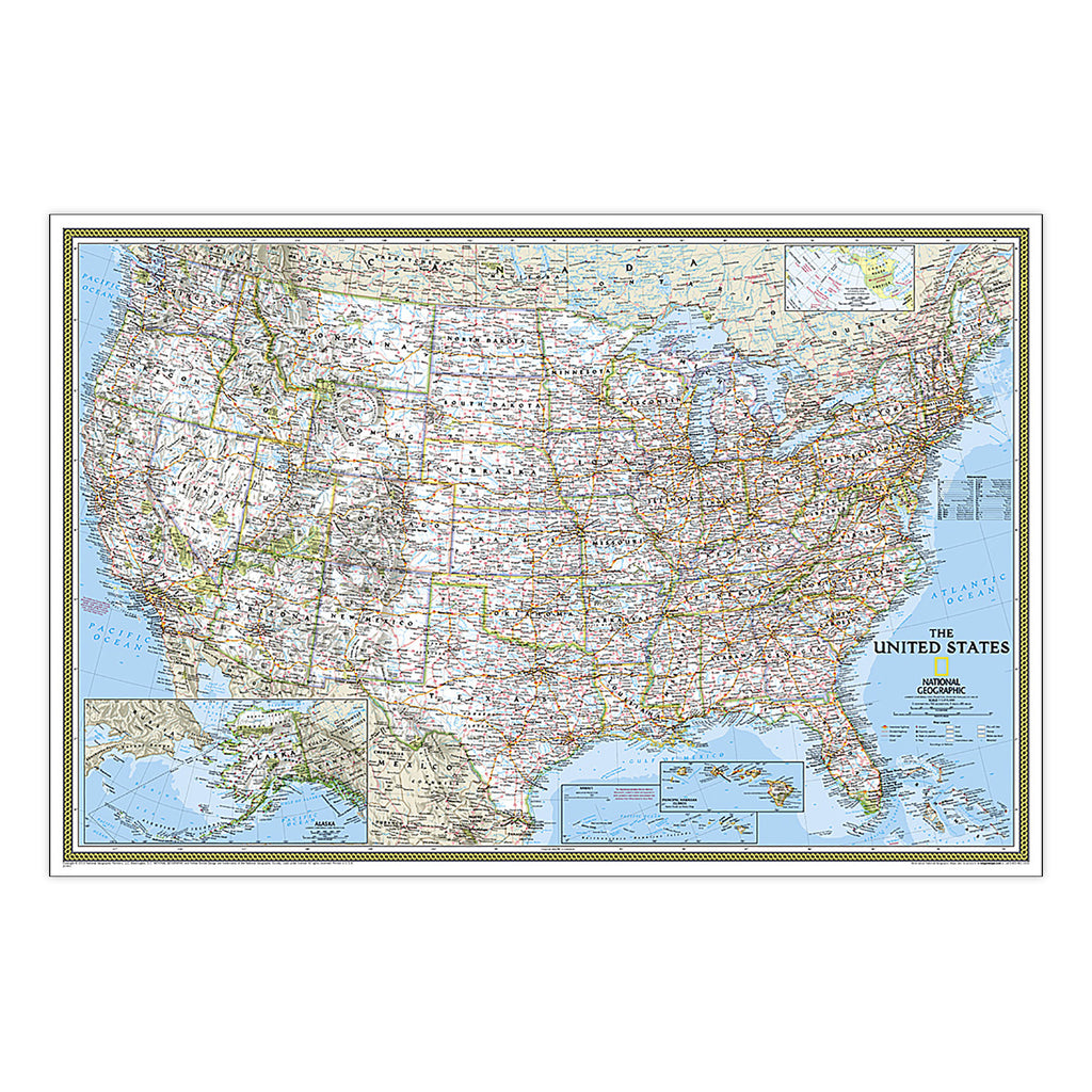

More Info
{"id":8580345069783,"title":"United States Classic Map, Poster Size and Laminated, 36\" x 24\"","handle":"united-states-classic-map-poster-size-and-laminated-36-x-24","description":"MPN: 006352\u003cbr\u003e\u003cbr\u003eUPC: 749717005266\u003cbr\u003eExpertly researched and designed, National Geographic's United States wall map is the standard by which other reference maps of the U.S. are measured. Signature Classic styling with bright, easy to read color palette with blue water and colorful state borders. All 50 states with insets for Hawaiian Islands and Alaska plus inset showing relative size of Alaska. Clearly defined state and country boundaries, cities, islands, national parks, and physical features. Thousands of place names carefully and artfully placed to maintain legibility in heavily populated areas. Background shows mountain ranges and valleys in subtle shaded relief with mountain ranges labeled. Major water bodies including rivers, lakes, gulfs, bays, straits, and ocean bathymetry. Transportation routes including interstate highways, major state routes, airports, waterways, canals, and ferries. The 36\" x 24\" poster size supports easy and affordable framing and mounting, and takes less wall space than standard wall maps. The map is encapsulated in heavy-duty 1.6 mil laminate which makes the paper much more durable and resistant to the swelling and shrinking caused by changes in humidity. Laminated maps can be framed without the need for glass, so the frames can be much lighter and less expensive.\u003cbr\u003e\u003cbr\u003eKey Features : \u003cbr\u003e\u003cbr\u003ei : National Geographic United States Wall Map is expertly researched and designed, National Geographic's United States wall map is the standard by which other reference maps of the U.S. are measured.\u003cbr\u003eii : Antique-style \"executive\" color palette\u003cbr\u003eiii : The 36\" x 24\" poster size supports easy and affordable framing and mounting, and takes less wall space than standard wall maps.\u003cbr\u003eiv : The map is encapsulated in heavy-duty 1.6 mil laminate which makes the paper much more durable and resistant to the swelling and shrinking caused by changes in humidity.\u003cbr\u003e\u003cbr\u003eSKU: ERSNGMRE01020385","published_at":"2024-06-14T05:44:14-04:00","created_at":"2024-06-14T05:44:15-04:00","vendor":"National Geographic","type":"Social Studies","tags":["8+ years","Maps \u0026 Map Skills","Multi","Paper","Plastic","Wall Maps"],"price":4103,"price_min":4103,"price_max":4103,"available":true,"price_varies":false,"compare_at_price":null,"compare_at_price_min":0,"compare_at_price_max":0,"compare_at_price_varies":false,"variants":[{"id":45287748796631,"title":"Default Title","option1":"Default Title","option2":null,"option3":null,"sku":"ERSNGMRE01020385","requires_shipping":true,"taxable":true,"featured_image":{"id":40908634980567,"product_id":8580345069783,"position":1,"created_at":"2024-06-14T05:44:15-04:00","updated_at":"2024-06-14T05:44:15-04:00","alt":null,"width":1800,"height":1800,"src":"\/\/shop.qualityucanafford.com\/cdn\/shop\/files\/ERSNGMRE01020385.jpg?v=1718358255","variant_ids":[45287748796631]},"available":true,"name":"United States Classic Map, Poster Size and Laminated, 36\" x 24\"","public_title":null,"options":["Default Title"],"price":4103,"weight":113,"compare_at_price":null,"inventory_quantity":18,"inventory_management":"shopify","inventory_policy":"deny","barcode":"749717005266","featured_media":{"alt":null,"id":33585773838551,"position":1,"preview_image":{"aspect_ratio":1.0,"height":1800,"width":1800,"src":"\/\/shop.qualityucanafford.com\/cdn\/shop\/files\/ERSNGMRE01020385.jpg?v=1718358255"}},"requires_selling_plan":false,"selling_plan_allocations":[]}],"images":["\/\/shop.qualityucanafford.com\/cdn\/shop\/files\/ERSNGMRE01020385.jpg?v=1718358255","\/\/shop.qualityucanafford.com\/cdn\/shop\/files\/ERSNGMRE01020385_1.jpg?v=1718358258","\/\/shop.qualityucanafford.com\/cdn\/shop\/files\/ERSNGMRE01020385_2.jpg?v=1718358260"],"featured_image":"\/\/shop.qualityucanafford.com\/cdn\/shop\/files\/ERSNGMRE01020385.jpg?v=1718358255","options":["Title"],"media":[{"alt":null,"id":33585773838551,"position":1,"preview_image":{"aspect_ratio":1.0,"height":1800,"width":1800,"src":"\/\/shop.qualityucanafford.com\/cdn\/shop\/files\/ERSNGMRE01020385.jpg?v=1718358255"},"aspect_ratio":1.0,"height":1800,"media_type":"image","src":"\/\/shop.qualityucanafford.com\/cdn\/shop\/files\/ERSNGMRE01020385.jpg?v=1718358255","width":1800},{"alt":null,"id":33585774002391,"position":2,"preview_image":{"aspect_ratio":1.0,"height":1800,"width":1800,"src":"\/\/shop.qualityucanafford.com\/cdn\/shop\/files\/ERSNGMRE01020385_1.jpg?v=1718358258"},"aspect_ratio":1.0,"height":1800,"media_type":"image","src":"\/\/shop.qualityucanafford.com\/cdn\/shop\/files\/ERSNGMRE01020385_1.jpg?v=1718358258","width":1800},{"alt":null,"id":33585774231767,"position":3,"preview_image":{"aspect_ratio":1.0,"height":1800,"width":1800,"src":"\/\/shop.qualityucanafford.com\/cdn\/shop\/files\/ERSNGMRE01020385_2.jpg?v=1718358260"},"aspect_ratio":1.0,"height":1800,"media_type":"image","src":"\/\/shop.qualityucanafford.com\/cdn\/shop\/files\/ERSNGMRE01020385_2.jpg?v=1718358260","width":1800}],"requires_selling_plan":false,"selling_plan_groups":[],"content":"MPN: 006352\u003cbr\u003e\u003cbr\u003eUPC: 749717005266\u003cbr\u003eExpertly researched and designed, National Geographic's United States wall map is the standard by which other reference maps of the U.S. are measured. Signature Classic styling with bright, easy to read color palette with blue water and colorful state borders. All 50 states with insets for Hawaiian Islands and Alaska plus inset showing relative size of Alaska. Clearly defined state and country boundaries, cities, islands, national parks, and physical features. Thousands of place names carefully and artfully placed to maintain legibility in heavily populated areas. Background shows mountain ranges and valleys in subtle shaded relief with mountain ranges labeled. Major water bodies including rivers, lakes, gulfs, bays, straits, and ocean bathymetry. Transportation routes including interstate highways, major state routes, airports, waterways, canals, and ferries. The 36\" x 24\" poster size supports easy and affordable framing and mounting, and takes less wall space than standard wall maps. The map is encapsulated in heavy-duty 1.6 mil laminate which makes the paper much more durable and resistant to the swelling and shrinking caused by changes in humidity. Laminated maps can be framed without the need for glass, so the frames can be much lighter and less expensive.\u003cbr\u003e\u003cbr\u003eKey Features : \u003cbr\u003e\u003cbr\u003ei : National Geographic United States Wall Map is expertly researched and designed, National Geographic's United States wall map is the standard by which other reference maps of the U.S. are measured.\u003cbr\u003eii : Antique-style \"executive\" color palette\u003cbr\u003eiii : The 36\" x 24\" poster size supports easy and affordable framing and mounting, and takes less wall space than standard wall maps.\u003cbr\u003eiv : The map is encapsulated in heavy-duty 1.6 mil laminate which makes the paper much more durable and resistant to the swelling and shrinking caused by changes in humidity.\u003cbr\u003e\u003cbr\u003eSKU: ERSNGMRE01020385"}
United States Classic Map, Poster Size and Laminated, 36" x 24"

United States Classic Map, Poster Size and Laminated, 36" x 24"

$41.03

MPN: 006352UPC: 749717005266Expertly researched and designed, National Geographic's United States wall map is the standard by which other reference maps of the U.S. are measured. Signature Classic styling with bright, easy to read color palette with blue water and colorful state borders. All 50 states with insets for Hawaiian Islands and Alaska ...


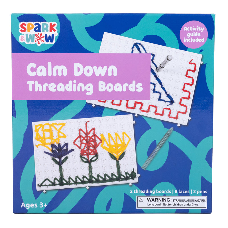
More Info
{"id":8580344905943,"title":"World and United States Coloring, Map Pack Bundle, 36\" x 24\"","handle":"world-and-united-states-coloring-map-pack-bundle-36-x-24","description":"MPN: 006352\u003cbr\u003e\u003cbr\u003eUPC: 749717054578\u003cbr\u003eLooking for a fun activity to reduce stress and learn geography? Well you're in luck, because the cartographers at National Geographic have adapted our World and United States for Kids Maps to black and white outline versions that you can color at home. Color the places you've been, or the ones you dream of visiting, or color the countries and states randomly with pastel or bold colors. Spend a few hours or a few days to color the maps. By the time you're done, you'll know a lot more about the world and the US than when you started.\n\nThe World and United States Coloring Maps include country and state flags that can all be colored along with a bonus full color letter size sheets that has all of the flags that you can use as a reference.\n\nThe World and United States Map Pack Includes:\nWorld Coloring Map\nUnited States Coloring Map\n\nThe map is packaged in a two inch diameter clear plastic tube. The tube has a decorative label showing a thumbnail of the map with dimensions and other pertinent information.\n\nAll proceeds from the purchase of a National Geographic map help support the Society's vital exploration, conservation, scientific research, and education programs.\u003cbr\u003e\u003cbr\u003eKey Features : \u003cbr\u003e\u003cbr\u003ei : National Geographic's cartographers adapted our World and United States for Kids Maps to black and white outline versions that you can color.\u003cbr\u003eii : The World and United States Coloring Maps include country and state flags that can all be colored along with a bonus full color letter size sheets that has all of the flags that you can use as a reference.\u003cbr\u003eiii : The map is packaged in a two inch diameter clear plastic tube. The tube has a decorative label showing a thumbnail of the map with dimensions and other pertinent information.\u003cbr\u003eiv : All proceeds from the purchase of a National Geographic map help support the Society's vital exploration, conservation, scientific research, and education programs.\u003cbr\u003ev : Measures 36\" x 24\"\u003cbr\u003e\u003cbr\u003eSKU: ERSNGMRE01021221B","published_at":"2024-06-14T05:44:06-04:00","created_at":"2024-06-14T05:44:07-04:00","vendor":"National Geographic","type":"Social Studies","tags":["8+ years","Maps \u0026 Map Skills","Multi","Paper","Wall Maps"],"price":2733,"price_min":2733,"price_max":2733,"available":true,"price_varies":false,"compare_at_price":null,"compare_at_price_min":0,"compare_at_price_max":0,"compare_at_price_varies":false,"variants":[{"id":45287748632791,"title":"Default Title","option1":"Default Title","option2":null,"option3":null,"sku":"ERSNGMRE01021221B","requires_shipping":true,"taxable":true,"featured_image":{"id":40908634292439,"product_id":8580344905943,"position":1,"created_at":"2024-06-14T05:44:07-04:00","updated_at":"2024-06-14T05:44:07-04:00","alt":null,"width":1500,"height":1500,"src":"\/\/shop.qualityucanafford.com\/cdn\/shop\/files\/ERSNGMRE01021221B.jpg?v=1718358247","variant_ids":[45287748632791]},"available":true,"name":"World and United States Coloring, Map Pack Bundle, 36\" x 24\"","public_title":null,"options":["Default Title"],"price":2733,"weight":113,"compare_at_price":null,"inventory_quantity":13,"inventory_management":"shopify","inventory_policy":"deny","barcode":"749717054578","featured_media":{"alt":null,"id":33585773019351,"position":1,"preview_image":{"aspect_ratio":1.0,"height":1500,"width":1500,"src":"\/\/shop.qualityucanafford.com\/cdn\/shop\/files\/ERSNGMRE01021221B.jpg?v=1718358247"}},"requires_selling_plan":false,"selling_plan_allocations":[]}],"images":["\/\/shop.qualityucanafford.com\/cdn\/shop\/files\/ERSNGMRE01021221B.jpg?v=1718358247","\/\/shop.qualityucanafford.com\/cdn\/shop\/files\/ERSNGMRE01021221B_2.jpg?v=1718358250","\/\/shop.qualityucanafford.com\/cdn\/shop\/files\/ERSNGMRE01021221B_1.jpg?v=1718358252"],"featured_image":"\/\/shop.qualityucanafford.com\/cdn\/shop\/files\/ERSNGMRE01021221B.jpg?v=1718358247","options":["Title"],"media":[{"alt":null,"id":33585773019351,"position":1,"preview_image":{"aspect_ratio":1.0,"height":1500,"width":1500,"src":"\/\/shop.qualityucanafford.com\/cdn\/shop\/files\/ERSNGMRE01021221B.jpg?v=1718358247"},"aspect_ratio":1.0,"height":1500,"media_type":"image","src":"\/\/shop.qualityucanafford.com\/cdn\/shop\/files\/ERSNGMRE01021221B.jpg?v=1718358247","width":1500},{"alt":null,"id":33585773281495,"position":2,"preview_image":{"aspect_ratio":1.0,"height":1800,"width":1800,"src":"\/\/shop.qualityucanafford.com\/cdn\/shop\/files\/ERSNGMRE01021221B_2.jpg?v=1718358250"},"aspect_ratio":1.0,"height":1800,"media_type":"image","src":"\/\/shop.qualityucanafford.com\/cdn\/shop\/files\/ERSNGMRE01021221B_2.jpg?v=1718358250","width":1800},{"alt":null,"id":33585773641943,"position":3,"preview_image":{"aspect_ratio":1.0,"height":1800,"width":1800,"src":"\/\/shop.qualityucanafford.com\/cdn\/shop\/files\/ERSNGMRE01021221B_1.jpg?v=1718358252"},"aspect_ratio":1.0,"height":1800,"media_type":"image","src":"\/\/shop.qualityucanafford.com\/cdn\/shop\/files\/ERSNGMRE01021221B_1.jpg?v=1718358252","width":1800}],"requires_selling_plan":false,"selling_plan_groups":[],"content":"MPN: 006352\u003cbr\u003e\u003cbr\u003eUPC: 749717054578\u003cbr\u003eLooking for a fun activity to reduce stress and learn geography? Well you're in luck, because the cartographers at National Geographic have adapted our World and United States for Kids Maps to black and white outline versions that you can color at home. Color the places you've been, or the ones you dream of visiting, or color the countries and states randomly with pastel or bold colors. Spend a few hours or a few days to color the maps. By the time you're done, you'll know a lot more about the world and the US than when you started.\n\nThe World and United States Coloring Maps include country and state flags that can all be colored along with a bonus full color letter size sheets that has all of the flags that you can use as a reference.\n\nThe World and United States Map Pack Includes:\nWorld Coloring Map\nUnited States Coloring Map\n\nThe map is packaged in a two inch diameter clear plastic tube. The tube has a decorative label showing a thumbnail of the map with dimensions and other pertinent information.\n\nAll proceeds from the purchase of a National Geographic map help support the Society's vital exploration, conservation, scientific research, and education programs.\u003cbr\u003e\u003cbr\u003eKey Features : \u003cbr\u003e\u003cbr\u003ei : National Geographic's cartographers adapted our World and United States for Kids Maps to black and white outline versions that you can color.\u003cbr\u003eii : The World and United States Coloring Maps include country and state flags that can all be colored along with a bonus full color letter size sheets that has all of the flags that you can use as a reference.\u003cbr\u003eiii : The map is packaged in a two inch diameter clear plastic tube. The tube has a decorative label showing a thumbnail of the map with dimensions and other pertinent information.\u003cbr\u003eiv : All proceeds from the purchase of a National Geographic map help support the Society's vital exploration, conservation, scientific research, and education programs.\u003cbr\u003ev : Measures 36\" x 24\"\u003cbr\u003e\u003cbr\u003eSKU: ERSNGMRE01021221B"}
World and United States Coloring, Map Pack Bundle, 36" x 24"

World and United States Coloring, Map Pack Bundle, 36" x 24"

$27.33

MPN: 006352UPC: 749717054578Looking for a fun activity to reduce stress and learn geography? Well you're in luck, because the cartographers at National Geographic have adapted our World and United States for Kids Maps to black and white outline versions that you can color at home. Color the places you've been, or the ones you dream of visiting, ...


More Info
{"id":8580344742103,"title":"United States Classic Map, Laminated, 43.5\" x 30.5\"","handle":"united-states-classic-map-laminated-43-5-x-30-5","description":"MPN: 006352\u003cbr\u003e\u003cbr\u003eUPC: 749717004443\u003cbr\u003eExpertly researched and designed, National Geographic's United States wall map is the standard by which other reference maps of the U.S. are measured. Signature Classic styling with bright, easy to read color palette with blue water and colorful state borders. All 50 states with insets for Hawaiian Islands and Alaska plus inset showing relative size of Alaska. Clearly defined state and country boundaries, cities, islands, national parks, and physical features. Thousands of place names carefully and artfully placed to maintain legibility in heavily populated areas. Background shows mountain ranges and valleys in subtle shaded relief with mountain ranges labeled. Major water bodies including rivers, lakes, gulfs, bays, straits, and ocean bathymetry. Transportation routes including interstate highways, major state routes, airports, waterways, canals, and ferries. The map is encapsulated in heavy-duty 1.6 mil laminate which makes the paper much more durable and resistant to the swelling and shrinking caused by changes in humidity. Laminated maps can be framed without the need for glass, so the frames can be much lighter and less expensive.\u003cbr\u003e\u003cbr\u003eKey Features : \u003cbr\u003e\u003cbr\u003ei : National Geographic's United States wall map is the standard by which other reference maps of the U.S. are measured\u003cbr\u003eii : Signature Classic styling with bright, easy to read color palette with blue water and colorful state borders. All 50 states with insets for Hawaiian Islands and Alaska plus inset showing relative size of Alaska\u003cbr\u003eiii : All 50 states with insets for Hawaiian Islands and Alaska plus inset showing relative size of Alaska.\u003cbr\u003eiv : The map is encapsulated in heavy-duty 1.6 mil laminate which makes the paper much more durable and resistant to the swelling and shrinking caused by changes in humidity.\u003cbr\u003ev : Measures 43.5\" x 30.5\"\u003cbr\u003e\u003cbr\u003eSKU: ERSNGMRE00620411","published_at":"2024-06-14T05:43:59-04:00","created_at":"2024-06-14T05:44:00-04:00","vendor":"National Geographic","type":"Social Studies","tags":["8+ years","Maps \u0026 Map Skills","Multi","Paper","Plastic","Wall Maps"],"price":4103,"price_min":4103,"price_max":4103,"available":true,"price_varies":false,"compare_at_price":null,"compare_at_price_min":0,"compare_at_price_max":0,"compare_at_price_varies":false,"variants":[{"id":45287748468951,"title":"Default Title","option1":"Default Title","option2":null,"option3":null,"sku":"ERSNGMRE00620411","requires_shipping":true,"taxable":true,"featured_image":{"id":40908633702615,"product_id":8580344742103,"position":1,"created_at":"2024-06-14T05:44:00-04:00","updated_at":"2024-06-14T05:44:00-04:00","alt":null,"width":1800,"height":1800,"src":"\/\/shop.qualityucanafford.com\/cdn\/shop\/files\/ERSNGMRE00620411.jpg?v=1718358240","variant_ids":[45287748468951]},"available":true,"name":"United States Classic Map, Laminated, 43.5\" x 30.5\"","public_title":null,"options":["Default Title"],"price":4103,"weight":172,"compare_at_price":null,"inventory_quantity":11,"inventory_management":"shopify","inventory_policy":"deny","barcode":"749717004443","featured_media":{"alt":null,"id":33585772265687,"position":1,"preview_image":{"aspect_ratio":1.0,"height":1800,"width":1800,"src":"\/\/shop.qualityucanafford.com\/cdn\/shop\/files\/ERSNGMRE00620411.jpg?v=1718358240"}},"requires_selling_plan":false,"selling_plan_allocations":[]}],"images":["\/\/shop.qualityucanafford.com\/cdn\/shop\/files\/ERSNGMRE00620411.jpg?v=1718358240","\/\/shop.qualityucanafford.com\/cdn\/shop\/files\/ERSNGMRE00620411_1.jpg?v=1718358243","\/\/shop.qualityucanafford.com\/cdn\/shop\/files\/ERSNGMRE00620411_2.jpg?v=1718358245"],"featured_image":"\/\/shop.qualityucanafford.com\/cdn\/shop\/files\/ERSNGMRE00620411.jpg?v=1718358240","options":["Title"],"media":[{"alt":null,"id":33585772265687,"position":1,"preview_image":{"aspect_ratio":1.0,"height":1800,"width":1800,"src":"\/\/shop.qualityucanafford.com\/cdn\/shop\/files\/ERSNGMRE00620411.jpg?v=1718358240"},"aspect_ratio":1.0,"height":1800,"media_type":"image","src":"\/\/shop.qualityucanafford.com\/cdn\/shop\/files\/ERSNGMRE00620411.jpg?v=1718358240","width":1800},{"alt":null,"id":33585772560599,"position":2,"preview_image":{"aspect_ratio":1.0,"height":1800,"width":1800,"src":"\/\/shop.qualityucanafford.com\/cdn\/shop\/files\/ERSNGMRE00620411_1.jpg?v=1718358243"},"aspect_ratio":1.0,"height":1800,"media_type":"image","src":"\/\/shop.qualityucanafford.com\/cdn\/shop\/files\/ERSNGMRE00620411_1.jpg?v=1718358243","width":1800},{"alt":null,"id":33585772757207,"position":3,"preview_image":{"aspect_ratio":1.0,"height":1800,"width":1800,"src":"\/\/shop.qualityucanafford.com\/cdn\/shop\/files\/ERSNGMRE00620411_2.jpg?v=1718358245"},"aspect_ratio":1.0,"height":1800,"media_type":"image","src":"\/\/shop.qualityucanafford.com\/cdn\/shop\/files\/ERSNGMRE00620411_2.jpg?v=1718358245","width":1800}],"requires_selling_plan":false,"selling_plan_groups":[],"content":"MPN: 006352\u003cbr\u003e\u003cbr\u003eUPC: 749717004443\u003cbr\u003eExpertly researched and designed, National Geographic's United States wall map is the standard by which other reference maps of the U.S. are measured. Signature Classic styling with bright, easy to read color palette with blue water and colorful state borders. All 50 states with insets for Hawaiian Islands and Alaska plus inset showing relative size of Alaska. Clearly defined state and country boundaries, cities, islands, national parks, and physical features. Thousands of place names carefully and artfully placed to maintain legibility in heavily populated areas. Background shows mountain ranges and valleys in subtle shaded relief with mountain ranges labeled. Major water bodies including rivers, lakes, gulfs, bays, straits, and ocean bathymetry. Transportation routes including interstate highways, major state routes, airports, waterways, canals, and ferries. The map is encapsulated in heavy-duty 1.6 mil laminate which makes the paper much more durable and resistant to the swelling and shrinking caused by changes in humidity. Laminated maps can be framed without the need for glass, so the frames can be much lighter and less expensive.\u003cbr\u003e\u003cbr\u003eKey Features : \u003cbr\u003e\u003cbr\u003ei : National Geographic's United States wall map is the standard by which other reference maps of the U.S. are measured\u003cbr\u003eii : Signature Classic styling with bright, easy to read color palette with blue water and colorful state borders. All 50 states with insets for Hawaiian Islands and Alaska plus inset showing relative size of Alaska\u003cbr\u003eiii : All 50 states with insets for Hawaiian Islands and Alaska plus inset showing relative size of Alaska.\u003cbr\u003eiv : The map is encapsulated in heavy-duty 1.6 mil laminate which makes the paper much more durable and resistant to the swelling and shrinking caused by changes in humidity.\u003cbr\u003ev : Measures 43.5\" x 30.5\"\u003cbr\u003e\u003cbr\u003eSKU: ERSNGMRE00620411"}
United States Classic Map, Laminated, 43.5" x 30.5"

United States Classic Map, Laminated, 43.5" x 30.5"

$41.03

MPN: 006352UPC: 749717004443Expertly researched and designed, National Geographic's United States wall map is the standard by which other reference maps of the U.S. are measured. Signature Classic styling with bright, easy to read color palette with blue water and colorful state borders. All 50 states with insets for Hawaiian Islands and Alaska ...
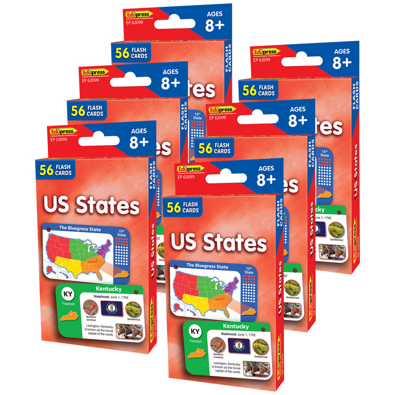

More Info
{"id":8580344611031,"title":"World and United States Classic, Poster Size, Map Pack Bundle, 36\" x 24\"","handle":"world-and-united-states-classic-poster-size-map-pack-bundle-36-x-24","description":"MPN: 006352\u003cbr\u003e\u003cbr\u003eUPC: 749717054615\u003cbr\u003eNational Geographic's World and United States maps are the standard by which all other reference maps are measured. The World and United States maps are meticulously researched and adhere to National Geographic's convention of making independent, apolitical decisions based on extensive research using multiple authoritative source.\n\nThe signature Classic style maps use a bright, easy to read color palette featuring blue oceans and stunning shaded relief that has been featured on National Geographic wall maps for over 75 years. The World Map is drawn in the Winkel Tripel projection, distortions are minimized and unlike many other World maps, Greenland is show the same size as Argentina and not as the size of all of South America.\n\nThousands of place names are carefully and artistically placed on the maps to maintain legibility even in the heavily populated areas of Europe, Asia and the Middle East. Details include clearly defined international boundaries, cities, physical features, rivers, and ocean floor features. Corner inset maps feature vegetation and land use, and population density as well as the north and south polar regions.\n\nPoster sized maps make a perfect addition to any sized space. They are specially designed to maximize content in a smaller footprint than standard wall maps and fit precisely into precut poster sized frames which makes finishing and hanging them a breeze.\n\nThe World and United States Classic Map Pack Includes:\nWorld Classic Map [Poster Size]\nUnited States Classic Map [Poster Size]\n\nThese maps are packaged in a two inch diameter clear plastic tube. The tube has a decorative label showing a thumbnail of the maps with dimensions and other pertinent information.\n\nAll proceeds from the purchase of a National Geographic map help support the Society's vital exploration, conservation, scientific research, and education programs.\u003cbr\u003e\u003cbr\u003eKey Features : \u003cbr\u003e\u003cbr\u003ei : National Geographic's World and United States maps are the standard by which all other reference maps are measured.\u003cbr\u003eii : The signature Classic style maps use a bright, easy to read color palette featuring blue oceans and stunning shaded relief that has been featured on National Geographic wall maps for over 75 years.\u003cbr\u003eiii : Poster sized maps make a perfect addition to any sized space. They are specially designed to maximize content in a smaller footprint than standard wall maps and fit precisely into precut poster sized frames which makes finishing and hanging them a breeze\u003cbr\u003eiv : The World and United States Classic Map Pack Includes: World Classic Map [Poster Size] and United States Classic Map [Poster Size]\u003cbr\u003ev : Measures 36\" x 24\"\u003cbr\u003e\u003cbr\u003eSKU: ERSNGMRE01021231B","published_at":"2024-10-28T06:36:48-04:00","created_at":"2024-06-14T05:43:53-04:00","vendor":"National Geographic","type":"Social Studies","tags":["8+ years","Maps \u0026 Map Skills","Multi","Paper","Wall Maps"],"price":4103,"price_min":4103,"price_max":4103,"available":true,"price_varies":false,"compare_at_price":null,"compare_at_price_min":0,"compare_at_price_max":0,"compare_at_price_varies":false,"variants":[{"id":45287748370647,"title":"Default Title","option1":"Default Title","option2":null,"option3":null,"sku":"ERSNGMRE01021231B","requires_shipping":true,"taxable":true,"featured_image":{"id":40908633178327,"product_id":8580344611031,"position":1,"created_at":"2024-06-14T05:43:53-04:00","updated_at":"2024-06-14T05:43:53-04:00","alt":null,"width":1800,"height":1800,"src":"\/\/shop.qualityucanafford.com\/cdn\/shop\/files\/ERSNGMRE01021231B.jpg?v=1718358233","variant_ids":[45287748370647]},"available":true,"name":"World and United States Classic, Poster Size, Map Pack Bundle, 36\" x 24\"","public_title":null,"options":["Default Title"],"price":4103,"weight":113,"compare_at_price":null,"inventory_quantity":15,"inventory_management":"shopify","inventory_policy":"deny","barcode":"749717054615","featured_media":{"alt":null,"id":33585771479255,"position":1,"preview_image":{"aspect_ratio":1.0,"height":1800,"width":1800,"src":"\/\/shop.qualityucanafford.com\/cdn\/shop\/files\/ERSNGMRE01021231B.jpg?v=1718358233"}},"requires_selling_plan":false,"selling_plan_allocations":[]}],"images":["\/\/shop.qualityucanafford.com\/cdn\/shop\/files\/ERSNGMRE01021231B.jpg?v=1718358233","\/\/shop.qualityucanafford.com\/cdn\/shop\/files\/ERSNGMRE01021231B_1.jpg?v=1718358236","\/\/shop.qualityucanafford.com\/cdn\/shop\/files\/ERSNGMRE01021231B_2.jpg?v=1718358238"],"featured_image":"\/\/shop.qualityucanafford.com\/cdn\/shop\/files\/ERSNGMRE01021231B.jpg?v=1718358233","options":["Title"],"media":[{"alt":null,"id":33585771479255,"position":1,"preview_image":{"aspect_ratio":1.0,"height":1800,"width":1800,"src":"\/\/shop.qualityucanafford.com\/cdn\/shop\/files\/ERSNGMRE01021231B.jpg?v=1718358233"},"aspect_ratio":1.0,"height":1800,"media_type":"image","src":"\/\/shop.qualityucanafford.com\/cdn\/shop\/files\/ERSNGMRE01021231B.jpg?v=1718358233","width":1800},{"alt":null,"id":33585771774167,"position":2,"preview_image":{"aspect_ratio":1.0,"height":1800,"width":1800,"src":"\/\/shop.qualityucanafford.com\/cdn\/shop\/files\/ERSNGMRE01021231B_1.jpg?v=1718358236"},"aspect_ratio":1.0,"height":1800,"media_type":"image","src":"\/\/shop.qualityucanafford.com\/cdn\/shop\/files\/ERSNGMRE01021231B_1.jpg?v=1718358236","width":1800},{"alt":null,"id":33585771970775,"position":3,"preview_image":{"aspect_ratio":1.0,"height":1800,"width":1800,"src":"\/\/shop.qualityucanafford.com\/cdn\/shop\/files\/ERSNGMRE01021231B_2.jpg?v=1718358238"},"aspect_ratio":1.0,"height":1800,"media_type":"image","src":"\/\/shop.qualityucanafford.com\/cdn\/shop\/files\/ERSNGMRE01021231B_2.jpg?v=1718358238","width":1800}],"requires_selling_plan":false,"selling_plan_groups":[],"content":"MPN: 006352\u003cbr\u003e\u003cbr\u003eUPC: 749717054615\u003cbr\u003eNational Geographic's World and United States maps are the standard by which all other reference maps are measured. The World and United States maps are meticulously researched and adhere to National Geographic's convention of making independent, apolitical decisions based on extensive research using multiple authoritative source.\n\nThe signature Classic style maps use a bright, easy to read color palette featuring blue oceans and stunning shaded relief that has been featured on National Geographic wall maps for over 75 years. The World Map is drawn in the Winkel Tripel projection, distortions are minimized and unlike many other World maps, Greenland is show the same size as Argentina and not as the size of all of South America.\n\nThousands of place names are carefully and artistically placed on the maps to maintain legibility even in the heavily populated areas of Europe, Asia and the Middle East. Details include clearly defined international boundaries, cities, physical features, rivers, and ocean floor features. Corner inset maps feature vegetation and land use, and population density as well as the north and south polar regions.\n\nPoster sized maps make a perfect addition to any sized space. They are specially designed to maximize content in a smaller footprint than standard wall maps and fit precisely into precut poster sized frames which makes finishing and hanging them a breeze.\n\nThe World and United States Classic Map Pack Includes:\nWorld Classic Map [Poster Size]\nUnited States Classic Map [Poster Size]\n\nThese maps are packaged in a two inch diameter clear plastic tube. The tube has a decorative label showing a thumbnail of the maps with dimensions and other pertinent information.\n\nAll proceeds from the purchase of a National Geographic map help support the Society's vital exploration, conservation, scientific research, and education programs.\u003cbr\u003e\u003cbr\u003eKey Features : \u003cbr\u003e\u003cbr\u003ei : National Geographic's World and United States maps are the standard by which all other reference maps are measured.\u003cbr\u003eii : The signature Classic style maps use a bright, easy to read color palette featuring blue oceans and stunning shaded relief that has been featured on National Geographic wall maps for over 75 years.\u003cbr\u003eiii : Poster sized maps make a perfect addition to any sized space. They are specially designed to maximize content in a smaller footprint than standard wall maps and fit precisely into precut poster sized frames which makes finishing and hanging them a breeze\u003cbr\u003eiv : The World and United States Classic Map Pack Includes: World Classic Map [Poster Size] and United States Classic Map [Poster Size]\u003cbr\u003ev : Measures 36\" x 24\"\u003cbr\u003e\u003cbr\u003eSKU: ERSNGMRE01021231B"}
World and United States Classic, Poster Size, Map Pack Bundle, 36" x 24"

World and United States Classic, Poster Size, Map Pack Bundle, 36" x 24"

$41.03

MPN: 006352UPC: 749717054615National Geographic's World and United States maps are the standard by which all other reference maps are measured. The World and United States maps are meticulously researched and adhere to National Geographic's convention of making independent, apolitical decisions based on extensive research using multiple authorit...


More Info
{"id":8580344512727,"title":"World and United States for Kids, Poster Size, Map Pack Bundle, 36\" x 24\"","handle":"world-and-united-states-for-kids-poster-size-map-pack-bundle-36-x-24","description":"MPN: 006352\u003cbr\u003e\u003cbr\u003eUPC: 749717054639\u003cbr\u003eNational Geographic's The World for Kids and United State for Kids wall maps are enticing and engaging world and United States maps perfect for classroom, home or library. Recommended by geography educators for ages 7–12, these maps feature an optimized map design for readability and easy, intuitive learning. All 195 independent countries and their official, colorful flags are represented and arranged in alphabetical order for ease-of-use.\n\nExpertly researched, The World for Kids and United States maps are essential reference tools for today's interesting geographical world. The World Map is drawn in the Winkel Tripel projection, distortions are minimized and unlike many other World maps, Greenland is show the same size as Argentina and not as the size of all of South America..\n\nThe World and United States for Kids Map Pack Includes:\nWorld Classic Map [Poster Size]\nUnited States Classic Map [Poster Size]\n\nThese maps are packaged in a two inch diameter clear plastic tube. The tube has a decorative label showing a thumbnail of the maps with dimensions and other pertinent information.\n\nAll proceeds from the purchase of a National Geographic map help support the Society's vital exploration, conservation, scientific research, and education programs.\u003cbr\u003e\u003cbr\u003eKey Features : \u003cbr\u003e\u003cbr\u003ei : National Geographic's The World for Kids and United State for Kids wall maps are enticing and engaging world and United States maps perfect for classroom, home or library.\u003cbr\u003eii : Recommended by geography educators for ages 7–12, these maps feature an optimized map design for readability and easy, intuitive learning.\u003cbr\u003eiii : Expertly researched, The World for Kids and United States maps are essential reference tools for today's interesting geographical world.\u003cbr\u003eiv : All proceeds from the purchase of a National Geographic map help support the Society's vital exploration, conservation, scientific research, and education programs.\u003cbr\u003ev : Measures 36\" x 24\"\u003cbr\u003e\u003cbr\u003eSKU: ERSNGMRE01021233B","published_at":"2024-06-14T05:43:45-04:00","created_at":"2024-06-14T05:43:46-04:00","vendor":"National Geographic","type":"Social Studies","tags":["7-12 years","Maps \u0026 Map Skills","Multi","Paper","Wall Maps"],"price":4103,"price_min":4103,"price_max":4103,"available":true,"price_varies":false,"compare_at_price":null,"compare_at_price_min":0,"compare_at_price_max":0,"compare_at_price_varies":false,"variants":[{"id":45287748239575,"title":"Default Title","option1":"Default Title","option2":null,"option3":null,"sku":"ERSNGMRE01021233B","requires_shipping":true,"taxable":true,"featured_image":{"id":40908632490199,"product_id":8580344512727,"position":1,"created_at":"2024-06-14T05:43:46-04:00","updated_at":"2024-06-14T05:43:46-04:00","alt":null,"width":1500,"height":1500,"src":"\/\/shop.qualityucanafford.com\/cdn\/shop\/files\/ERSNGMRE01021233B.jpg?v=1718358226","variant_ids":[45287748239575]},"available":true,"name":"World and United States for Kids, Poster Size, Map Pack Bundle, 36\" x 24\"","public_title":null,"options":["Default Title"],"price":4103,"weight":113,"compare_at_price":null,"inventory_quantity":16,"inventory_management":"shopify","inventory_policy":"deny","barcode":"749717054639","featured_media":{"alt":null,"id":33585770627287,"position":1,"preview_image":{"aspect_ratio":1.0,"height":1500,"width":1500,"src":"\/\/shop.qualityucanafford.com\/cdn\/shop\/files\/ERSNGMRE01021233B.jpg?v=1718358226"}},"requires_selling_plan":false,"selling_plan_allocations":[]}],"images":["\/\/shop.qualityucanafford.com\/cdn\/shop\/files\/ERSNGMRE01021233B.jpg?v=1718358226","\/\/shop.qualityucanafford.com\/cdn\/shop\/files\/ERSNGMRE01021233B_2.jpg?v=1718358229","\/\/shop.qualityucanafford.com\/cdn\/shop\/files\/ERSNGMRE01021233B_1.jpg?v=1718358231"],"featured_image":"\/\/shop.qualityucanafford.com\/cdn\/shop\/files\/ERSNGMRE01021233B.jpg?v=1718358226","options":["Title"],"media":[{"alt":null,"id":33585770627287,"position":1,"preview_image":{"aspect_ratio":1.0,"height":1500,"width":1500,"src":"\/\/shop.qualityucanafford.com\/cdn\/shop\/files\/ERSNGMRE01021233B.jpg?v=1718358226"},"aspect_ratio":1.0,"height":1500,"media_type":"image","src":"\/\/shop.qualityucanafford.com\/cdn\/shop\/files\/ERSNGMRE01021233B.jpg?v=1718358226","width":1500},{"alt":null,"id":33585770856663,"position":2,"preview_image":{"aspect_ratio":1.0,"height":1800,"width":1800,"src":"\/\/shop.qualityucanafford.com\/cdn\/shop\/files\/ERSNGMRE01021233B_2.jpg?v=1718358229"},"aspect_ratio":1.0,"height":1800,"media_type":"image","src":"\/\/shop.qualityucanafford.com\/cdn\/shop\/files\/ERSNGMRE01021233B_2.jpg?v=1718358229","width":1800},{"alt":null,"id":33585771086039,"position":3,"preview_image":{"aspect_ratio":1.0,"height":1500,"width":1500,"src":"\/\/shop.qualityucanafford.com\/cdn\/shop\/files\/ERSNGMRE01021233B_1.jpg?v=1718358231"},"aspect_ratio":1.0,"height":1500,"media_type":"image","src":"\/\/shop.qualityucanafford.com\/cdn\/shop\/files\/ERSNGMRE01021233B_1.jpg?v=1718358231","width":1500}],"requires_selling_plan":false,"selling_plan_groups":[],"content":"MPN: 006352\u003cbr\u003e\u003cbr\u003eUPC: 749717054639\u003cbr\u003eNational Geographic's The World for Kids and United State for Kids wall maps are enticing and engaging world and United States maps perfect for classroom, home or library. Recommended by geography educators for ages 7–12, these maps feature an optimized map design for readability and easy, intuitive learning. All 195 independent countries and their official, colorful flags are represented and arranged in alphabetical order for ease-of-use.\n\nExpertly researched, The World for Kids and United States maps are essential reference tools for today's interesting geographical world. The World Map is drawn in the Winkel Tripel projection, distortions are minimized and unlike many other World maps, Greenland is show the same size as Argentina and not as the size of all of South America..\n\nThe World and United States for Kids Map Pack Includes:\nWorld Classic Map [Poster Size]\nUnited States Classic Map [Poster Size]\n\nThese maps are packaged in a two inch diameter clear plastic tube. The tube has a decorative label showing a thumbnail of the maps with dimensions and other pertinent information.\n\nAll proceeds from the purchase of a National Geographic map help support the Society's vital exploration, conservation, scientific research, and education programs.\u003cbr\u003e\u003cbr\u003eKey Features : \u003cbr\u003e\u003cbr\u003ei : National Geographic's The World for Kids and United State for Kids wall maps are enticing and engaging world and United States maps perfect for classroom, home or library.\u003cbr\u003eii : Recommended by geography educators for ages 7–12, these maps feature an optimized map design for readability and easy, intuitive learning.\u003cbr\u003eiii : Expertly researched, The World for Kids and United States maps are essential reference tools for today's interesting geographical world.\u003cbr\u003eiv : All proceeds from the purchase of a National Geographic map help support the Society's vital exploration, conservation, scientific research, and education programs.\u003cbr\u003ev : Measures 36\" x 24\"\u003cbr\u003e\u003cbr\u003eSKU: ERSNGMRE01021233B"}
World and United States for Kids, Poster Size, Map Pack Bundle, 36" x 24"

World and United States for Kids, Poster Size, Map Pack Bundle, 36" x 24"

$41.03

MPN: 006352UPC: 749717054639National Geographic's The World for Kids and United State for Kids wall maps are enticing and engaging world and United States maps perfect for classroom, home or library. Recommended by geography educators for ages 7–12, these maps feature an optimized map design for readability and easy, intuitive learning. All 195 ...


More Info
{"id":8580344414423,"title":"World and United States Executive, Poster Size, Map Pack Bundle, 36\" x 24\"","handle":"world-and-united-states-executive-poster-size-map-pack-bundle-36-x-24","description":"MPN: 006352\u003cbr\u003e\u003cbr\u003eUPC: 749717054622\u003cbr\u003eNational Geographic's World and United States maps are the standard by which all other reference maps are measured. The World and United States maps are meticulously researched and adheres to National Geographic's convention of making independent, apolitical decisions based on extensive research using multiple authoritative source. Thousands of place names are carefully and artistically placed on the maps to maintain legibility even in the heavily populated areas of Europe, Asia and the Middle East. Details include clearly defined international boundaries, cities, physical features, rivers, and ocean floor features. Corner inset maps feature vegetation and land use, and population density as well as the north and south polar regions.\n\nPoster sized maps make a perfect addition to any sized space. They are specially designed to maximize content in a smaller footprint than standard wall maps and fit precisely into precut poster sized frames which makes finishing and hanging them a breeze.\n\nThe World and United States Executive Map Pack Includes:\nWorld Executive Map [Poster Size]\nUnited States Executive Map [Poster Size]\n\nThese maps are packaged in a two inch diameter clear plastic tube. The tube has a decorative label showing a thumbnail of the maps with dimensions and other pertinent information.\n\nAll proceeds from the purchase of a National Geographic map help support the Society's vital exploration, conservation, scientific research, and education programs.\u003cbr\u003e\u003cbr\u003eKey Features : \u003cbr\u003e\u003cbr\u003ei : National Geographic's World and United States maps are the standard by which all other reference maps are measured.\u003cbr\u003eii : Antique-style \"executive\" color palette\u003cbr\u003eiii : Poster sized maps make a perfect addition to any sized space. They are specially designed to maximize content in a smaller footprint than standard wall maps and fit precisely into precut poster sized frames which makes finishing and hanging them a breeze.\u003cbr\u003eiv : These maps are packaged in a two inch diameter clear plastic tube. The tube has a decorative label showing a thumbnail of the maps with dimensions and other pertinent information.\u003cbr\u003ev : Measures 36\" x 24\"\u003cbr\u003e\u003cbr\u003eSKU: ERSNGMRE01021232B","published_at":"2024-06-14T05:43:38-04:00","created_at":"2024-06-14T05:43:40-04:00","vendor":"National Geographic","type":"Social Studies","tags":["14+ years","Maps \u0026 Map Skills","Multi","Paper","Wall Maps"],"price":4103,"price_min":4103,"price_max":4103,"available":true,"price_varies":false,"compare_at_price":null,"compare_at_price_min":0,"compare_at_price_max":0,"compare_at_price_varies":false,"variants":[{"id":45287748141271,"title":"Default Title","option1":"Default Title","option2":null,"option3":null,"sku":"ERSNGMRE01021232B","requires_shipping":true,"taxable":true,"featured_image":{"id":40908631900375,"product_id":8580344414423,"position":1,"created_at":"2024-06-14T05:43:40-04:00","updated_at":"2024-06-14T05:43:40-04:00","alt":null,"width":1500,"height":1500,"src":"\/\/shop.qualityucanafford.com\/cdn\/shop\/files\/ERSNGMRE01021232B.jpg?v=1718358220","variant_ids":[45287748141271]},"available":true,"name":"World and United States Executive, Poster Size, Map Pack Bundle, 36\" x 24\"","public_title":null,"options":["Default Title"],"price":4103,"weight":113,"compare_at_price":null,"inventory_quantity":12,"inventory_management":"shopify","inventory_policy":"deny","barcode":"749717054622","featured_media":{"alt":null,"id":33585769742551,"position":1,"preview_image":{"aspect_ratio":1.0,"height":1500,"width":1500,"src":"\/\/shop.qualityucanafford.com\/cdn\/shop\/files\/ERSNGMRE01021232B.jpg?v=1718358220"}},"requires_selling_plan":false,"selling_plan_allocations":[]}],"images":["\/\/shop.qualityucanafford.com\/cdn\/shop\/files\/ERSNGMRE01021232B.jpg?v=1718358220","\/\/shop.qualityucanafford.com\/cdn\/shop\/files\/ERSNGMRE01021232B_2.jpg?v=1718358223","\/\/shop.qualityucanafford.com\/cdn\/shop\/files\/ERSNGMRE01021232B_1.jpg?v=1718358225"],"featured_image":"\/\/shop.qualityucanafford.com\/cdn\/shop\/files\/ERSNGMRE01021232B.jpg?v=1718358220","options":["Title"],"media":[{"alt":null,"id":33585769742551,"position":1,"preview_image":{"aspect_ratio":1.0,"height":1500,"width":1500,"src":"\/\/shop.qualityucanafford.com\/cdn\/shop\/files\/ERSNGMRE01021232B.jpg?v=1718358220"},"aspect_ratio":1.0,"height":1500,"media_type":"image","src":"\/\/shop.qualityucanafford.com\/cdn\/shop\/files\/ERSNGMRE01021232B.jpg?v=1718358220","width":1500},{"alt":null,"id":33585770135767,"position":2,"preview_image":{"aspect_ratio":1.0,"height":1800,"width":1800,"src":"\/\/shop.qualityucanafford.com\/cdn\/shop\/files\/ERSNGMRE01021232B_2.jpg?v=1718358223"},"aspect_ratio":1.0,"height":1800,"media_type":"image","src":"\/\/shop.qualityucanafford.com\/cdn\/shop\/files\/ERSNGMRE01021232B_2.jpg?v=1718358223","width":1800},{"alt":null,"id":33585770463447,"position":3,"preview_image":{"aspect_ratio":1.0,"height":1800,"width":1800,"src":"\/\/shop.qualityucanafford.com\/cdn\/shop\/files\/ERSNGMRE01021232B_1.jpg?v=1718358225"},"aspect_ratio":1.0,"height":1800,"media_type":"image","src":"\/\/shop.qualityucanafford.com\/cdn\/shop\/files\/ERSNGMRE01021232B_1.jpg?v=1718358225","width":1800}],"requires_selling_plan":false,"selling_plan_groups":[],"content":"MPN: 006352\u003cbr\u003e\u003cbr\u003eUPC: 749717054622\u003cbr\u003eNational Geographic's World and United States maps are the standard by which all other reference maps are measured. The World and United States maps are meticulously researched and adheres to National Geographic's convention of making independent, apolitical decisions based on extensive research using multiple authoritative source. Thousands of place names are carefully and artistically placed on the maps to maintain legibility even in the heavily populated areas of Europe, Asia and the Middle East. Details include clearly defined international boundaries, cities, physical features, rivers, and ocean floor features. Corner inset maps feature vegetation and land use, and population density as well as the north and south polar regions.\n\nPoster sized maps make a perfect addition to any sized space. They are specially designed to maximize content in a smaller footprint than standard wall maps and fit precisely into precut poster sized frames which makes finishing and hanging them a breeze.\n\nThe World and United States Executive Map Pack Includes:\nWorld Executive Map [Poster Size]\nUnited States Executive Map [Poster Size]\n\nThese maps are packaged in a two inch diameter clear plastic tube. The tube has a decorative label showing a thumbnail of the maps with dimensions and other pertinent information.\n\nAll proceeds from the purchase of a National Geographic map help support the Society's vital exploration, conservation, scientific research, and education programs.\u003cbr\u003e\u003cbr\u003eKey Features : \u003cbr\u003e\u003cbr\u003ei : National Geographic's World and United States maps are the standard by which all other reference maps are measured.\u003cbr\u003eii : Antique-style \"executive\" color palette\u003cbr\u003eiii : Poster sized maps make a perfect addition to any sized space. They are specially designed to maximize content in a smaller footprint than standard wall maps and fit precisely into precut poster sized frames which makes finishing and hanging them a breeze.\u003cbr\u003eiv : These maps are packaged in a two inch diameter clear plastic tube. The tube has a decorative label showing a thumbnail of the maps with dimensions and other pertinent information.\u003cbr\u003ev : Measures 36\" x 24\"\u003cbr\u003e\u003cbr\u003eSKU: ERSNGMRE01021232B"}
World and United States Executive, Poster Size, Map Pack Bundle, 36" x 24"

World and United States Executive, Poster Size, Map Pack Bundle, 36" x 24"

$41.03

MPN: 006352UPC: 749717054622National Geographic's World and United States maps are the standard by which all other reference maps are measured. The World and United States maps are meticulously researched and adheres to National Geographic's convention of making independent, apolitical decisions based on extensive research using multiple authori...


More Info
{"id":8580253024471,"title":"Continental Divide Trail Map, Laminated, 18\" x 48\"","handle":"continental-divide-trail-map-laminated-18-x-48","description":"MPN: 006352\u003cbr\u003e\u003cbr\u003eUPC: 749717008410\u003cbr\u003eExpertly researched and designed, National Geographic's map of the Continental Divide Trail is ideal for fans and hikers of this magnificent National Scenic Trail. It makes a great planning tool or as reference to track progress on the 3,100 plus mile length. This beautiful map shows the entire length of the trail from Mexico to Canada through New Mexico, Colorado, Wyoming, Idaho, and Montana. A unique elevation profile highlights the trail's peaks and valleys, and an informative mileage chart shows the distance between key locations. Also highlighted on this map are passes, peaks, national forests, national parks, state parks, and Indian reservations. Additional points of interest include lodges and campgrounds near the trail.\n\nThe map is encapsulated in heavy-duty 1.6 mil laminate which makes the paper much more durable and resistant to the swelling and shrinking caused by changes in humidity. Laminated maps can be framed without the need for glass, so the frames can be much lighter and less expensive.\u003cbr\u003e\u003cbr\u003eKey Features : \u003cbr\u003e\u003cbr\u003ei : National Geographic Continental Divide Trail Wall Map, expertly researched and designed, National Geographic's map of the Continental Divide Trail is ideal for fans and hikers of this magnificent National Scenic Trail.\u003cbr\u003eii : It makes a great planning tool or as reference to track progress on the 3,100 plus mile length.\u003cbr\u003eiii : A unique elevation profile highlights the trail's peaks and valleys, and an informative mileage chart shows the distance between key locations.\u003cbr\u003eiv : The map is encapsulated in heavy-duty 1.6 mil laminate which makes the paper much more durable and resistant to the swelling and shrinking caused by changes in humidity.\u003cbr\u003ev : Measures 18\" x 48\"\u003cbr\u003e\u003cbr\u003eSKU: ERSNGMRE01021203","published_at":"2024-06-14T04:15:07-04:00","created_at":"2024-06-14T04:15:07-04:00","vendor":"National Geographic","type":"Social Studies","tags":["14+ years","Maps \u0026 Map Skills","Multi","Paper","Plastic","Wall Maps"],"price":4103,"price_min":4103,"price_max":4103,"available":true,"price_varies":false,"compare_at_price":null,"compare_at_price_min":0,"compare_at_price_max":0,"compare_at_price_varies":false,"variants":[{"id":45287552123095,"title":"Default Title","option1":"Default Title","option2":null,"option3":null,"sku":"ERSNGMRE01021203","requires_shipping":true,"taxable":true,"featured_image":null,"available":true,"name":"Continental Divide Trail Map, Laminated, 18\" x 48\"","public_title":null,"options":["Default Title"],"price":4103,"weight":86,"compare_at_price":null,"inventory_quantity":16,"inventory_management":"shopify","inventory_policy":"deny","barcode":"749717008410","requires_selling_plan":false,"selling_plan_allocations":[]}],"images":[],"featured_image":null,"options":["Title"],"requires_selling_plan":false,"selling_plan_groups":[],"content":"MPN: 006352\u003cbr\u003e\u003cbr\u003eUPC: 749717008410\u003cbr\u003eExpertly researched and designed, National Geographic's map of the Continental Divide Trail is ideal for fans and hikers of this magnificent National Scenic Trail. It makes a great planning tool or as reference to track progress on the 3,100 plus mile length. This beautiful map shows the entire length of the trail from Mexico to Canada through New Mexico, Colorado, Wyoming, Idaho, and Montana. A unique elevation profile highlights the trail's peaks and valleys, and an informative mileage chart shows the distance between key locations. Also highlighted on this map are passes, peaks, national forests, national parks, state parks, and Indian reservations. Additional points of interest include lodges and campgrounds near the trail.\n\nThe map is encapsulated in heavy-duty 1.6 mil laminate which makes the paper much more durable and resistant to the swelling and shrinking caused by changes in humidity. Laminated maps can be framed without the need for glass, so the frames can be much lighter and less expensive.\u003cbr\u003e\u003cbr\u003eKey Features : \u003cbr\u003e\u003cbr\u003ei : National Geographic Continental Divide Trail Wall Map, expertly researched and designed, National Geographic's map of the Continental Divide Trail is ideal for fans and hikers of this magnificent National Scenic Trail.\u003cbr\u003eii : It makes a great planning tool or as reference to track progress on the 3,100 plus mile length.\u003cbr\u003eiii : A unique elevation profile highlights the trail's peaks and valleys, and an informative mileage chart shows the distance between key locations.\u003cbr\u003eiv : The map is encapsulated in heavy-duty 1.6 mil laminate which makes the paper much more durable and resistant to the swelling and shrinking caused by changes in humidity.\u003cbr\u003ev : Measures 18\" x 48\"\u003cbr\u003e\u003cbr\u003eSKU: ERSNGMRE01021203"}

Continental Divide Trail Map, Laminated, 18" x 48"

$41.03

MPN: 006352UPC: 749717008410Expertly researched and designed, National Geographic's map of the Continental Divide Trail is ideal for fans and hikers of this magnificent National Scenic Trail. It makes a great planning tool or as reference to track progress on the 3,100 plus mile length. This beautiful map shows the entire length of the trail fro...


More Info
{"id":8580252696791,"title":"United States for Kids Map, Laminated, 24\" x 36\"","handle":"united-states-for-kids-map-laminated-24-x-36","description":"MPN: 006352\u003cbr\u003e\u003cbr\u003eUPC: 749717008304\u003cbr\u003eExpertly researched and designed, National Geographic's The United States for Kids wall map is an enticing and engaging United States map perfect for classroom, home or library. Recommended by geography educators for ages 7 – 12, this map features an optimized map design for readability and easy, intuitive learning. All 50 states and the District of Columbia are shown with their official, colorful flags, The flags are arranged in alphabetical order for ease-of-use. Expertly researched, The United States for Kids map is an essential reference tool for today's well informed student of geography.\n\nThe map is encapsulated in heavy-duty 1.6 mil laminate which makes the paper much more durable and resistant to the swelling and shrinking caused by changes in humidity. Laminated maps can be framed without the need for glass, so the frames can be much lighter and less expensive.\u003cbr\u003e\u003cbr\u003eKey Features : \u003cbr\u003e\u003cbr\u003ei : Expertly researched and designed, National Geographic's The United States for Kids wall map is an enticing and engaging United States map perfect for classroom, home or library.\u003cbr\u003eii : Recommended by geography educators for ages 7–12, this map features an optimized map design for readability and easy, intuitive learning.\u003cbr\u003eiii : Expertly researched, The United States for Kids map is an essential reference tool for today's well informed student of geography.\u003cbr\u003eiv : The map is encapsulated in heavy-duty 1.6 mil laminate which makes the paper much more durable and resistant to the swelling and shrinking caused by changes in humidity.\u003cbr\u003ev : Measures 24\" x 36\"\u003cbr\u003e\u003cbr\u003eSKU: ERSNGMRE01021159","published_at":"2024-06-14T04:14:54-04:00","created_at":"2024-06-14T04:14:54-04:00","vendor":"National Geographic","type":"Social Studies","tags":["7-12 years","Maps \u0026 Map Skills","Multi","Paper","Plastic","Wall Maps"],"price":4103,"price_min":4103,"price_max":4103,"available":true,"price_varies":false,"compare_at_price":null,"compare_at_price_min":0,"compare_at_price_max":0,"compare_at_price_varies":false,"variants":[{"id":45287551795415,"title":"Default Title","option1":"Default Title","option2":null,"option3":null,"sku":"ERSNGMRE01021159","requires_shipping":true,"taxable":true,"featured_image":null,"available":true,"name":"United States for Kids Map, Laminated, 24\" x 36\"","public_title":null,"options":["Default Title"],"price":4103,"weight":113,"compare_at_price":null,"inventory_quantity":10,"inventory_management":"shopify","inventory_policy":"deny","barcode":"749717008304","requires_selling_plan":false,"selling_plan_allocations":[]}],"images":[],"featured_image":null,"options":["Title"],"requires_selling_plan":false,"selling_plan_groups":[],"content":"MPN: 006352\u003cbr\u003e\u003cbr\u003eUPC: 749717008304\u003cbr\u003eExpertly researched and designed, National Geographic's The United States for Kids wall map is an enticing and engaging United States map perfect for classroom, home or library. Recommended by geography educators for ages 7 – 12, this map features an optimized map design for readability and easy, intuitive learning. All 50 states and the District of Columbia are shown with their official, colorful flags, The flags are arranged in alphabetical order for ease-of-use. Expertly researched, The United States for Kids map is an essential reference tool for today's well informed student of geography.\n\nThe map is encapsulated in heavy-duty 1.6 mil laminate which makes the paper much more durable and resistant to the swelling and shrinking caused by changes in humidity. Laminated maps can be framed without the need for glass, so the frames can be much lighter and less expensive.\u003cbr\u003e\u003cbr\u003eKey Features : \u003cbr\u003e\u003cbr\u003ei : Expertly researched and designed, National Geographic's The United States for Kids wall map is an enticing and engaging United States map perfect for classroom, home or library.\u003cbr\u003eii : Recommended by geography educators for ages 7–12, this map features an optimized map design for readability and easy, intuitive learning.\u003cbr\u003eiii : Expertly researched, The United States for Kids map is an essential reference tool for today's well informed student of geography.\u003cbr\u003eiv : The map is encapsulated in heavy-duty 1.6 mil laminate which makes the paper much more durable and resistant to the swelling and shrinking caused by changes in humidity.\u003cbr\u003ev : Measures 24\" x 36\"\u003cbr\u003e\u003cbr\u003eSKU: ERSNGMRE01021159"}

United States for Kids Map, Laminated, 24" x 36"

$41.03

MPN: 006352UPC: 749717008304Expertly researched and designed, National Geographic's The United States for Kids wall map is an enticing and engaging United States map perfect for classroom, home or library. Recommended by geography educators for ages 7 – 12, this map features an optimized map design for readability and easy, intuitive learning. A...


More Info
{"id":8580251975895,"title":"The World for Kids Map, Laminated, 36\" x 24\"","handle":"the-world-for-kids-map-laminated-36-x-24","description":"MPN: 006352\u003cbr\u003e\u003cbr\u003eUPC: 749717008106\u003cbr\u003eExpertly researched and designed, National Geographic's The World for Kids wall map is an enticing and engaging world map perfect for classroom, home or library. Recommended by geography educators for ages 7 – 12, this map features an optimized map design for readability and easy, intuitive learning. All 195 independent countries and their official, colorful flags are represented and arranged in alphabetical order for ease-of-use. Expertly researched, The World for Kids map is an essential reference tool for today's interesting geographical world. Drawn in the Winkel Tripel projection, distortions are minimized and unlike many other World maps, Greenland is show the same size as Argentina and not as the size of all of South America.\n\nThe map is encapsulated in heavy-duty 1.6 mil laminate which makes the paper much more durable and resistant to the swelling and shrinking caused by changes in humidity. Laminated maps can be framed without the need for glass, so the frames can be much lighter and less expensive.\u003cbr\u003e\u003cbr\u003eKey Features : \u003cbr\u003e\u003cbr\u003ei : Expertly researched and designed, National Geographic's The World for Kids wall map is an enticing and engaging world map perfect for classroom, home or library.\u003cbr\u003eii : Recommended by geography educators for ages 7–12, this map features an optimized map design for readability and easy, intuitive learning.\u003cbr\u003eiii : Expertly researched, The World for Kids map is an essential reference tool for today's interesting geographical world.\u003cbr\u003eiv : The map is encapsulated in heavy-duty 1.6 mil laminate which makes the paper much more durable and resistant to the swelling and shrinking caused by changes in humidity.\u003cbr\u003ev : Measures 36\" x 24\"\u003cbr\u003e\u003cbr\u003eSKU: ERSNGMRE01020772","published_at":"2024-06-14T04:14:24-04:00","created_at":"2024-06-14T04:14:24-04:00","vendor":"National Geographic","type":"Social Studies","tags":["7-12 years","Maps \u0026 Map Skills","Multi","Paper","Plastic","Wall Maps"],"price":4103,"price_min":4103,"price_max":4103,"available":true,"price_varies":false,"compare_at_price":null,"compare_at_price_min":0,"compare_at_price_max":0,"compare_at_price_varies":false,"variants":[{"id":45287551008983,"title":"Default Title","option1":"Default Title","option2":null,"option3":null,"sku":"ERSNGMRE01020772","requires_shipping":true,"taxable":true,"featured_image":null,"available":true,"name":"The World for Kids Map, Laminated, 36\" x 24\"","public_title":null,"options":["Default Title"],"price":4103,"weight":113,"compare_at_price":null,"inventory_quantity":8,"inventory_management":"shopify","inventory_policy":"deny","barcode":"749717008106","requires_selling_plan":false,"selling_plan_allocations":[]}],"images":[],"featured_image":null,"options":["Title"],"requires_selling_plan":false,"selling_plan_groups":[],"content":"MPN: 006352\u003cbr\u003e\u003cbr\u003eUPC: 749717008106\u003cbr\u003eExpertly researched and designed, National Geographic's The World for Kids wall map is an enticing and engaging world map perfect for classroom, home or library. Recommended by geography educators for ages 7 – 12, this map features an optimized map design for readability and easy, intuitive learning. All 195 independent countries and their official, colorful flags are represented and arranged in alphabetical order for ease-of-use. Expertly researched, The World for Kids map is an essential reference tool for today's interesting geographical world. Drawn in the Winkel Tripel projection, distortions are minimized and unlike many other World maps, Greenland is show the same size as Argentina and not as the size of all of South America.\n\nThe map is encapsulated in heavy-duty 1.6 mil laminate which makes the paper much more durable and resistant to the swelling and shrinking caused by changes in humidity. Laminated maps can be framed without the need for glass, so the frames can be much lighter and less expensive.\u003cbr\u003e\u003cbr\u003eKey Features : \u003cbr\u003e\u003cbr\u003ei : Expertly researched and designed, National Geographic's The World for Kids wall map is an enticing and engaging world map perfect for classroom, home or library.\u003cbr\u003eii : Recommended by geography educators for ages 7–12, this map features an optimized map design for readability and easy, intuitive learning.\u003cbr\u003eiii : Expertly researched, The World for Kids map is an essential reference tool for today's interesting geographical world.\u003cbr\u003eiv : The map is encapsulated in heavy-duty 1.6 mil laminate which makes the paper much more durable and resistant to the swelling and shrinking caused by changes in humidity.\u003cbr\u003ev : Measures 36\" x 24\"\u003cbr\u003e\u003cbr\u003eSKU: ERSNGMRE01020772"}

The World for Kids Map, Laminated, 36" x 24"

$41.03

MPN: 006352UPC: 749717008106Expertly researched and designed, National Geographic's The World for Kids wall map is an enticing and engaging world map perfect for classroom, home or library. Recommended by geography educators for ages 7 – 12, this map features an optimized map design for readability and easy, intuitive learning. All 195 independe...


More Info
{"id":8580251877591,"title":"The Dynamic Earth, Plate Tectonics Map, Laminated, 36\" x 24\"","handle":"the-dynamic-earth-plate-tectonics-map-laminated-36-x-24","description":"MPN: 006352\u003cbr\u003e\u003cbr\u003eUPC: 749717006744\u003cbr\u003eThe Dynamic Earth map illustrates plate tectonics and features stunning bathymetry and naturally colored relief, as well as volcano and earthquake data through 2011.\n\nLike pieces of a giant jigsaw puzzle, tectonic plates fit together to form the earth's outer shell. The interaction of these plates causes earthquakes and volcanoes and shapes the earth's crust into mountains, valleys and deep-sea trenches. The Dynamic Earth map illustrates 17 major tectonic plates and highlights diffuse plate boundaries, convergent boundaries, spreading boundaries, fault zones, hot spots, notable earthquakes and volcanic eruptions of the 20th and 21st centuries, earthquakes with a magnitude of greater than 6.5 during the 20th and early 21st centuries, and notable volcanic eruptions during the past 10,000 years.\n\nThe map is encapsulated in heavy-duty 1.6 mil laminate which makes the paper much more durable and resistant to the swelling and shrinking caused by changes in humidity. Laminated maps can be framed without the need for glass, so the frames can be much lighter and less expensive.\u003cbr\u003e\u003cbr\u003eKey Features : \u003cbr\u003e\u003cbr\u003ei : National Geographic Dynamic Earth, Plate Tectonics Wall Map illustrates plate tectonics and features stunning bathymetry and naturally colored relief, as well as volcano and earthquake data through 2011.\u003cbr\u003eii : The Dynamic Earth map illustrates 17 major tectonic plates and highlights diffuse plate boundaries, convergent boundaries, spreading boundaries, fault zones, hot spots, notable earthquakes and volcanic eruptions of the 20th and 21st centuries, earthquakes with a magnitude of greater than 6.5 during the 20th and early 21st centuries, and notable volcanic eruptions during the past 10,000 years.\u003cbr\u003eiii : The interaction of these plates causes earthquakes and volcanoes and shapes the earth's crust into mountains, valleys and deep-sea trenches.\u003cbr\u003eiv : The map is encapsulated in heavy-duty 1.6 mil laminate which makes the paper much more durable and resistant to the swelling and shrinking caused by changes in humidity.\u003cbr\u003ev : Measures 36\" x 24\"\u003cbr\u003e\u003cbr\u003eSKU: ERSNGMRE01020634","published_at":"2024-06-14T04:14:22-04:00","created_at":"2024-06-14T04:14:22-04:00","vendor":"National Geographic","type":"Social Studies","tags":["12+ years","Maps \u0026 Map Skills","Multi","Paper","Plastic","Wall Maps"],"price":4103,"price_min":4103,"price_max":4103,"available":true,"price_varies":false,"compare_at_price":null,"compare_at_price_min":0,"compare_at_price_max":0,"compare_at_price_varies":false,"variants":[{"id":45287550877911,"title":"Default Title","option1":"Default Title","option2":null,"option3":null,"sku":"ERSNGMRE01020634","requires_shipping":true,"taxable":true,"featured_image":null,"available":true,"name":"The Dynamic Earth, Plate Tectonics Map, Laminated, 36\" x 24\"","public_title":null,"options":["Default Title"],"price":4103,"weight":113,"compare_at_price":null,"inventory_quantity":15,"inventory_management":"shopify","inventory_policy":"deny","barcode":"749717006744","requires_selling_plan":false,"selling_plan_allocations":[]}],"images":[],"featured_image":null,"options":["Title"],"requires_selling_plan":false,"selling_plan_groups":[],"content":"MPN: 006352\u003cbr\u003e\u003cbr\u003eUPC: 749717006744\u003cbr\u003eThe Dynamic Earth map illustrates plate tectonics and features stunning bathymetry and naturally colored relief, as well as volcano and earthquake data through 2011.\n\nLike pieces of a giant jigsaw puzzle, tectonic plates fit together to form the earth's outer shell. The interaction of these plates causes earthquakes and volcanoes and shapes the earth's crust into mountains, valleys and deep-sea trenches. The Dynamic Earth map illustrates 17 major tectonic plates and highlights diffuse plate boundaries, convergent boundaries, spreading boundaries, fault zones, hot spots, notable earthquakes and volcanic eruptions of the 20th and 21st centuries, earthquakes with a magnitude of greater than 6.5 during the 20th and early 21st centuries, and notable volcanic eruptions during the past 10,000 years.\n\nThe map is encapsulated in heavy-duty 1.6 mil laminate which makes the paper much more durable and resistant to the swelling and shrinking caused by changes in humidity. Laminated maps can be framed without the need for glass, so the frames can be much lighter and less expensive.\u003cbr\u003e\u003cbr\u003eKey Features : \u003cbr\u003e\u003cbr\u003ei : National Geographic Dynamic Earth, Plate Tectonics Wall Map illustrates plate tectonics and features stunning bathymetry and naturally colored relief, as well as volcano and earthquake data through 2011.\u003cbr\u003eii : The Dynamic Earth map illustrates 17 major tectonic plates and highlights diffuse plate boundaries, convergent boundaries, spreading boundaries, fault zones, hot spots, notable earthquakes and volcanic eruptions of the 20th and 21st centuries, earthquakes with a magnitude of greater than 6.5 during the 20th and early 21st centuries, and notable volcanic eruptions during the past 10,000 years.\u003cbr\u003eiii : The interaction of these plates causes earthquakes and volcanoes and shapes the earth's crust into mountains, valleys and deep-sea trenches.\u003cbr\u003eiv : The map is encapsulated in heavy-duty 1.6 mil laminate which makes the paper much more durable and resistant to the swelling and shrinking caused by changes in humidity.\u003cbr\u003ev : Measures 36\" x 24\"\u003cbr\u003e\u003cbr\u003eSKU: ERSNGMRE01020634"}

The Dynamic Earth, Plate Tectonics Map, Laminated, 36" x 24"

$41.03

MPN: 006352UPC: 749717006744The Dynamic Earth map illustrates plate tectonics and features stunning bathymetry and naturally colored relief, as well as volcano and earthquake data through 2011. Like pieces of a giant jigsaw puzzle, tectonic plates fit together to form the earth's outer shell. The interaction of these plates causes earthquakes a...


More Info
{"id":8580251812055,"title":"National Parks of the United States Map, Laminated, 42\" x 30\"","handle":"national-parks-of-the-united-states-map-laminated-42-x-30","description":"MPN: 006352\u003cbr\u003e\u003cbr\u003eUPC: 749717006478\u003cbr\u003eExpertly researched and designed, National Geographic's wall map of National Parks of the United States highlights the nearly 400 magnificent parks across America. The country is represented in subtle earth-tones with shaded mountain relief and intricately drawn river systems. Photos capture some of the diverse landscapes preserved and protected by the national park system.\n\nSeparate inset maps provide detail and descriptions of seven of the parks: Yellowstone, Yosemite, Acadia, Grand Canyon, Great Smoky Mountains, Everglades, and Zion. Parks located in U.S. territories are included on an inset world map. Includes insets of the Yellowstone, Yosemite, Acadia, Grand Canyon, Great Smoky Mountains, Everglades, and Zion National Parks, an inset world map showing outlying U.S. National Parks, a list of parks near metropolitan areas. Popular Places Included on the Map include Yellowstone, Yosemite, Denali, Joshua Tree, Acadia, Grand Canyon, Great Smoky Mountains, Hawai'i Volcanoes, Everglades, Zion, Mount Rushmore, Great Sand Dune, and Rocky Mountain national parks. The map is encapsulated in heavy-duty 1.6 mil laminate which makes the paper much more durable and resistant to the swelling and shrinking caused by changes in humidity. Laminated maps can be framed without the need for glass, so the frames can be much lighter and less expensive.\u003cbr\u003e\u003cbr\u003eKey Features : \u003cbr\u003e\u003cbr\u003ei : Expertly researched and designed, National Geographic's wall map of National Parks of the United States highlights the nearly 400 magnificent parks across America.\u003cbr\u003eii : The country is represented in subtle earth-tones with shaded mountain relief and intricately drawn river systems.\u003cbr\u003eiii : Includes insets of the Yellowstone, Yosemite, Acadia, Grand Canyon, Great Smoky Mountains, Everglades, and Zion National Parks, an inset world map showing outlying U.S. National Parks, a list of parks near metropolitan areas.\u003cbr\u003eiv : The map is encapsulated in heavy-duty 1.6 mil laminate which makes the paper much more durable and resistant to the swelling and shrinking caused by changes in humidity.\u003cbr\u003ev : Measures 42\" x 30\"\u003cbr\u003e\u003cbr\u003eSKU: ERSNGMRE01020602","published_at":"2024-06-14T04:14:21-04:00","created_at":"2024-06-14T04:14:21-04:00","vendor":"National Geographic","type":"Social Studies","tags":["12+ years","Maps \u0026 Map Skills","Multi","Paper","Plastic","Wall Maps"],"price":4788,"price_min":4788,"price_max":4788,"available":true,"price_varies":false,"compare_at_price":null,"compare_at_price_min":0,"compare_at_price_max":0,"compare_at_price_varies":false,"variants":[{"id":45287550845143,"title":"Default Title","option1":"Default Title","option2":null,"option3":null,"sku":"ERSNGMRE01020602","requires_shipping":true,"taxable":true,"featured_image":null,"available":true,"name":"National Parks of the United States Map, Laminated, 42\" x 30\"","public_title":null,"options":["Default Title"],"price":4788,"weight":172,"compare_at_price":null,"inventory_quantity":9,"inventory_management":"shopify","inventory_policy":"deny","barcode":"749717006478","requires_selling_plan":false,"selling_plan_allocations":[]}],"images":[],"featured_image":null,"options":["Title"],"requires_selling_plan":false,"selling_plan_groups":[],"content":"MPN: 006352\u003cbr\u003e\u003cbr\u003eUPC: 749717006478\u003cbr\u003eExpertly researched and designed, National Geographic's wall map of National Parks of the United States highlights the nearly 400 magnificent parks across America. The country is represented in subtle earth-tones with shaded mountain relief and intricately drawn river systems. Photos capture some of the diverse landscapes preserved and protected by the national park system.\n\nSeparate inset maps provide detail and descriptions of seven of the parks: Yellowstone, Yosemite, Acadia, Grand Canyon, Great Smoky Mountains, Everglades, and Zion. Parks located in U.S. territories are included on an inset world map. Includes insets of the Yellowstone, Yosemite, Acadia, Grand Canyon, Great Smoky Mountains, Everglades, and Zion National Parks, an inset world map showing outlying U.S. National Parks, a list of parks near metropolitan areas. Popular Places Included on the Map include Yellowstone, Yosemite, Denali, Joshua Tree, Acadia, Grand Canyon, Great Smoky Mountains, Hawai'i Volcanoes, Everglades, Zion, Mount Rushmore, Great Sand Dune, and Rocky Mountain national parks. The map is encapsulated in heavy-duty 1.6 mil laminate which makes the paper much more durable and resistant to the swelling and shrinking caused by changes in humidity. Laminated maps can be framed without the need for glass, so the frames can be much lighter and less expensive.\u003cbr\u003e\u003cbr\u003eKey Features : \u003cbr\u003e\u003cbr\u003ei : Expertly researched and designed, National Geographic's wall map of National Parks of the United States highlights the nearly 400 magnificent parks across America.\u003cbr\u003eii : The country is represented in subtle earth-tones with shaded mountain relief and intricately drawn river systems.\u003cbr\u003eiii : Includes insets of the Yellowstone, Yosemite, Acadia, Grand Canyon, Great Smoky Mountains, Everglades, and Zion National Parks, an inset world map showing outlying U.S. National Parks, a list of parks near metropolitan areas.\u003cbr\u003eiv : The map is encapsulated in heavy-duty 1.6 mil laminate which makes the paper much more durable and resistant to the swelling and shrinking caused by changes in humidity.\u003cbr\u003ev : Measures 42\" x 30\"\u003cbr\u003e\u003cbr\u003eSKU: ERSNGMRE01020602"}

National Parks of the United States Map, Laminated, 42" x 30"

$47.88

MPN: 006352UPC: 749717006478Expertly researched and designed, National Geographic's wall map of National Parks of the United States highlights the nearly 400 magnificent parks across America. The country is represented in subtle earth-tones with shaded mountain relief and intricately drawn river systems. Photos capture some of the diverse landsc...


More Info
{"id":8580251582679,"title":"United States Executive Map, Poster Size and Laminated, 36\" x 24\"","handle":"united-states-executive-map-poster-size-and-laminated-36-x-24","description":"MPN: 006352\u003cbr\u003e\u003cbr\u003eUPC: 749717005297\u003cbr\u003eExpertly researched and designed, National Geographic's United States wall map is the standard by which other reference maps of the U.S. are measured. Antique-style \"executive\" color palette. All 50 states with insets for Hawaiian Islands and Alaska plus inset showing relative size of Alaska. Clearly defined state and country boundaries, cities, islands, national parks, and physical features. Thousands of place names carefully and artfully placed to maintain legibility in heavily populated areas. Background shows mountain ranges and valleys in subtle shaded relief with mountain ranges labeled. Major water bodies including rivers, lakes, gulfs, bays, straits, and ocean bathymetry. Transportation routes including interstate highways, major state routes, airports, waterways, canals, and ferries. The 36\" x 24\" poster size supports easy and affordable framing and mounting, and takes less wall space than standard wall maps. The map is encapsulated in heavy-duty 1.6 mil laminate which makes the paper much more durable and resistant to the swelling and shrinking caused by changes in humidity. Laminated maps can be framed without the need for glass, so the frames can be much lighter and less expensive.\u003cbr\u003e\u003cbr\u003eKey Features : \u003cbr\u003e\u003cbr\u003ei : National Geographic's United States wall map is the standard by which other reference maps of the U.S. are measured.\u003cbr\u003eii : Antique-style \"executive\" color palette\u003cbr\u003eiii : The 36\" x 24\" poster size supports easy and affordable framing and mounting, and takes less wall space than standard wall maps.\u003cbr\u003eiv : The map is encapsulated in heavy-duty 1.6 mil laminate which makes the paper much more durable and resistant to the swelling and shrinking caused by changes in humidity.\u003cbr\u003e\u003cbr\u003eSKU: ERSNGMRE01020388","published_at":"2024-06-14T04:14:11-04:00","created_at":"2024-06-14T04:14:13-04:00","vendor":"National Geographic","type":"Social Studies","tags":["14+ years","Maps \u0026 Map Skills","Multi","Paper","Plastic","Wall Maps"],"price":4103,"price_min":4103,"price_max":4103,"available":true,"price_varies":false,"compare_at_price":null,"compare_at_price_min":0,"compare_at_price_max":0,"compare_at_price_varies":false,"variants":[{"id":45287550615767,"title":"Default Title","option1":"Default Title","option2":null,"option3":null,"sku":"ERSNGMRE01020388","requires_shipping":true,"taxable":true,"featured_image":{"id":40908131205335,"product_id":8580251582679,"position":1,"created_at":"2024-06-14T04:14:13-04:00","updated_at":"2024-06-14T04:14:13-04:00","alt":null,"width":1800,"height":1800,"src":"\/\/shop.qualityucanafford.com\/cdn\/shop\/files\/ERSNGMRE01020388.jpg?v=1718352853","variant_ids":[45287550615767]},"available":true,"name":"United States Executive Map, Poster Size and Laminated, 36\" x 24\"","public_title":null,"options":["Default Title"],"price":4103,"weight":113,"compare_at_price":null,"inventory_quantity":12,"inventory_management":"shopify","inventory_policy":"deny","barcode":"749717005297","featured_media":{"alt":null,"id":33585165959383,"position":1,"preview_image":{"aspect_ratio":1.0,"height":1800,"width":1800,"src":"\/\/shop.qualityucanafford.com\/cdn\/shop\/files\/ERSNGMRE01020388.jpg?v=1718352853"}},"requires_selling_plan":false,"selling_plan_allocations":[]}],"images":["\/\/shop.qualityucanafford.com\/cdn\/shop\/files\/ERSNGMRE01020388.jpg?v=1718352853","\/\/shop.qualityucanafford.com\/cdn\/shop\/files\/ERSNGMRE01020388_2.jpg?v=1718352856","\/\/shop.qualityucanafford.com\/cdn\/shop\/files\/ERSNGMRE01020388_1.jpg?v=1718352858"],"featured_image":"\/\/shop.qualityucanafford.com\/cdn\/shop\/files\/ERSNGMRE01020388.jpg?v=1718352853","options":["Title"],"media":[{"alt":null,"id":33585165959383,"position":1,"preview_image":{"aspect_ratio":1.0,"height":1800,"width":1800,"src":"\/\/shop.qualityucanafford.com\/cdn\/shop\/files\/ERSNGMRE01020388.jpg?v=1718352853"},"aspect_ratio":1.0,"height":1800,"media_type":"image","src":"\/\/shop.qualityucanafford.com\/cdn\/shop\/files\/ERSNGMRE01020388.jpg?v=1718352853","width":1800},{"alt":null,"id":33585166352599,"position":2,"preview_image":{"aspect_ratio":1.0,"height":1800,"width":1800,"src":"\/\/shop.qualityucanafford.com\/cdn\/shop\/files\/ERSNGMRE01020388_2.jpg?v=1718352856"},"aspect_ratio":1.0,"height":1800,"media_type":"image","src":"\/\/shop.qualityucanafford.com\/cdn\/shop\/files\/ERSNGMRE01020388_2.jpg?v=1718352856","width":1800},{"alt":null,"id":33585166549207,"position":3,"preview_image":{"aspect_ratio":1.0,"height":1800,"width":1800,"src":"\/\/shop.qualityucanafford.com\/cdn\/shop\/files\/ERSNGMRE01020388_1.jpg?v=1718352858"},"aspect_ratio":1.0,"height":1800,"media_type":"image","src":"\/\/shop.qualityucanafford.com\/cdn\/shop\/files\/ERSNGMRE01020388_1.jpg?v=1718352858","width":1800}],"requires_selling_plan":false,"selling_plan_groups":[],"content":"MPN: 006352\u003cbr\u003e\u003cbr\u003eUPC: 749717005297\u003cbr\u003eExpertly researched and designed, National Geographic's United States wall map is the standard by which other reference maps of the U.S. are measured. Antique-style \"executive\" color palette. All 50 states with insets for Hawaiian Islands and Alaska plus inset showing relative size of Alaska. Clearly defined state and country boundaries, cities, islands, national parks, and physical features. Thousands of place names carefully and artfully placed to maintain legibility in heavily populated areas. Background shows mountain ranges and valleys in subtle shaded relief with mountain ranges labeled. Major water bodies including rivers, lakes, gulfs, bays, straits, and ocean bathymetry. Transportation routes including interstate highways, major state routes, airports, waterways, canals, and ferries. The 36\" x 24\" poster size supports easy and affordable framing and mounting, and takes less wall space than standard wall maps. The map is encapsulated in heavy-duty 1.6 mil laminate which makes the paper much more durable and resistant to the swelling and shrinking caused by changes in humidity. Laminated maps can be framed without the need for glass, so the frames can be much lighter and less expensive.\u003cbr\u003e\u003cbr\u003eKey Features : \u003cbr\u003e\u003cbr\u003ei : National Geographic's United States wall map is the standard by which other reference maps of the U.S. are measured.\u003cbr\u003eii : Antique-style \"executive\" color palette\u003cbr\u003eiii : The 36\" x 24\" poster size supports easy and affordable framing and mounting, and takes less wall space than standard wall maps.\u003cbr\u003eiv : The map is encapsulated in heavy-duty 1.6 mil laminate which makes the paper much more durable and resistant to the swelling and shrinking caused by changes in humidity.\u003cbr\u003e\u003cbr\u003eSKU: ERSNGMRE01020388"}
United States Executive Map, Poster Size and Laminated, 36" x 24"

United States Executive Map, Poster Size and Laminated, 36" x 24"

$41.03

MPN: 006352UPC: 749717005297Expertly researched and designed, National Geographic's United States wall map is the standard by which other reference maps of the U.S. are measured. Antique-style "executive" color palette. All 50 states with insets for Hawaiian Islands and Alaska plus inset showing relative size of Alaska. Clearly defined state and...


More Info