The Dynamic Earth, Plate Tectonics Map, Laminated, 36" x 24"

Related Products
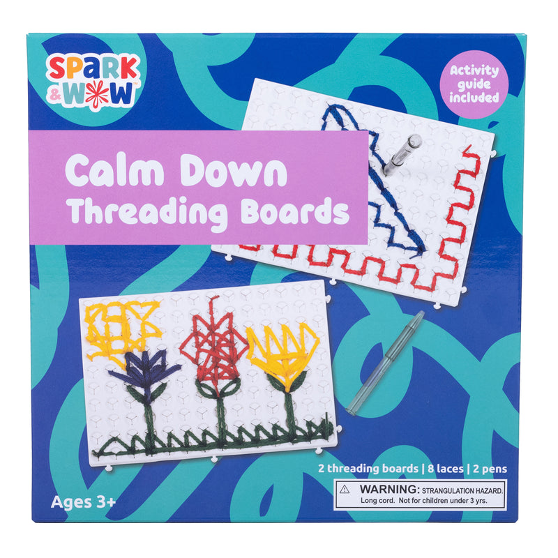
Calm Down Threading Boards

Calm Down Threading Boards
$24.65
MPN: 005646UPC: 819852019289Create and inspire calm with this powerful sensory resource! This set includes 2 threading boards, 8 laces in 4 colors, 2 threading pens and an activity guide. Add this sensory resource to calm down corners, therapy resources or social-emotional learning activities. This threading activity can act as a tool to assist ...
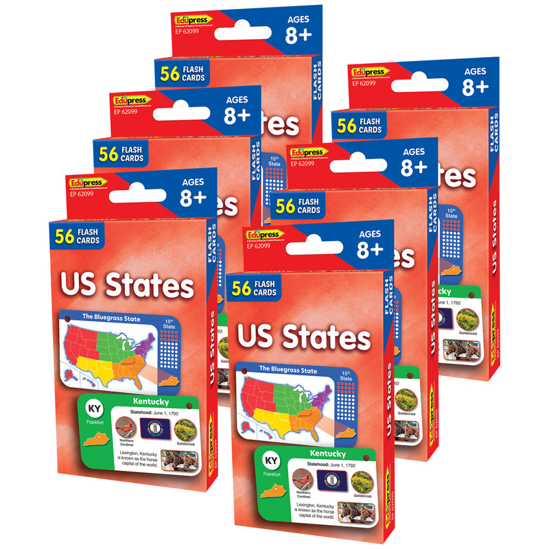

US States Flash Cards, 6 Packs
$41.02
MPN: 005003UPC: 194629156344The flash card set is a versatile and engaging tool for both teachers and parents. Each set includes a collection of full-color, high-interest student cards, along with instructions and tips for educators and caregivers. The set also comes with suggested activities and additional blank cards for customization. The car...

Zoomi Game

Zoomi Game
$34.24
MPN: 006651UPC: 628011475022Are you ready to Zoomi?! Easy to pick up....hard to put down! Twist, turn and tumble through the 6 panels of a-maze-ment! 1) Place the ball at the "START." 2) Twist, turn, and tumble through the 5 mazes. 2) Finish the maze at the "STOP". Victory! Challenge yourself to make it through Zoomi without getting stuck. Try m...

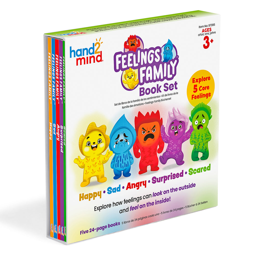
Feelings Family™ Book Set Happy, Sad, Angry, Scared & Surprised
$34.24
MPN: 005083UPC: 848850122448The Feelings Family helps children explore how feelings can look on the outside and feel on the inside. This book set teaches children about Happy, Sad, Angry, Scared, and Surprised through lively characters and relatable scenarios. Prompts and questions are included within the 5 books to engage children and spark tho...
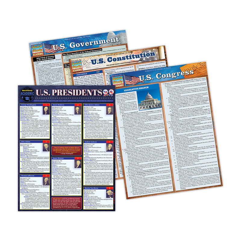

Laminated Study Guide, History Bundle, Set of 4
$41.00
MPN: 006469UPC: 9781423251248This bundle includes one each of U.S. President, U.S. Government, U.S. Congress & U.S. Constitution Laminated Study Guide sets. This bundle is a great learning tool for students and detailed facts they need to know about the U.S. Constitution the U.S. Presidents and how the U.S. Government and U.S. Congress works...

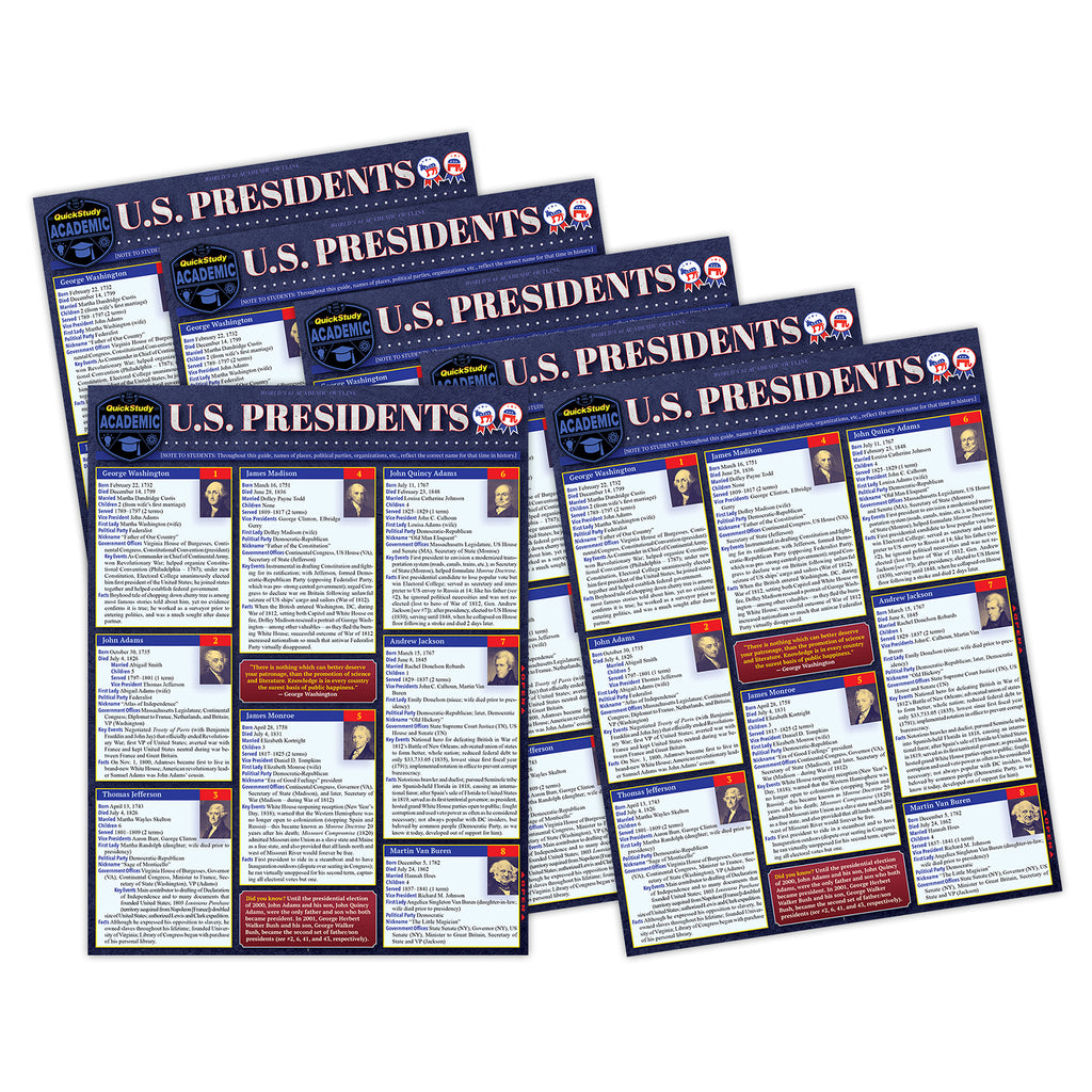
Laminated Study Guide, U.S. Presidents
$74.65
MPN: 006469UPC: 9781423251200Essential facts for the 47 presidents of the United States with key events that give a quick and concise picture of each president, their time in office, and their personality as recorded in history. A great learning tool for students and the facts they need-to-know, but also a great read for those interested in poli...
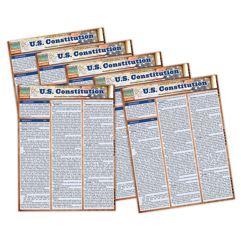

Laminated Study Guide, U.S. Constitution
$57.13
MPN: 006469UPC: 9781423251231Own an indestructible copy of the most important and revered document in U.S. history that is the centerpiece of political discussion and debate more than 200 years after it was written. Reference the actual words and the full text as written and influenced by the Founding Fathers, rather than relying on partial and ...


Laminated Study Guide, U.S. Government
$57.13
MPN: 006469UPC: 9781423251224Worldwide the U.S. government is a hot topic concerning politics, the balance of power, and the future of democracy. This essential six page laminated reference is a concise breakdown of the inner workings of the system as a whole. Written by author and professor Zachary Courser, PhD, a Fellow with the Bipartisan Pol...

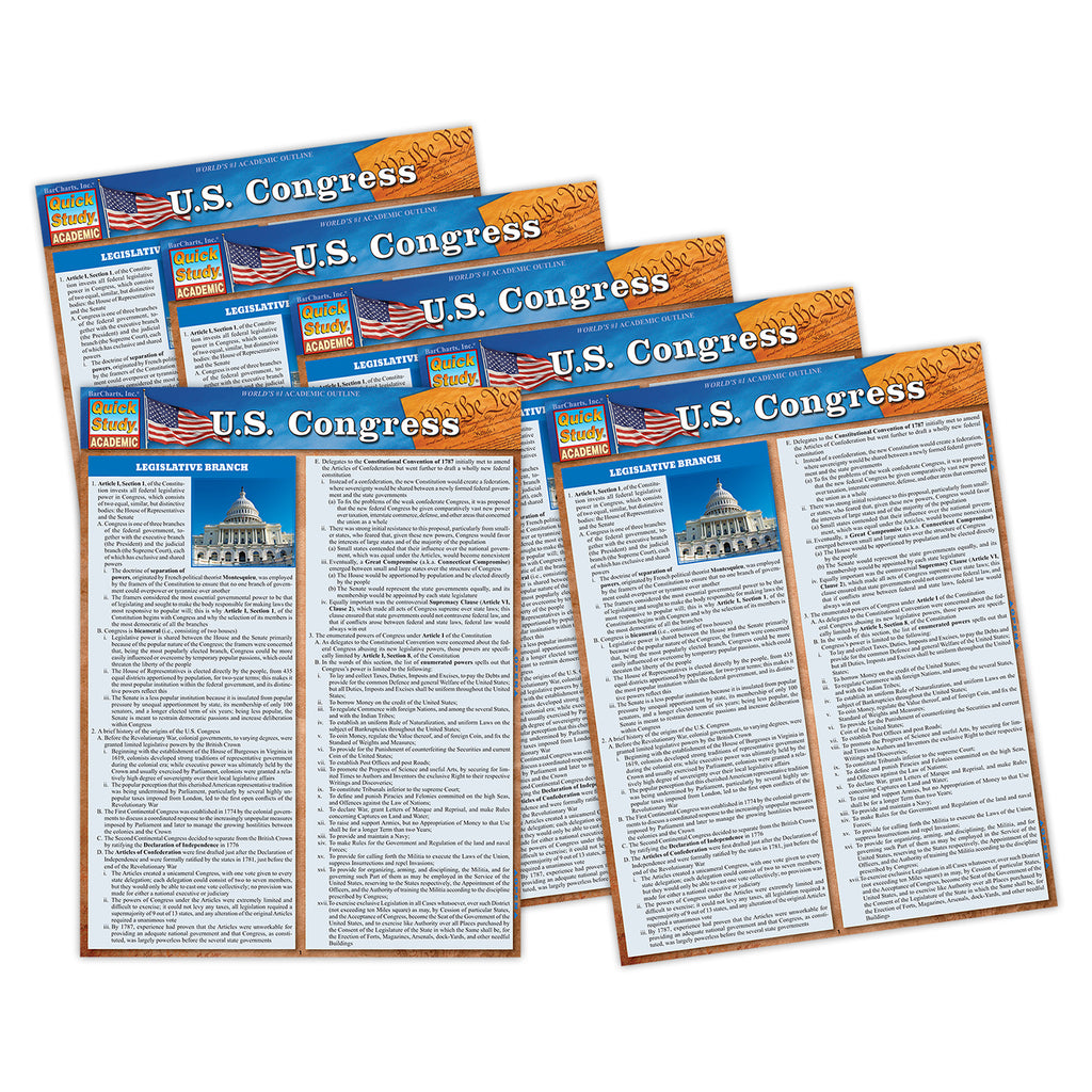
Laminated Study Guide, U.S. Congress
$48.91
MPN: 006469UPC: 9781423251217In the U.S. and worldwide Congress is a hot topic concerning politics, the balance of power, and the future of democracy. This essential six page laminated reference is a concise breakdown of the inner workings of the House and Senate and how they work together to get things done with the Executive Branch. Written by...
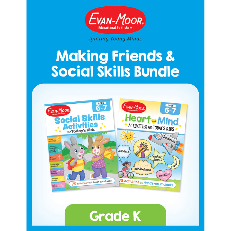

Making Friends & Social Skills Bundle, Grade K
$31.50
MPN: 005033UPC: 9781645144212The Making Friends & Social Skills Bundle, Grade K is a dynamic two-book set designed to help young children build essential social and emotional skills for positive relationships. This bundle includes Social Skills Activities for Today’s Kids Workbook, Ages 6-7 and Heart and Mind Activities for Today's Kids, Age...
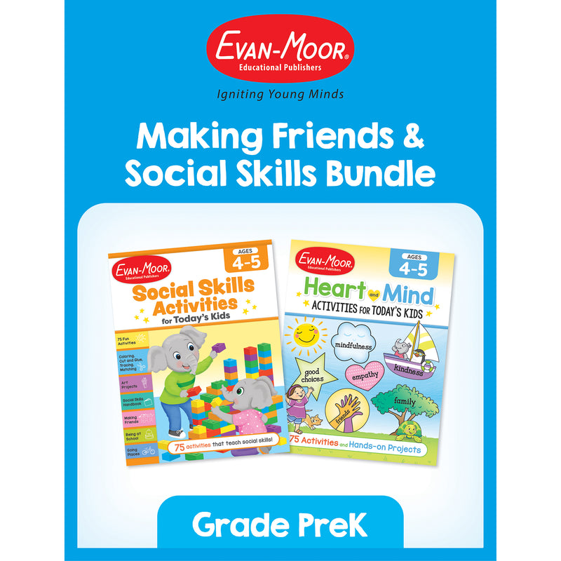
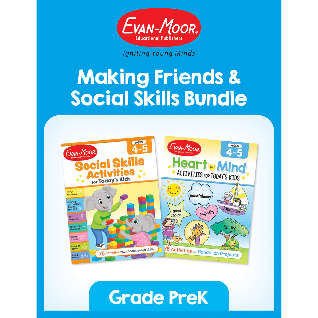
Making Friends & Social Skills Bundle, Grade PreK
$34.24
MPN: 005033UPC: 9781645144205The Making Friends & Social Skills Bundle, Grade PreK is the perfect resource to support young children in developing key social and emotional skills essential for forming positive relationships and navigating everyday interactions. This bundle includes two award-winning workbooks: Social Skills Activities for To...
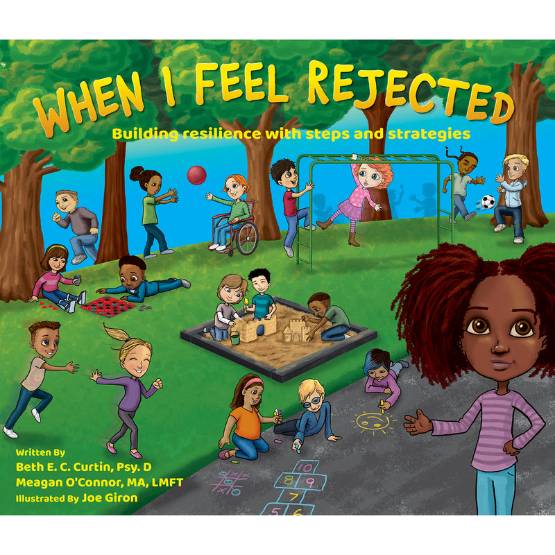
When I Feel Rejected Book

When I Feel Rejected Book
$26.02
MPN: 006438UPC: 899600003883Rejection is a tough, but universal experience. When I Feel Rejected navigates multiple characters through school based incidents in which a rejection occurs. The book acts as a social emotional learning tool that outlines possible responses and coping strategies to rejection.Key Features : i : When I Feel Rejected na...